- Elevation
- 1,280 m
- above sea level
- Local time
- UTC+09:00
- Asia/Tokyo · UTC+09:00
- Population
- 13,231,995
- 13.2M
- Airports
- KMJ Kumamoto Airport47 km
- KOJ Kagoshima Airport74 km
About Kyūshū
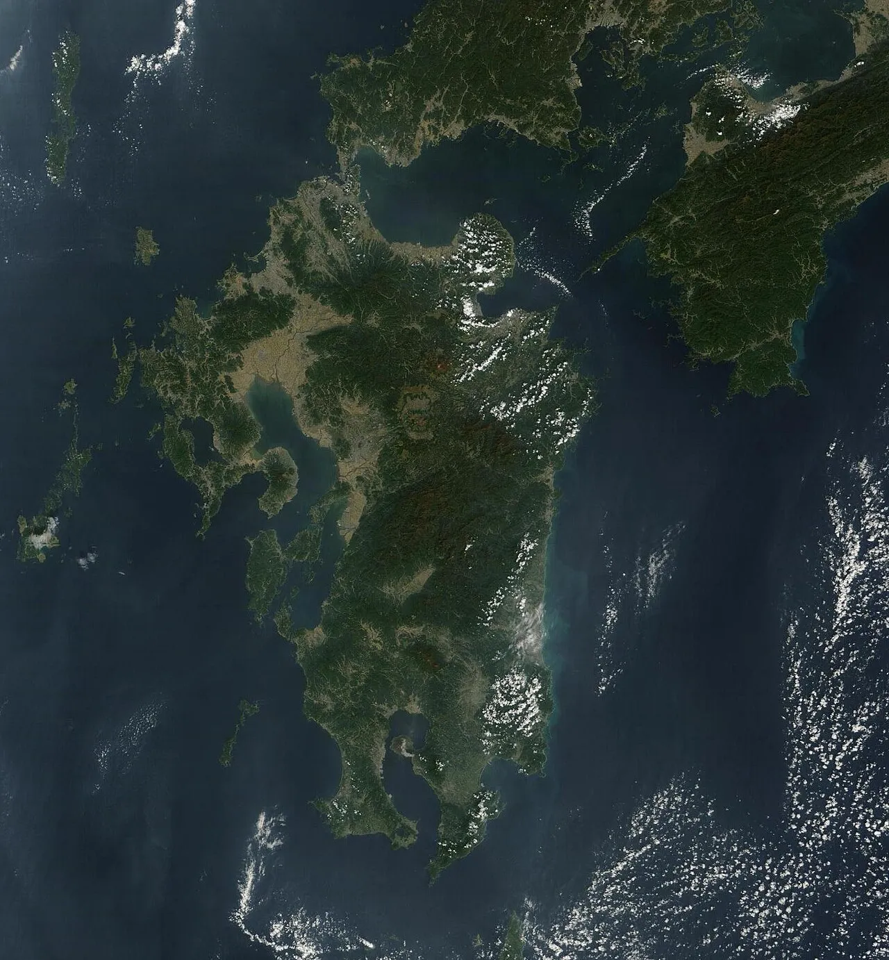
Kyūshū is an island. Location: Kumamoto, Japan. Population: 13,231,995.
Kyushu (Japanese: 九州, Hepburn: Kyūshū; pronounced [k̟ʲj̊ɨ́ɨ̀.ɕɨ̀ɨ̀] , lit. 'nine provinces') is the third-largest and most southerly of Japan's four main islands. In the past, it has been known as Kyūkoku (九国, "Nine Countries"), Chinzei (鎮西, "West of the Pacified Area") and Tsukushi-no-shima (筑紫島, "Island of Tsukushi"). The historical regional name Saikaidō (西海道; lit. West Sea Circuit) referred to Kyushu and its surrounding islands.
Read more on Wikipedia Text: Wikipedia contributors · CC BY-SA 4.0 · shortened
At a glance
- Area
- 36,782 km²
Source: Wikidata
Climate of Kyūshū
Best months for sightseeingBest months for sightseeing: July–September.
Bars: average monthly low and high temperature. Below: precipitation. Monthly averages for 1970–2000 at about 18 km resolution, adjusted for elevation. Highlighted months are mild and relatively dry. Source: WorldClim 2.1 (CC BY 4.0).
Show values as a table
| Month | Jan | Feb | Mar | Apr | May | Jun | Jul | Aug | Sep | Oct | Nov | Dec |
|---|---|---|---|---|---|---|---|---|---|---|---|---|
| Average high (°C) | 1° | 3° | 6° | 12° | 16° | 18° | 22° | 23° | 20° | 15° | 10° | 4° |
| Average low (°C) | -6° | -5° | -2° | 4° | 8° | 12° | 16° | 16° | 13° | 8° | 2° | -4° |
| Precipitation (mm) | 92 | 125 | 199 | 251 | 303 | 533 | 579 | 343 | 261 | 144 | 100 | 73 |
Airports nearest to Kyūshū
- Kumamoto Airport (KMJ) Kumamoto 47 km
- Kagoshima Airport (KOJ) Kagoshima 74 km
- Miyazaki Airport (KMI) Miyazaki 75 km
Straight-line distance; airports with scheduled flights only. Source: OurAirports (public domain).
Nearest towns and villages
-
Mizukami Mura Municipality, Kuma-gun7.5 km S
-
Shiiba Son Municipality, Higashiusuki-gun15 km E
-
Itsuki Mura Municipality, Kuma-gun14 km W
-
Yunomae Village, Kuma-gun16 km S
-
Taragi Machi Municipality, Kuma-gun21 km S
-
Taragi Town, Taragi Machi19 km S
More lakes, rivers and coasts in Japan
-
Shimoshima Island Island, Kumamoto86 km W
-
Kuma River River, Kumamoto40 km W
-
 Ōyano Jima Island, Kumamoto55 km W
-
Hi Kawa River, Kumamoto39 km NW
-
Kami Shima Island, Kumamoto62 km W
-
Kikuchi River River, Kumamoto66 km NW
Sources & licences
Data last updated: · 2 independent sources