Ōshika Mura
Local name: 大鹿村
Located in Shimoina-gun, Nagano Coordinates: 35°33′29″ N 138°04′28″ E
- Population
- 1,116
- 1.1K
- Elevation
- 1,657 m
- above sea level
- Local time
- UTC+09:00
- Asia/Tokyo · UTC+09:00
- Airports
- MMJ Shinshu-Matsumoto Airport69 km
- FSZ Mount Fuji Shizuoka Airport85 km
About Ōshika Mura
Ōshika Mura is a municipality. Location: Shimoina-gun, Nagano. Population: 1,116. Elevation: 1,657 m.
Ōshika (大鹿村, Ōshika-mura) is a village located in Nagano Prefecture, Japan. As of 1 October 2018, the village had an estimated population of 977, and a population density of 3.9 persons per km2. The total area of the village is 248.28 square kilometres (95.86 sq mi). Ōshika is listed as one of the Most Beautiful Villages in Japan.
Source: Wikipedia · CC BY-SA 4.0
Places bordering Ōshika Mura
- Shizuoka
- Ina
- Komagane
- Iida
- Matsukawa Machi
- Nakagawa Mura
- Toyooka Mura
Population of Ōshika Mura over time
| 2010 | 1,160 | |
|---|---|---|
| 2015 | 1,023 | |
| 2021 | 928 |
Censuses and official estimates; source: Wikidata.
Climate of Ōshika Mura
Best months for sightseeingBest months for sightseeing: July–August.
This month · November
A cold month
Day 8° · Night -2° · Rain 81 mm
Better nearby cities in November
- Kofu · 46 km east17°
- Fujinomiya · 62 km southeast18°
- Fuji · 70 km southeast20°
- Hottest month
- August (day 23°)
- Coldest month
- January (night -11°)
- Wettest month
- September (261 mm)
- Driest month
- December (41 mm)
Bars: average monthly low and high temperature. Below: precipitation. Monthly averages for 1970–2000 at about 18 km resolution, adjusted for elevation. Highlighted months are mild and relatively dry. Source: WorldClim 2.1 (CC BY 4.0).
Show values as a table
| Month | Jan | Feb | Mar | Apr | May | Jun | Jul | Aug | Sep | Oct | Nov | Dec |
|---|---|---|---|---|---|---|---|---|---|---|---|---|
| Average high (°C) | 0° | 0° | 4° | 11° | 15° | 18° | 22° | 23° | 19° | 13° | 8° | 3° |
| Average low (°C) | -11° | -10° | -7° | -1° | 4° | 9° | 13° | 14° | 10° | 4° | -2° | -8° |
| Precipitation (mm) | 44 | 63 | 110 | 151 | 164 | 244 | 235 | 255 | 261 | 150 | 81 | 41 |
How to get to Ōshika Mura
The nearest airport is Shinshu-Matsumoto Airport (MMJ), 69 km to the north as the crow flies. For international flights: Mount Fuji Shizuoka Airport (FSZ) (85 km). The nearest large city is Iida, 23 km to the west.
Airports
- Shinshu-Matsumoto Airport (MMJ) Matsumoto 69 kmnorth
- Mount Fuji Shizuoka Airport (FSZ) Makinohara / Shimada 85 kmsouth
- Nagoya Airport / JASDF Komaki Air Base (NKM) Nagoya 110 kmwest
Nearby large cities
- Iida Population: 101.5K 23 kmwest
- Kofu Population: 189.6K 46 kmeast
- Fujinomiya Population: 132.5K 62 kmsoutheast
- Shizuoka Population: 693.4K 70 kmsoutheast
- Fuji Population: 245.4K 70 kmsoutheast
Straight-line distances; road distances are longer. Airport data: OurAirports.
Day trips from Ōshika Mura
Within 100 km: 4 historic and cultural sites, 52 natural sites, 17 lakes, rivers and coasts.
0–25 km8 places
- Mount Senjō Mountain 20 kmNE
- Mount Aino Mountain 17 kmNE
- Mount Shiomi Mountain 10 kmE
- Mount Tekari Mountain 25 kmS
25–60 km19 places
- Honshu Island 49 kmN
- Lake Shoji Lake 49 kmE
- Mount Nokogiri Mountain 27 kmNE
- Chausu-yama Mountain 37 kmNW
60–100 km46 places
- Mount Echizen-dake Mountain 74 kmSE
- Suruga Bay Natural site 90 kmSE
- Fuji River River 71 kmSE
- Oi River River 90 kmS
Straight-line distances.
Nearby attractions & nature
Everything nearby-
 Arakawa-dake Mountain, Japan11 km SE
-
 Mount Shiomi Mountain, Aoi-ku10 km E
-
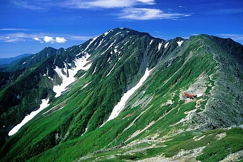 Mount Aino Mountain, Aoi-ku17 km NE
-
 Mount Senjō Mountain, Ina Shi20 km NE
-
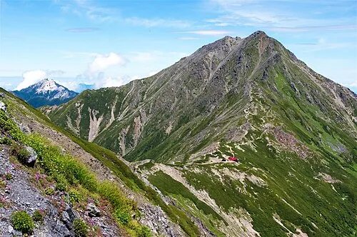 Kita-dake Mountain, Nagano20 km NE
-
 Mount Akaishi Mountain, Aoi-ku13 km SE
-
Mount Akaishi Mountain, Japan18 km SE
-
 Mount Tekari Mountain, Kawanehon Chō25 km S
Sources & licences
Data last updated: · 2 independent sources