Shimabara
Local name: 島原市
Located in Shimabara Shi, Nagasaki Coordinates: 32°47′00″ N 130°22′00″ E
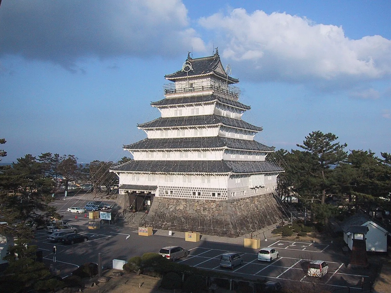
- Population
- 43,338
- 43.3K
- Elevation
- 11 m
- above sea level
- Local time
- UTC+09:00
- Asia/Tokyo · UTC+09:00
- Airports
- AXJ Amakusa Airport39 km
- HSG Kyushu Saga International Airport41 km
About Shimabara
Shimabara is a city. Location: Shimabara Shi, Nagasaki. Population: 43,338. Elevation: 11 m.
Shimabara (島原市, Shimabara-shi) is a city located in Nagasaki Prefecture, Kyushu, Japan. As of 30 June 2024, the city had an estimated population of 42,181 in 19917 households, and a population density of 510 people per km2. The total area of the city is 170.13 km2 (65.69 sq mi).
Source: Wikipedia · CC BY-SA 4.0
Photos of Shimabara
-

Luck one · Public domain -

lienyuan lee · CC BY 3.0 -

663highland · CC BY 2.5 -

そらみみ · CC BY-SA 4.0 -

Takeshi Kuboki from Amagasaki, Japan · CC BY 2.0


Travel notes for Shimabara
From Wikivoyage
Shimabara (島原市) is a city in Nagasaki prefecture on the island of Kyushu, Japan.
Understand+
Shimabara is a castle town on a peninsula in the far south-east corner of Nagasaki Prefecture, on the flanks of Mt. Unzen, an active volcano dominating the region. After nearly 200 years of dormancy, Mt Unzen last erupted in 1991, killing 43 and devastating the southern district of town with the resultant pyroclastic flows.
The city is also the site of the Shimabara Rebellion in which Christians and locals who were unsatisfied with grossly high taxes and oppression of Christianity fought to regain control of the territory. They were unsuccessful, and with the help of the Dutch, the Japanese stopped the rebellion and beheaded approximately 37,000 Christians and peasants. It also led to the ousting of the Portuguese who they no longer trusted, making the Dutch the only Europeans the Japanese were willing to trade with. Although Christianity had already been banned prior to the rebellion, the rebellion made the government even more anti-Christian and even stricter enforcement of the religious ban was established.
Nowadays Shimabara acts as the gateway between Nagasaki and Kumamoto and sightseeing in the Unzen Volcanic Area Geopark.
Tourist information site:
The local tourist association has a Japanese-only guide site. Its Pamphlet section has some materials in English and other languages.
Get in+
By train:
Trains run direct from Isahaya, near Nagasaki along the private Shimabara line. As with many private lines in Kyushu, the Shimabara line departs from a slightly hidden "platform zero" within the JR station. Don't leave through the JR gates, just hop on the train and buy your tickets from the driver.
By ferry:
Various ferry options will let you reach Shimabara from neighbouring Kumamoto.
Ocean Arrow will take you from Kumamoto Port (熊本港) to Shimabara Port (島原港) in 30 minutes. One way is ¥800, a round trip ¥1520. Buses from Kumamoto city centre station to Kumamoto port are ¥480 one way (¥420 from the JR station). The ¥1800 discount roundtrip special including connecting bus fare only runs from Shimabara -> Kumamoto -> Shimabara, and not reverse rendering it utterly useless for a tourist. The last ferry back to Kumamoto leaves at 19:20.
The cheaper Kyusho Ferry (九商フェリー) will get you from Kumamoto Port (熊本港) to Shimabara Port (島原港) in 60 minutes but for ¥680 one way or ¥1000 round trip. The connecting bus to the Kumamoto city centre course will still set you back ¥480 (¥420 for the JR station) each way. The last ferry back to Kumamoto leaves at 18:55.
Although primarily designed to get Nagasaki residents to the Greenland theme park, an alternate option does exist to the north. For ¥430 each way, Ariake Ferry (有明フェリー) will give you a 45-minute ride from Nagasu Port (長洲港) just north of Kumamoto to Taira Port (多比良港) just north of Shimabara. The last eastbound ferry leaves at 20:00.
Source: Wikivoyage · CC BY-SA 4.0 · abridged
Places bordering Shimabara
- Unzen Shi
- Minamishimabara Shi
Population of Shimabara over time
| 2010 | 47,455 | |
|---|---|---|
| 2015 | 45,436 | |
| 2021 | 42,858 |
Censuses and official estimates; source: Wikidata.
Climate of Shimabara
Best months for sightseeingBest months for sightseeing: May, October.
This month · November
Outside the best season
Day 18° · Night 9° · Rain 74 mm
Better nearby cities in November
- Beppu · 119 km northeast17°
- Kirishima · 122 km south19°
- Nobeoka · 124 km east18°
- Hottest month
- August (day 31°)
- Coldest month
- January (night 2°)
- Wettest month
- June (360 mm)
- Driest month
- December (59 mm)
Bars: average monthly low and high temperature. Below: precipitation. Monthly averages for 1970–2000 at about 18 km resolution, adjusted for elevation. Highlighted months are mild and relatively dry. Source: WorldClim 2.1 (CC BY 4.0).
Show values as a table
| Month | Jan | Feb | Mar | Apr | May | Jun | Jul | Aug | Sep | Oct | Nov | Dec |
|---|---|---|---|---|---|---|---|---|---|---|---|---|
| Average high (°C) | 10° | 11° | 14° | 20° | 24° | 26° | 30° | 31° | 28° | 23° | 18° | 12° |
| Average low (°C) | 2° | 3° | 6° | 11° | 15° | 19° | 23° | 24° | 20° | 15° | 9° | 4° |
| Precipitation (mm) | 62 | 85 | 129 | 169 | 197 | 360 | 358 | 202 | 198 | 97 | 74 | 59 |
How to get to Shimabara
The nearest airport is Amakusa Airport (AXJ), 39 km to the southwest as the crow flies. For international flights: Kyushu Saga International Airport (HSG) (41 km). The nearest large city is Omuta, 29 km to the north.
Airports
- Amakusa Airport (AXJ) Amakusa 39 kmsouthwest
- Kyushu Saga International Airport (HSG) Saga 41 kmnorth
- Nagasaki Airport (NGS) Nagasaki 45 kmwest
Nearby large cities
- Omuta Population: 132K 29 kmnorth
- Isahaya Population: 135.5K 31 kmwest
- Honmachi Population: 123.1K 38 kmsoutheast
- Nagasaki Population: 409.1K 45 kmwest
- Saga Population: 233.3K 50 kmnorth
Straight-line distances; road distances are longer. Airport data: OurAirports.
Day trips from Shimabara
Within 100 km: 17 historic and cultural sites, 18 natural sites, 15 lakes, rivers and coasts.
0–25 km5 places
- Mount Unzen Mountain 9 kmSW
- Ōyano Jima Island 23 kmS
- Shimabara-hantō Natural site 12 kmW
- Shimabara Castle Historic site 1 kmN
25–60 km12 places
- Shimoshima Island Island 57 kmSW
- Nishisonoki-hantō Natural site 60 kmW
- Chikugo River River 40 kmN
- Hi Kawa River 32 kmSE
60–100 km33 places
- Kyūshū Island 71 kmSE
- Hario Jima Island 67 kmNW
- Kitamatsuura Hantō Natural site 84 kmNW
- Kami Shima Island 61 kmSW
Straight-line distances.
Nearby attractions & nature
Everything nearby-
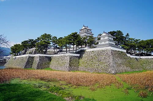 Shimabara Castle Historic site, Shimabara Shi0.7 km N
-
 Mount Unzen Mountain, Nagasaki8.6 km SW
-
 Shimabara-hantō Natural site, Nagasaki12 km W
-
Kikuchi River River, Kumamoto18 km NE
-
 Ōyano Jima Island, Kumamoto23 km S
Sources & licences
Data last updated: · 2 independent sources