
- Elevation
- 629 m
- above sea level
- Local time
- UTC+09:00
- Asia/Tokyo · UTC+09:00
- Airports
- AXJ Amakusa Airport31 km
- NGS Nagasaki Airport37 km
About Shimabara-hantō
Shimabara-hantō is a natural site. Location: Nagasaki, Japan.
The Shimabara Peninsula (島原半島, Shimabara-hantō) is a peninsula located in Nagasaki Prefecture on the island of Kyushu, Japan. The peninsula incorporates the cities of Shimabara, Minamishimabara, and Unzen. The northern, eastern, and southeastern coasts of the peninsula face the Ariake Sea, and the western coast faces Tachibana Bay. An active group of volcanoes known collectively as Mount Unzen lies in the middle of the peninsula, with many hot springs, such as Unzen Onsen and the extremely hot Obama Onsen.
Source: Wikipedia · CC BY-SA 4.0
Climate of Shimabara-hantō
Best months for sightseeingBest months for sightseeing: May–July, September–October.
This month · November
Outside the best season
Day 14° · Night 6° · Rain 81 mm
Better nearby cities in November
- Kirishima · 122 km southeast19°
- Beppu · 130 km northeast17°
- Nobeoka · 134 km east18°
- Hottest month
- August (day 27°)
- Coldest month
- January (night -2°)
- Wettest month
- July (437 mm)
- Driest month
- December (63 mm)
Bars: average monthly low and high temperature. Below: precipitation. Monthly averages for 1970–2000 at about 18 km resolution, adjusted for elevation. Highlighted months are mild and relatively dry. Source: WorldClim 2.1 (CC BY 4.0).
Show values as a table
| Month | Jan | Feb | Mar | Apr | May | Jun | Jul | Aug | Sep | Oct | Nov | Dec |
|---|---|---|---|---|---|---|---|---|---|---|---|---|
| Average high (°C) | 5° | 7° | 10° | 16° | 20° | 22° | 26° | 27° | 24° | 19° | 14° | 8° |
| Average low (°C) | -2° | -1° | 2° | 7° | 11° | 15° | 20° | 20° | 17° | 11° | 6° | 0° |
| Precipitation (mm) | 76 | 100 | 160 | 194 | 229 | 410 | 437 | 226 | 227 | 112 | 81 | 63 |
Other places to visit in this season: May June July September October
How to get to Shimabara-hantō
The nearest airport is Amakusa Airport (AXJ), 31 km to the south as the crow flies. For international flights: Nagasaki Airport (NGS) (37 km). The nearest large city is Isahaya, 22 km to the northwest.
Airports
- Amakusa Airport (AXJ) Amakusa 31 kmsouth
- Nagasaki Airport (NGS) Nagasaki 37 kmnorthwest
- Kyushu Saga International Airport (HSG) Saga 45 kmnorth
Nearby large cities
- Isahaya Population: 135.5K 22 kmnorthwest
- Nagasaki Population: 409.1K 34 kmwest
- Omuta Population: 132K 37 kmnortheast
- Honmachi Population: 123.1K 43 kmsoutheast
- Saga Population: 233.3K 54 kmnorth
Straight-line distances; road distances are longer. Airport data: OurAirports.
Nearest towns and villages
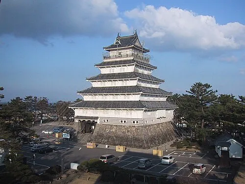
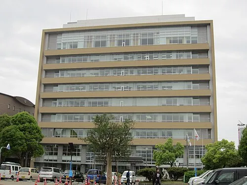
Nearby attractions & nature
Everything nearby-
 Mount Unzen Mountain, Nagasaki3.1 km E
-
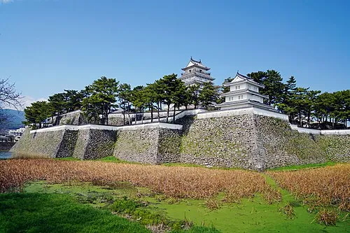 Shimabara Castle Historic site, Shimabara Shi12 km E
More nature in Japan
-
 Nishisonoki-hantō Natural site, Nagasaki50 km W
-
Ōmura-wan Natural site, Nagasaki42 km NW
-
Kitamatsuura Hantō Natural site, Nagasaki79 km NW
Sources & licences
Data last updated: · 2 independent sources