Tenkawa-mura
Local name: 天川村
Located in Yoshino-gun, Nara Coordinates: 34°14′31″ N 135°51′19″ E
- Population
- 1,615
- 1.6K
- Elevation
- 608 m
- above sea level
- Local time
- UTC+09:00
- Asia/Tokyo · UTC+09:00
- Places inside
- 1
- listed under Tenkawa-mura
- Airports
- KIX Kansai International Airport60 km
- ITM Osaka Itami International Airport71 km
About Tenkawa-mura
Tenkawa-mura is a municipality. Location: Yoshino-gun, Nara. Population: 1,615. Elevation: 608 m.
Tenkawa (天川村, Tenkawa-mura) is a village located in Yoshino District, Nara Prefecture, Japan. As of 1 January 2025, the village had an estimated population of 1,031 and a population density of 5.9 persons per km2. The total area of the village is 175.66 km2 (67.82 sq mi).
Source: Wikipedia · CC BY-SA 4.0
Photos of Tenkawa-mura
-
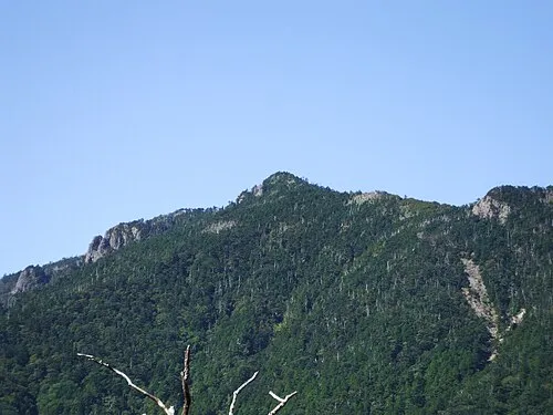
Hakken-san Mass Ave 975 · CC BY-SA 3.0 -

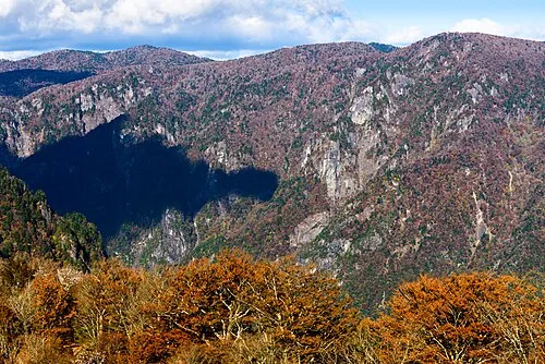
Mount Ōtenjō 8-hachiro · CC BY-SA 4.0


Travel notes for Tenkawa-mura
From Wikivoyage
Tenkawa (天川) is a village in Nara Prefecture in Japan, about 10 to 15 km south of Yoshino.
Understand+
The village has an official Japanese-only guide site.
Get in+
By car:
Driving is one option. From Koriyama IC (郡山) of E25 (Nishi-Meihan Expressway) drive Route 24 and Route 169 southbound. At Shimoichiguchi crossing turn right onto Route 309 and drive until you get to Tenkawa.
By bus:
There is a bus leaving from Kintetsu Shimoichiguchi Station (下市口), which is on the Kintetsu Yoshino Line. You can board an express train (急行) for Yoshino (吉野) at Osaka Abenobashi Station, the Kintetsu station adjacent to JR Tennoji. That train will take you to Shimoichiguchi, from where you can take a bus for about an hour until you reach Tenkawa Mura (天川村).
On foot:
Tenkawa is on the Ōmine Okugake-michi road of the Kumano Kodo pilgrimage trail, which begins in Yoshino. This is one of the less travelled and more challenging routes, and you'll need to bring food and camping gear to tackle it end to end.
Source: Wikivoyage · CC BY-SA 4.0 · abridged
Places bordering Tenkawa-mura
- Gojō
- Kurotaki Mura
- Kawakami-mura
- Kamikitayama Mura
Population of Tenkawa-mura over time
| 2010 | 1,572 | |
|---|---|---|
| 2015 | 1,354 | |
| 2021 | 1,148 |
Censuses and official estimates; source: Wikidata.
Climate of Tenkawa-mura
Best months for sightseeingBest months for sightseeing: May–June, September.
This month · November
A wet month
Day 14° · Night 6° · Rain 109 mm
Better nearby cities in November
- Kochi · 228 km west18°
- Fujinomiya · 275 km northeast18°
- Fuji · 278 km east20°
- Hottest month
- August (day 28°)
- Coldest month
- January (night -2°)
- Wettest month
- June (314 mm)
- Driest month
- December (61 mm)
Bars: average monthly low and high temperature. Below: precipitation. Monthly averages for 1970–2000 at about 18 km resolution, adjusted for elevation. Highlighted months are mild and relatively dry. Source: WorldClim 2.1 (CC BY 4.0).
Show values as a table
| Month | Jan | Feb | Mar | Apr | May | Jun | Jul | Aug | Sep | Oct | Nov | Dec |
|---|---|---|---|---|---|---|---|---|---|---|---|---|
| Average high (°C) | 6° | 6° | 10° | 16° | 20° | 23° | 27° | 28° | 24° | 19° | 14° | 9° |
| Average low (°C) | -2° | -2° | 1° | 7° | 12° | 16° | 20° | 21° | 17° | 11° | 6° | 1° |
| Precipitation (mm) | 72 | 83 | 138 | 198 | 212 | 314 | 275 | 253 | 289 | 177 | 109 | 61 |
How to get to Tenkawa-mura
The nearest airport is Kansai International Airport (KIX), 60 km to the west as the crow flies. The nearest large city is Kashiwara, 24 km to the north.
Airports
- Kansai International Airport (KIX) Osaka 60 kmwest
- Osaka Itami International Airport (ITM) Osaka 71 kmnorthwest
- Kobe Airport (UKB) Kobe 72 kmnorthwest
Nearby large cities
- Kashiwara Population: 120.9K 24 kmnorth
- Kashihara-shi Population: 124.5K 30 kmnorth
- Kawachi-Nagano Population: 101.7K 33 kmnorthwest
- Tondabayashi Population: 132.9K 37 kmnorthwest
- Habikino Population: 109.5K 42 kmnorthwest
Straight-line distances; road distances are longer. Airport data: OurAirports.
Day trips from Tenkawa-mura
Within 100 km: 28 historic and cultural sites, 42 natural sites, 22 lakes, rivers and coasts.
0–25 km7 places
- Mount Ōdaigahara Mountain 21 kmE
- Mount Azami Mountain 23 kmNE
- Mount Shisuniwa Mountain 10 kmNE
- Hakken-san Mountain 9 kmSE
25–60 km22 places
- Mount Miwa Mountain 32 kmN
- Mount Amanokagu Mountain 28 kmN
- Mount Miminashi Mountain 31 kmN
- Mount Unebi Mountain 29 kmN
60–100 km63 places
- Awaji Island Island 96 kmW
- Tōshi-jima Island 100 kmE
- Kii Ōshima Island 86 kmS
- Mount Rokkō Mountain 81 kmNW
Straight-line distances.
Places in Tenkawa-mura
1 placeNearby attractions & nature
Everything nearby-
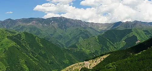 Ōmine Sanmyaku Mountain, Japan8.6 km S
-
Mount Ōtenjō Mountain, Kawakami-mura7.3 km NE
-
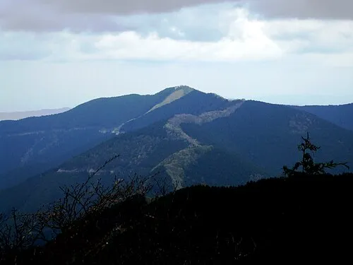 Mount Shisuniwa Mountain, Kurotaki Mura10 km NE
-
 Mount Shakka Mountain, Totsukawa Mura15 km S
-
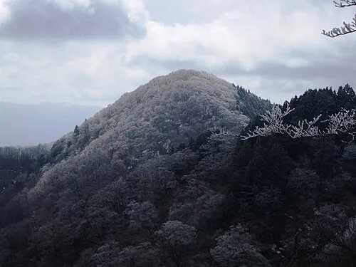 Mount Azami Mountain, Kawakami-mura23 km NE
-
 Mount Ōdaigahara Mountain, Kamikitayama Mura21 km E
Sources & licences
Data last updated: · 2 independent sources