- Population
- 48,816
- 48.8K
- Elevation
- 19 m
- above sea level
- Local time
- UTC+09:00
- Asia/Tokyo · UTC+09:00
- Places inside
- 2
- listed under Ishigaki-shi
- Airports
- ISG New Ishigaki Airport4 km
- TRA Tarama Airport56 km
About Ishigaki-shi
Ishigaki-shi is a district. Location: Okinawa, Japan. Population: 48,816.
§ Cultural properties Ishigaki (石垣市, Ishigaki-shi; Japanese pronunciation: [ì.ɕí.ɡä́.k̟ʲí, -k̟ʲi̥.ɕì, -ŋä́-] Yaeyama: Isïgaksï, Ishanagzï) is a city in Okinawa Prefecture, Japan. It includes Ishigaki island and the Senkaku Islands territory. The city is the political, cultural, and economic center of the Yaeyama Islands. New Ishigaki Airport serves the city. As of December 2012, the city has an estimated population of 48,816 and a population density of 213 persons per km2. The total area is 229.00 km2.
Source: Wikipedia · CC BY-SA 4.0
Twin towns and sister cities of Ishigaki-shi
- Okazaki· Japan
- Wakkanai· Japan
- Kitakami· Japan
- Kamiita Chō· Japan
- Kauai· United States
Source: Wikidata. Only places with a page on this site are shown.
Population of Ishigaki-shi over time
| 2010 | 46,922 | |
|---|---|---|
| 2015 | 47,564 | |
| 2021 | 48,258 |
Censuses and official estimates; source: Wikidata.
Climate of Ishigaki-shi
Best months for sightseeingBest months for sightseeing: November–April.
This month · November
A good month to visit
Day 25° · Night 21° · Rain 172 mm
- Hottest month
- July (day 31°)
- Coldest month
- January (night 16°)
- Wettest month
- August (239 mm)
- Driest month
- February (128 mm)
Bars: average monthly low and high temperature. Below: precipitation. Monthly averages for 1970–2000 at about 18 km resolution, adjusted for elevation. Highlighted months are mild and relatively dry. Source: WorldClim 2.1 (CC BY 4.0).
Show values as a table
| Month | Jan | Feb | Mar | Apr | May | Jun | Jul | Aug | Sep | Oct | Nov | Dec |
|---|---|---|---|---|---|---|---|---|---|---|---|---|
| Average high (°C) | 20° | 21° | 23° | 25° | 28° | 30° | 31° | 31° | 30° | 28° | 25° | 22° |
| Average low (°C) | 16° | 16° | 18° | 21° | 23° | 25° | 27° | 26° | 25° | 23° | 21° | 18° |
| Precipitation (mm) | 149 | 128 | 132 | 158 | 214 | 190 | 155 | 239 | 212 | 208 | 172 | 151 |
Other places to visit in this season: January February March April November December
How to get to Ishigaki-shi
The nearest airport is New Ishigaki Airport (ISG), 4 km to the east as the crow flies.
Airports
- New Ishigaki Airport (ISG) Ishigaki 4 kmeast
- Tarama Airport (TRA) Tarama 56 kmnortheast
- Shimojishima Airport (SHI) Miyakojima 107 kmnortheast
Straight-line distances; road distances are longer. Airport data: OurAirports.
Places in Ishigaki-shi
2 placesIshigaki
Population: 47.6K
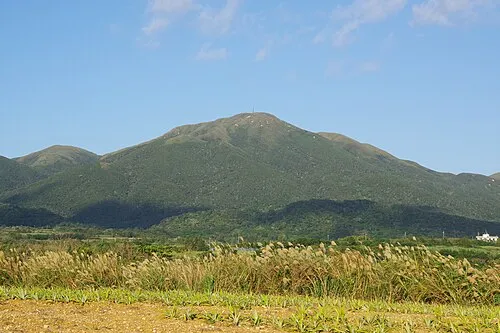
Nearby attractions & nature
Everything nearby-
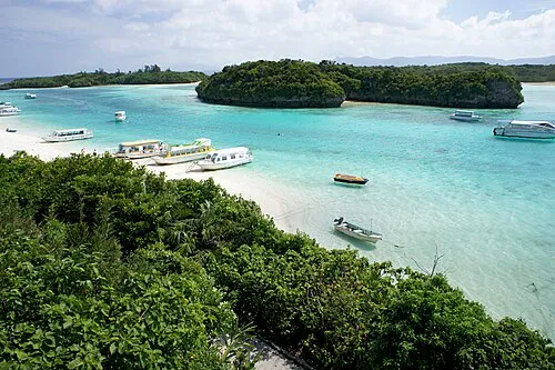 Ishigaki Jima Island, Okinawa0.7 km N
-
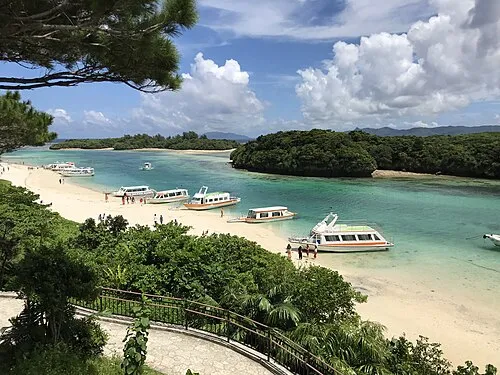 Kabira Bay Natural site, Okinawa8.5 km NW
-
 Taketomi-shima Island, Okinawa15 km SW
-
 Yaeyama Group Island, Okinawa21 km W
-
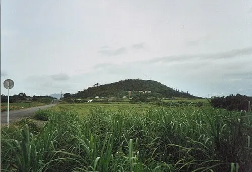 Kohama Island Island, Okinawa23 km W
Sources & licences
Data last updated: · 2 independent sources