Joto-ku
Local name: 城東区
Located in Osaka City, Osaka Coordinates: 34°42′00″ N 135°33′00″ E
- Population
- 167,907
- 167.9K
- Elevation
- 4 m
- above sea level
- Local time
- UTC+09:00
- Asia/Tokyo · UTC+09:00
- Airports
- ITM Osaka Itami International Airport13 km
- UKB Kobe Airport31 km
About Joto-ku
Joto-ku is a municipality. Location: Osaka City, Osaka. Population: 167,907. Elevation: 4 m.
Jōtō-ku (城東区, Jōtō-ku) is one of the 24 wards of Osaka, Japan. "Jōtō" literally means "east of the castle", referring to Osaka Castle. It was separated from Higashinari and Asahi in 1943, and eastern Jōtō became Tsurumi in 1974. As of 2025, the population density is the second largest of a city-designated municipality in Japan, after Nishi Ward. Additionally, when the special wards of Tokyo are also included, it is the eighth densest ward overall after Toshima, Nakano, Sumida, Arakawa, Bunkyō and Taitō.
Source: Wikipedia · CC BY-SA 4.0
Places bordering Joto-ku
- Tsurumi-ku
- Higashinari Ku
- Chūō Ku
- Miyakojima-ku
Population of Joto-ku over time
| 2010 | 165,832 | |
|---|---|---|
| 2015 | 164,697 | |
| 2021 | 167,907 |
Censuses and official estimates; source: Wikidata.
Climate of Joto-ku
Best months for sightseeingBest months for sightseeing: May, October.
This month · November
Outside the best season
Day 18° · Night 8° · Rain 69 mm
Better nearby cities in November
- Kochi · 225 km southwest18°
- Fujinomiya · 285 km east18°
- Fuji · 290 km east20°
- Hottest month
- August (day 33°)
- Coldest month
- January (night 1°)
- Wettest month
- June (215 mm)
- Driest month
- December (37 mm)
Bars: average monthly low and high temperature. Below: precipitation. Monthly averages for 1970–2000 at about 18 km resolution, adjusted for elevation. Highlighted months are mild and relatively dry. Source: WorldClim 2.1 (CC BY 4.0).
Show values as a table
| Month | Jan | Feb | Mar | Apr | May | Jun | Jul | Aug | Sep | Oct | Nov | Dec |
|---|---|---|---|---|---|---|---|---|---|---|---|---|
| Average high (°C) | 10° | 10° | 14° | 20° | 25° | 28° | 31° | 33° | 29° | 23° | 18° | 12° |
| Average low (°C) | 1° | 1° | 4° | 9° | 14° | 19° | 23° | 24° | 20° | 14° | 8° | 3° |
| Precipitation (mm) | 45 | 60 | 100 | 133 | 143 | 215 | 172 | 111 | 183 | 113 | 69 | 37 |
How to get to Joto-ku
The nearest airport is Osaka Itami International Airport (ITM), 13 km to the northwest as the crow flies. The nearest large city is Moriguchi, 4 km to the north.
Airports
- Osaka Itami International Airport (ITM) Osaka 13 kmnorthwest
- Kobe Airport (UKB) Kobe 31 kmwest
- Kansai International Airport (KIX) Osaka 41 kmsouthwest
Nearby large cities
- Moriguchi Population: 143.1K 4 kmnorth
- Kadoma Population: 131.7K 5 kmnortheast
- Higashiosaka Population: 493.9K 5 kmsoutheast
- Daitō Population: 119.4K 7 kmeast
- Suita Population: 385.6K 8 kmnorthwest
Straight-line distances; road distances are longer. Airport data: OurAirports.
Day trips from Joto-ku
Within 100 km: 31 historic and cultural sites, 44 natural sites, 21 lakes, rivers and coasts.
0–25 km15 places
- Mount Shigi Mountain 15 kmSE
- Yamato Gawa River 14 kmSW
- PL Peace Tower Landmark 22 kmS
- Mukogawa River River 17 kmW
25–60 km50 places
- Mount Rokkō Mountain 28 kmW
- Mount Miwa Mountain 34 kmSE
- Mount Amanokagu Mountain 34 kmSE
- Mount Miminashi Mountain 31 kmSE
60–100 km31 places
- Awaji Island Island 75 kmSW
- Kumozu River River 91 kmE
- Mount Ōdaigahara Mountain 75 kmSE
- Mount Kunimi Mountain 72 kmSE
Straight-line distances.
Joto-ku and similar cities
Side by side with cities of similar size in the same country: population, elevation and climate.
| Measure | Joto-ku | Kushiro | Oyama | Hirosaki |
|---|---|---|---|---|
| Population | 167.9K | 167.9K | 167.6K | 168.7K |
| Elevation | 4 m | 6 m | 41 m | 45 m |
| Summer day (hottest month) | 33° | 21° | 30° | 28° |
| Winter night (coldest month) | 1° | -11° | -2° | -5° |
| Annual rainfall | 1,381 mm | 1,054 mm | 1,289 mm | 1,390 mm |
| Best months | May, Oct | Jul–Sep | May–Jun, Sep–Oct | May–Jul, Sep |
| Distance | — | 1,195 km | 424 km | 785 km |
Climate values are 1970–2000 monthly averages; straight-line distance.
Nearby attractions & nature
Everything nearby-
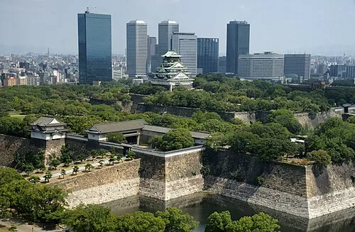 Osaka Castle Historic site, Chūō Ku2.6 km SW
-
 National Museum of Ethnology Museum, Suita Shi13 km N
-
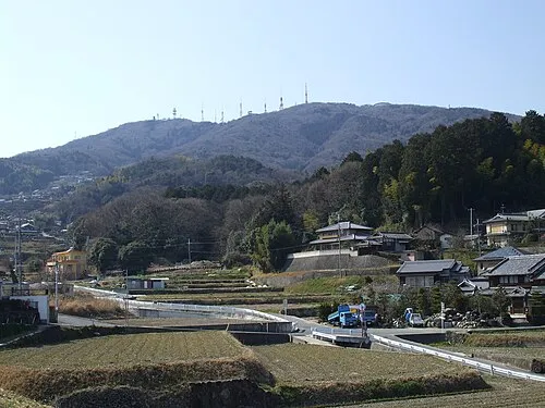 Ikoma Yama Mountain, Ikoma-shi12 km E
-
Yamato Gawa River, Japan14 km SW
-
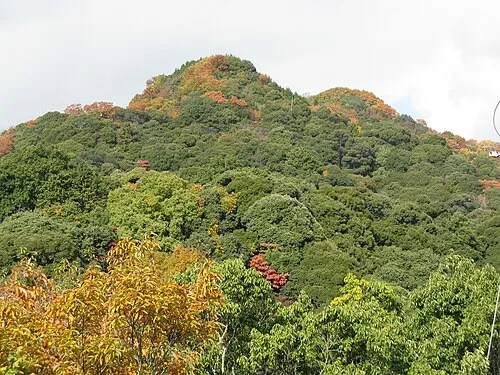 Mount Shigi Mountain, Heguri-chō15 km SE
-
Tenpō Zan Mountain, Minato-ku12 km SW
-
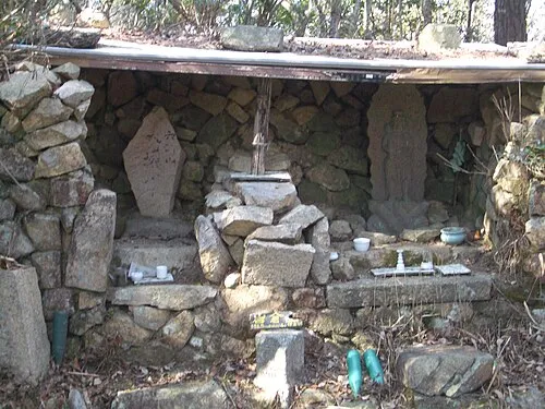 Mount Iwakura Mountain, Takarazuka Shi24 km NW
-
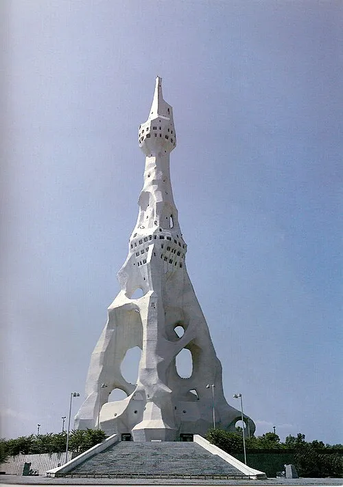 PL Peace Tower Landmark, Tondabayashi Shi22 km S
Sources & licences
Data last updated: · 2 independent sources