- Population
- 20,706
- 20.7K
- Elevation
- 44 m
- above sea level
- Local time
- UTC+09:00
- Asia/Tokyo · UTC+09:00
- Airports
- HND Tokyo Haneda International Airport64 km
- NRT Narita International Airport98 km
About Hatoyama Machi
Hatoyama Machi is a municipality. Location: Hiki-gun, Saitama. Population: 20,706. Elevation: 44 m.
Hatoyama (鳩山町, Hatoyama-machi) is a town located in Saitama Prefecture, in the central Kantō region of Japan. As of 1 March 2021, the town had an estimated population of 13,414 in 6006 households and a population density of 520 persons per km2. The total area of the town is 25.73 square kilometres (9.93 sq mi). The JAXA Earth Observation Center is located in Hatoyama.
Source: Wikipedia · CC BY-SA 4.0
Places bordering Hatoyama Machi
- Higashimatsuyama Shi
- Sakado Shi
- Ranzan Machi
- Tokigawa-machi
- Ogose
- Moroyama-machi
Population of Hatoyama Machi over time
| 2010 | 15,305 | |
|---|---|---|
| 2015 | 14,338 | |
| 2021 | 13,365 |
Censuses and official estimates; source: Wikidata.
Climate of Hatoyama Machi
Best months for sightseeingBest months for sightseeing: April–June, October.
This month · November
Outside the best season
Day 16° · Night 6° · Rain 69 mm
Better nearby cities in November
- Isehara · 65 km south18°
- Kofu · 78 km southwest17°
- Odawara · 83 km south19°
- Hottest month
- August (day 30°)
- Coldest month
- January (night -2°)
- Wettest month
- September (201 mm)
- Driest month
- January (38 mm)
Bars: average monthly low and high temperature. Below: precipitation. Monthly averages for 1970–2000 at about 18 km resolution, adjusted for elevation. Highlighted months are mild and relatively dry. Source: WorldClim 2.1 (CC BY 4.0).
Show values as a table
| Month | Jan | Feb | Mar | Apr | May | Jun | Jul | Aug | Sep | Oct | Nov | Dec |
|---|---|---|---|---|---|---|---|---|---|---|---|---|
| Average high (°C) | 9° | 10° | 13° | 19° | 23° | 25° | 29° | 30° | 26° | 21° | 16° | 11° |
| Average low (°C) | -2° | -1° | 2° | 8° | 13° | 17° | 21° | 22° | 19° | 12° | 6° | 0° |
| Precipitation (mm) | 38 | 53 | 79 | 99 | 127 | 180 | 162 | 181 | 201 | 158 | 69 | 41 |
Other places to visit in this season: April May June October
How to get to Hatoyama Machi
The nearest airport is Tokyo Haneda International Airport (HND), 64 km to the southeast as the crow flies. The nearest large city is Sakado, 6 km to the southeast.
Airports
- Tokyo Haneda International Airport (HND) Tokyo 64 kmsoutheast
- Narita International Airport (NRT) Narita 98 kmeast
- Ibaraki Airport (IBR) Omitama 100 kmeast
Nearby large cities
- Sakado Population: 100.3K 6 kmsoutheast
- Kawagoe Population: 354.6K 16 kmsoutheast
- Sayama Population: 160.8K 17 kmsoutheast
- Kumagaya Population: 195.3K 17 kmnorth
- Kōnosu Population: 116.8K 19 kmnortheast
Straight-line distances; road distances are longer. Airport data: OurAirports.
Day trips from Hatoyama Machi
Within 100 km: 50 historic and cultural sites, 51 natural sites, 44 lakes, rivers and coasts.
0–25 km3 places
- Mount Bukō Mountain 22 kmW
- Iruma River River 21 kmSE
- Kumagaya Rugby Ground Landmark 21 kmN
25–60 km60 places
- Saitama Super Arena Landmark 29 kmE
- Umeda Ko Lake 55 kmN
- Naka River River 59 kmSE
- Mukōjima Hyakkaen Attraction 52 kmSE
60–100 km82 places
- Jōga Shima Island 98 kmS
- Enoshima Island 77 kmS
- Lake Shoji Lake 86 kmSW
- Mount Echizen-dake Mountain 96 kmSW
Straight-line distances.
Nearby attractions & nature
Everything nearby-
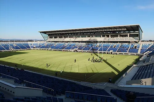 Kumagaya Rugby Ground Landmark, Kumagaya21 km N
-
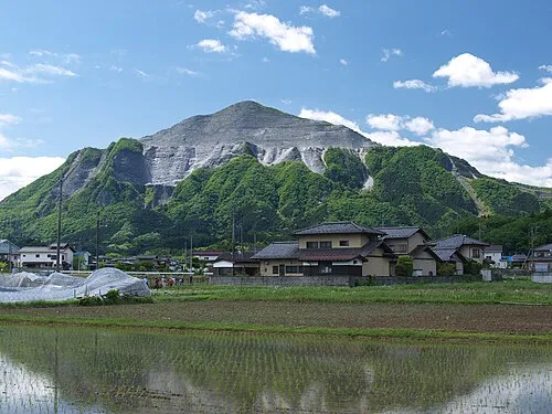 Mount Bukō Mountain, Chichibu-gun22 km W
-
Iruma River River, Saitama21 km SE
Other cities and towns in Hiki-gun
-
Namegawa-machi Municipality, Hiki-gun9.2 km N
-
Yoshimi-machi Municipality, Hiki-gun13 km NE
-
Kawajima Machi Municipality, Hiki-gun14 km E
-
Tokigawa-machi Municipality, Hiki-gun9.2 km W
-
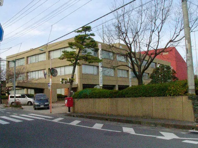 Ogawamachi Town, Ogawa Machi9.5 km NW
-
Ogawa Machi Municipality, Hiki-gun11 km NW
Sources & licences
Data last updated: · 2 independent sources