- Population
- 737,187
- 737.2K
- Elevation
- 24 m
- above sea level
- Local time
- UTC+09:00
- Asia/Tokyo · UTC+09:00
- Places inside
- 7
- listed under Ōta-ku
- Airports
- HND Tokyo Haneda International Airport7 km
- NRT Narita International Airport65 km
About Ōta-ku
Ōta-ku is a district. Location: Tokyo, Japan. Population: 737,187.
Ōta (大田区, Ōta-ku; Japanese pronunciation: [ò̞ó̞.tä́(.kɯ̈̀), ó̞ó̞-]) is a special ward in the Tokyo Metropolis in Japan. The ward refers to itself in English as Ōta City. It was formed in 1947 as a merger of Ōmori and Kamata following Tokyo City's transformation into Tokyo Metropolis. The southernmost of the 23 special wards, Ōta borders the special wards of Shinagawa, Meguro and Setagaya to the north, and Kōtō to the east.
Read more on Wikipedia Text: Wikipedia contributors · CC BY-SA 4.0 · shortened
Places bordering Ōta-ku
- Koto-ku
- Shinagawa
- Setagaya-ku
- Meguro-ku
Twin towns and sister cities of Ōta-ku
- Salem· United States
- Higashimatsushima· Japan
- Tōmi· Japan
- Misato Chō· Japan
Source: Wikidata. Only places with a page on this site are shown.
Population of Ōta-ku over time
| 2010 | 693,373 | |
|---|---|---|
| 2015 | 717,082 | |
| 2021 | 737,187 |
Censuses and official estimates; source: Wikidata.
Climate of Ōta-ku
Best months for sightseeingBest months for sightseeing: May–June, September–October.
Bars: average monthly low and high temperature. Below: precipitation. Monthly averages for 1970–2000 at about 18 km resolution, adjusted for elevation. Highlighted months are mild and relatively dry. Source: WorldClim 2.1 (CC BY 4.0).
Show values as a table
| Month | Jan | Feb | Mar | Apr | May | Jun | Jul | Aug | Sep | Oct | Nov | Dec |
|---|---|---|---|---|---|---|---|---|---|---|---|---|
| Average high (°C) | 10° | 10° | 13° | 18° | 23° | 25° | 28° | 30° | 26° | 21° | 17° | 12° |
| Average low (°C) | 1° | 2° | 5° | 10° | 14° | 18° | 22° | 23° | 20° | 14° | 9° | 4° |
| Precipitation (mm) | 49 | 63 | 113 | 129 | 137 | 184 | 156 | 157 | 206 | 179 | 95 | 44 |
Other places to visit in this season: May June September October
Airports nearest to Ōta-ku
- Tokyo Haneda International Airport (HND) Tokyo 7 km
- Narita International Airport (NRT) Narita 65 km
- Oshima Airport (OIM) Izu Oshima 92 km
Straight-line distance; airports with scheduled flights only. Source: OurAirports (public domain).
Places in Ōta-ku
7 placesBar: population relative to the most populous place in this list.
Cities & villages1
- Shimomaruko · Neighbourhood
Nearby attractions & nature
Everything nearby-
 Sōji Ji Attraction, Tsurumi Ku7.3 km SW
-
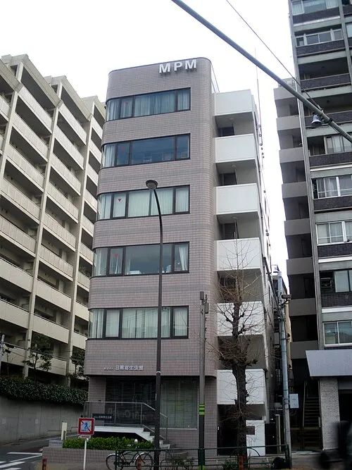 Meguro Parasitological Museum Museum, Meguro-ku7.9 km N
-
Meguro River River, Tokyo7.1 km NE
-
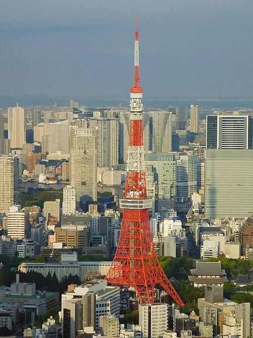 Tokyo Tower Landmark, Minato-ku11 km N
-
Sumida River River, Tokyo11 km NE
-
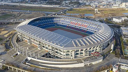 Nissan Stadium Landmark, Kōhoku-ku11 km SW
Sources & licences
Data last updated: · 2 independent sources