- Population
- 523,419
- 523.4K
- Elevation
- 11 m
- above sea level
- Local time
- UTC+09:00
- Asia/Tokyo · UTC+09:00
- Places inside
- 8
- listed under Koto-ku
- Airports
- HND Tokyo Haneda International Airport13 km
- NRT Narita International Airport53 km
About Koto-ku
Koto-ku is a district. Location: Tokyo, Japan. Population: 523,419.
Kōtō (江東区, Kōtō-ku; Japanese pronunciation: [kò̞ó̞.tó̞ó̞, -tó̞ò̞.kɯ̈̀, kó̞ó̞-]) is a special ward in the Tokyo Metropolis in Japan. It is known as Kōtō City in English. As of May 1, 2025, the ward has an estimated population of 543,730, and a population density of 12,648/km2 (32,760/sq mi). The total area is 42.99 km2 (16.60 sq mi). Kōtō is east of the Tokyo metropolitan center, bounded by the Sumida River to the west and the Arakawa River to the east.
Read more on Wikipedia Text: Wikipedia contributors · CC BY-SA 4.0 · shortened
Places bordering Koto-ku
- Edogawa-ku
- Ōta-ku
- Shinagawa
- Sumida
- Chuo
- Minato-ku
Population of Koto-ku over time
| 2010 | 460,819 | |
|---|---|---|
| 2015 | 498,109 | |
| 2021 | 523,419 |
Censuses and official estimates; source: Wikidata.
Climate of Koto-ku
Best months for sightseeingBest months for sightseeing: May–June, October.
Bars: average monthly low and high temperature. Below: precipitation. Monthly averages for 1970–2000 at about 18 km resolution, adjusted for elevation. Highlighted months are mild and relatively dry. Source: WorldClim 2.1 (CC BY 4.0).
Show values as a table
| Month | Jan | Feb | Mar | Apr | May | Jun | Jul | Aug | Sep | Oct | Nov | Dec |
|---|---|---|---|---|---|---|---|---|---|---|---|---|
| Average high (°C) | 10° | 10° | 13° | 19° | 23° | 25° | 29° | 31° | 27° | 22° | 17° | 12° |
| Average low (°C) | 1° | 1° | 4° | 10° | 14° | 18° | 22° | 23° | 20° | 14° | 8° | 3° |
| Precipitation (mm) | 43 | 58 | 101 | 119 | 129 | 174 | 157 | 157 | 202 | 167 | 85 | 40 |
Airports nearest to Koto-ku
- Tokyo Haneda International Airport (HND) Tokyo 13 km
- Narita International Airport (NRT) Narita 53 km
- Ibaraki Airport (IBR) Omitama 79 km
Straight-line distance; airports with scheduled flights only. Source: OurAirports (public domain).
Places in Koto-ku
8 placesBar: population relative to the most populous place in this list.
-
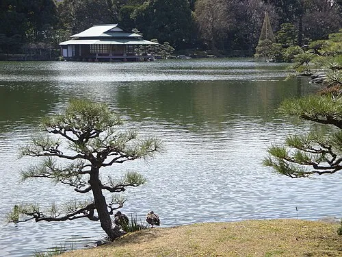 Kiyosumi Teien Attraction
-
Wakasu Village
-
Yumenoshima Village
-
Yumenoshima Park Natural site
Nearby attractions & nature
Everything nearby-
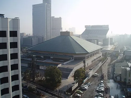 Ryōgoku Kokugikan Landmark, Sumida4 km NW
-
Kanda River River, Tokyo4.1 km NW
-
Arakawa Drainage Canal River, Japan2.9 km E
-
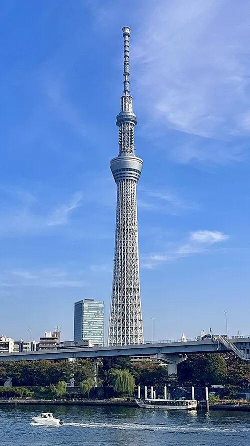 Tokyo Sky Tree Landmark, Sumida4.8 km N
-
Sumida River River, Tokyo5 km W
-
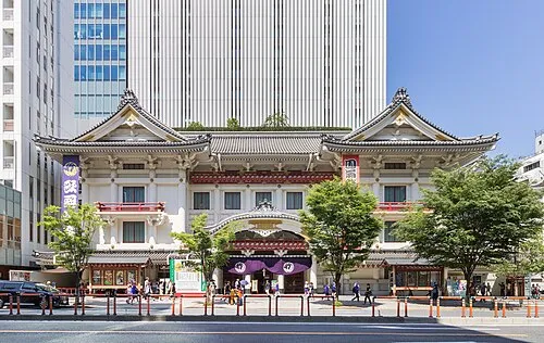 Kabuki-za 歌舞伎座 Attraction, Chuo4.4 km W
Sources & licences
Data last updated: · 2 independent sources