Tateyama Machi
Local name: 立山町
Located in Nakaniikawa Gun, Toyama Coordinates: 36°35′10″ N 137°30′36″ E
- Population
- 27,195
- 27.2K
- Elevation
- 1,374 m
- above sea level
- Local time
- UTC+09:00
- Asia/Tokyo · UTC+09:00
- Places inside
- 2
- listed under Tateyama Machi
- Airports
- TOY Toyama Kitokito Airport30 km
- MMJ Shinshu-Matsumoto Airport59 km
About Tateyama Machi
Tateyama Machi is a municipality. Location: Nakaniikawa Gun, Toyama. Population: 27,195. Elevation: 1,374 m.
Tateyama (立山町, Tateyama-machi) is a town located in Nakaniikawa District, Toyama Prefecture, Japan. As of 1 October 2016, the town had an estimated population of 26,212 in 9452 households and a population density of 85 persons per km2. The total area of the town was 307.29 square kilometres (118.65 sq mi).
Source: Wikipedia · CC BY-SA 4.0
Places bordering Tateyama Machi
- Toyama
- Kurobe-shi
- Kamiichi
- Funahashi Mura
- Ōmachi-shi
Population of Tateyama Machi over time
| 2010 | 27,466 | |
|---|---|---|
| 2015 | 26,317 | |
| 2021 | 24,697 |
Censuses and official estimates; source: Wikidata.
Climate of Tateyama Machi
Best months for sightseeingBest months for sightseeing: July–September.
This month · November
A wet month
Day 8° · Night -2° · Rain 106 mm
Better nearby cities in November
- Kofu · 140 km southeast17°
- Fujinomiya · 182 km southeast18°
- Fuji · 190 km southeast20°
- Hottest month
- August (day 24°)
- Coldest month
- January (night -11°)
- Wettest month
- September (256 mm)
- Driest month
- December (78 mm)
Bars: average monthly low and high temperature. Below: precipitation. Monthly averages for 1970–2000 at about 18 km resolution, adjusted for elevation. Highlighted months are mild and relatively dry. Source: WorldClim 2.1 (CC BY 4.0).
Show values as a table
| Month | Jan | Feb | Mar | Apr | May | Jun | Jul | Aug | Sep | Oct | Nov | Dec |
|---|---|---|---|---|---|---|---|---|---|---|---|---|
| Average high (°C) | -2° | -2° | 2° | 9° | 15° | 19° | 23° | 24° | 20° | 14° | 8° | 1° |
| Average low (°C) | -11° | -11° | -8° | -1° | 5° | 10° | 14° | 16° | 11° | 5° | -2° | -8° |
| Precipitation (mm) | 81 | 81 | 110 | 143 | 159 | 229 | 254 | 243 | 256 | 143 | 106 | 78 |
How to get to Tateyama Machi
The nearest airport is Toyama Kitokito Airport (TOY), 30 km to the west as the crow flies. The nearest large city is Toyama, 29 km to the northwest.
Airports
- Toyama Kitokito Airport (TOY) Toyama 30 kmwest
- Shinshu-Matsumoto Airport (MMJ) Matsumoto 59 kmsoutheast
- Noto Satoyama Airport (NTQ) Wajima 92 kmnorthwest
Nearby large cities
- Toyama Population: 415.8K 29 kmnorthwest
- Takaoka Population: 170.1K 48 kmnorthwest
- Matsumoto Population: 241.1K 57 kmsoutheast
- Nagano Population: 372.8K 61 kmeast
- Ueda Population: 157.5K 72 kmeast
Straight-line distances; road distances are longer. Airport data: OurAirports.
Day trips from Tateyama Machi
Within 100 km: 2 historic and cultural sites, 51 natural sites, 17 lakes, rivers and coasts.
0–25 km7 places
- Mount Suisho Mountain 19 kmSE
- Mount Tate Mountain 10 kmE
- Mount Yakushi Mountain 13 kmS
- Mount Tsurugi Mountain 10 kmNE
25–60 km27 places
- Lake Kizaki Lake 29 kmE
- Mount Kamuriki Mountain 55 kmE
- Joganji River River 27 kmNW
- Tsubakuro Dake Mountain 27 kmSE
60–100 km36 places
- Honshu Island 79 kmSE
- Arakawa River River 94 kmNE
- Takada castle Historic site 88 kmNE
- Chausu-yama Mountain 90 kmS
Straight-line distances.
Places in Tateyama Machi
2 placesBar: population relative to the most populous place in this list.
Mountains & nature1
- Mount Tate · Mountain
Nearby attractions & nature
Everything nearby-
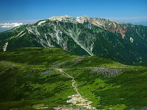 Mount Yakushi Mountain, Toyama Shi13 km S
-
 Mount Tsurugi Mountain, Japan10 km NE
-
 Mount Suisho Mountain, Toyama Shi19 km SE
-
 Mount Kurobegorō Mountain, Takayama Shi22 km S
-
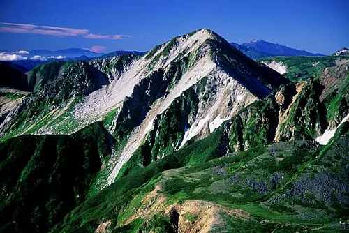 Washū Dake Mountain, Ōmachi-shi22 km SE
-
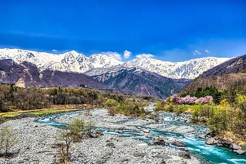 Hida-sammyaku Mountain, Japan21 km SE
Sources & licences
Data last updated: · 2 independent sources