- Population
- 7,629
- 7.6K
- Elevation
- 28 m
- above sea level
- Local time
- UTC+00:00
- Atlantic/Canary · UTC+00:00
- Airports
- ACE César Manrique-Lanzarote Airport12 km
- FUE Fuerteventura Airport70 km
About Costa Teguise
Costa Teguise is a town. Location: Teguise, Las Palmas. Population: 7,629. Elevation: 28 m.
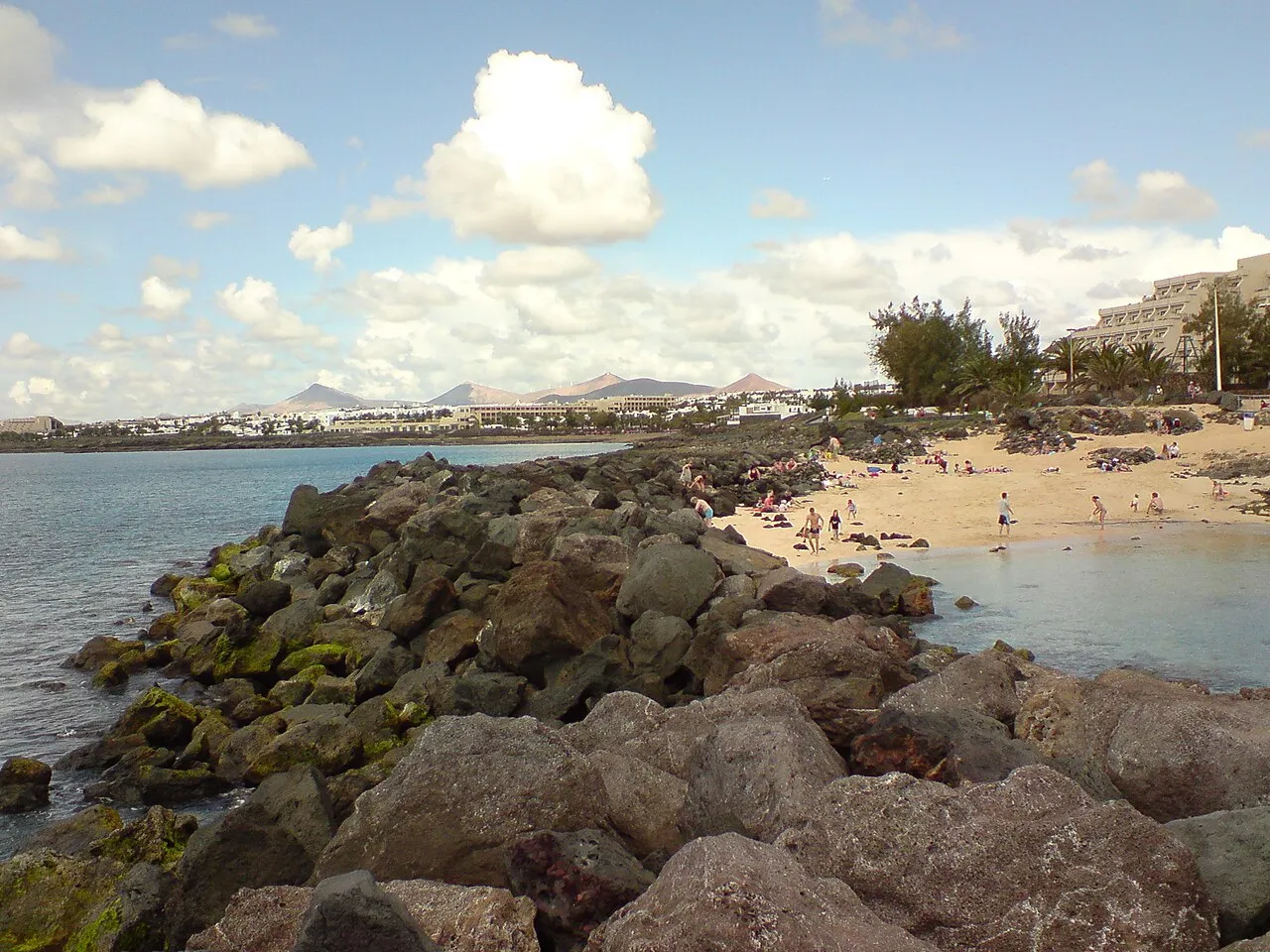
Costa Teguise is a coastal town in the Municipality of Teguise on the island of Lanzarote (in the Canary Islands of Spain). It was built intentionally to accommodate tourism, and prior to building commencing the streets were planned, constructed, and serviced in advance. The town has four main beaches, all of which are natural: Playa de los Charcos, Playa de las Cucharas, Playa del Jablillo and Playa Bastián.
Source: Wikipedia · CC BY-SA 4.0
Photos of Costa Teguise
-

Miguel Mendez · CC BY 2.0 -

Miguel Mendez · CC BY 2.0 -

Gerd Eichmann · CC BY 4.0 -
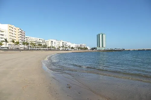
Playa Reducto Paul Stephenson from London · CC BY 2.0 -
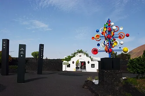
Fundación César Manrique Balou46 · CC BY-SA 3.0


Travel notes for Costa Teguise
From Wikivoyage
Costa Teguise is a beach resort on the east coast of Lanzarote in the Canary Islands. It's about 7 km east of the capital Arrecife and 15 km from the island's airport. In 2022 the resident population was 8949, but this is greatly swelled by visitors, as it's a popular spot for budget package holidays. It was built as a planned resort in the 1970s, which must have been exciting times here, as the bedrock is tough lava and the developer was Rio Tinto Explosives.
Get in+
Arrecife Airport (ACE IATA) is 15 km (9.3 mi) southwest: most visitors are on package flights and are bussed straight to their hotels. By public bus, you need to ride into Arrecife and change. A family group will find it simpler to grab a taxi.
By bus:
Bus 3. Runs from Arrecife to Costa Teguise taking 20 min, every 20 minutes in the daytime and hourly at night. Westbound it continues past the city to Playa Honda and Puerto del Carmen, another 40 min. (updated Dec 2023)
Bus 11. Takes 30 min from Costa Teguise to Teguise Market, with five runs on Sunday morning, returning early afternoon. (updated Dec 2023)
Bus 31. Takes 45 min from Caleta de Famara on the north coast, daily every 90 min. (updated Dec 2023)
1 Hotel Salinas is how the bus turnaround in Costa Teguise is shown on timetables. It's just a turning loop with no facilities, by the entrance to Paradisus Salinas.
Source: Wikivoyage · CC BY-SA 4.0 · abridged
Climate of Costa Teguise
Best months for sightseeingBest months for sightseeing: May–December.
This month · November
A good month to visit
Day 23° · Night 18° · Rain 17 mm
- Hottest month
- September (day 24°)
- Coldest month
- January (night 15°)
- Wettest month
- December (26 mm)
- Driest month
- June (0 mm)
Bars: average monthly low and high temperature. Below: precipitation. Monthly averages for 1970–2000 at about 18 km resolution, adjusted for elevation. Highlighted months are mild and relatively dry. Source: WorldClim 2.1 (CC BY 4.0).
Show values as a table
| Month | Jan | Feb | Mar | Apr | May | Jun | Jul | Aug | Sep | Oct | Nov | Dec |
|---|---|---|---|---|---|---|---|---|---|---|---|---|
| Average high (°C) | 20° | 20° | 20° | 20° | 20° | 21° | 23° | 24° | 24° | 24° | 23° | 21° |
| Average low (°C) | 15° | 15° | 16° | 16° | 17° | 19° | 20° | 20° | 20° | 19° | 18° | 16° |
| Precipitation (mm) | 25 | 19 | 13 | 7 | 2 | 0 | 0 | 1 | 3 | 6 | 17 | 26 |
Other places to visit in this season: May June July August September October November December
How to get to Costa Teguise
The nearest airport is César Manrique-Lanzarote Airport (ACE), 12 km to the southwest as the crow flies. The nearest large city is Las Palmas de Gran Canaria, 212 km to the southwest.
Airports
- César Manrique-Lanzarote Airport (ACE) San Bartolomé 12 kmsouthwest
- Fuerteventura Airport (FUE) El Matorral 70 kmsouthwest
- Laayoune Hassan I International Airport (EUN) El Aaiún 207 kmsouth
Nearby large cities
- Las Palmas de Gran Canaria Population: 383.5K 212 kmsouthwest
- Telde Population: 123.3K 219 kmsouthwest
- Santa Cruz de Tenerife Population: 211.4K 276 kmwest
- San Cristóbal de La Laguna Population: 150.7K 281 kmwest
Straight-line distances; road distances are longer. Airport data: OurAirports.
Day trips from Costa Teguise
Within 100 km: 67 historic and cultural sites, 88 natural sites, 76 lakes, rivers and coasts.
0–25 km93 places
- Lanzarote Island 14 kmW
- Playa Del Risco Beach 24 kmN
- Playa La Francesa Beach 25 kmN
- Playa Montaña Amarilla Beach 25 kmN
25–60 km80 places
- Graciosa Island 28 kmN
- Playa de las Conchas Beach 31 kmN
- Playa del Puerto Beach 26 kmN
- Playa del Salado Beach 25 kmN
60–100 km58 places
- Fuerteventura Island 86 kmSW
- Montaña de Tao Mountain 74 kmSW
- Monte Muda Mountain 65 kmSW
- Playa de Marfolín Beach 60 kmSW
Straight-line distances.
Nearby attractions & nature
Everything nearby-
Playa de las Cucharas Beach, Las Palmas1 km E
-
Playa Bastián Beach, Teguise1.3 km E
-
Playa del Jablillo Beach, Teguise1.7 km E
-
Playa de los Charcos Beach, Teguise1.6 km E
-
Montaña Corona Mountain, Teguise2.6 km N
-
Fundación César Manrique Museum, Teguise4.7 km W
-
Cabo Ancones Natural site, Teguise4 km NE
-
Museo Internacional de Arte Contemporáneo Castillo de San José Museum, Arrecife4.5 km SW
Sources & licences
Data last updated: · 2 independent sources