- Elevation
- 203 m
- above sea level
- Local time
- UTC+00:00
- Atlantic/Canary · UTC+00:00
- Airports
- ACE César Manrique-Lanzarote Airport13 km
- FUE Fuerteventura Airport72 km
About Montaña Corona
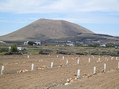
Montaña Corona is a mountain. Location: Teguise, Las Palmas. Elevation: 203 m. The best months to visit are October–July. The nearest airport is César Manrique-Lanzarote Airport (13 km). Nearby sights include Playa del Jablillo and Playa de las Cucharas.
Photos of Montaña Corona
-
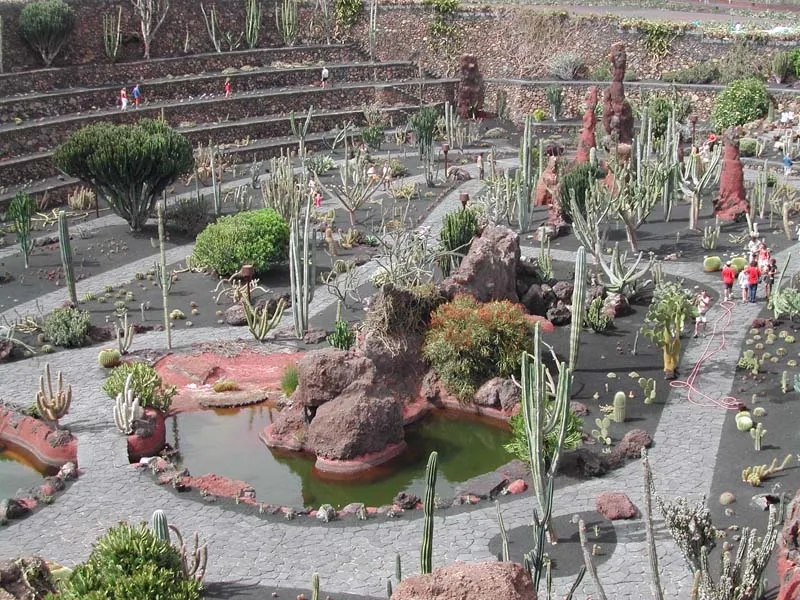
Jardín de Cactus Wikimedia Commons · CC BY-SA 3.0 -
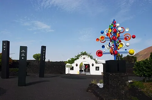
Fundación César Manrique Balou46 · CC BY-SA 3.0


Climate of Montaña Corona
Best months for sightseeingBest months for sightseeing: October–July.
This month · November
A good month to visit
Day 23° · Night 15° · Rain 21 mm
- Hottest month
- August (day 27°)
- Coldest month
- January (night 12°)
- Wettest month
- December (32 mm)
- Driest month
- July (0 mm)
Bars: average monthly low and high temperature. Below: precipitation. Monthly averages for 1970–2000 at about 18 km resolution, adjusted for elevation. Highlighted months are mild and relatively dry. Source: WorldClim 2.1 (CC BY 4.0).
Show values as a table
| Month | Jan | Feb | Mar | Apr | May | Jun | Jul | Aug | Sep | Oct | Nov | Dec |
|---|---|---|---|---|---|---|---|---|---|---|---|---|
| Average high (°C) | 20° | 21° | 22° | 23° | 24° | 25° | 26° | 27° | 27° | 25° | 23° | 21° |
| Average low (°C) | 12° | 13° | 13° | 14° | 15° | 16° | 18° | 18° | 18° | 17° | 15° | 13° |
| Precipitation (mm) | 30 | 23 | 17 | 10 | 3 | 1 | 0 | 1 | 4 | 8 | 21 | 32 |
Other places to visit in this season: January February March April May June July October November December
How to get to Montaña Corona
The nearest airport is César Manrique-Lanzarote Airport (ACE), 13 km to the southwest as the crow flies. The nearest large city is Las Palmas de Gran Canaria, 213 km to the southwest.
Airports
- César Manrique-Lanzarote Airport (ACE) San Bartolomé 13 kmsouthwest
- Fuerteventura Airport (FUE) El Matorral 72 kmsouthwest
- Laayoune Hassan I International Airport (EUN) El Aaiún 210 kmsouth
Nearby large cities
- Las Palmas de Gran Canaria Population: 383.5K 213 kmsouthwest
- Telde Population: 123.3K 220 kmsouthwest
- Santa Cruz de Tenerife Population: 211.4K 276 kmwest
- San Cristóbal de La Laguna Population: 150.7K 282 kmwest
Straight-line distances; road distances are longer. Airport data: OurAirports.
Day trips from Montaña Corona
Within 100 km: 67 historic and cultural sites, 86 natural sites, 76 lakes, rivers and coasts.
0–25 km95 places
- Lanzarote Island 14 kmW
- Playa Del Risco Beach 21 kmN
- Playa del Puerto Beach 23 kmN
- Playa La Francesa Beach 22 kmN
25–60 km68 places
- Graciosa Island 25 kmN
- Playa de las Conchas Beach 28 kmN
- Amber Beach 28 kmN
- Pedro Barba Mountain 25 kmN
60–100 km66 places
- Fuerteventura Island 88 kmSW
- Montaña de Tao Mountain 76 kmSW
- Monte Muda Mountain 67 kmSW
- Playa de Marfolín Beach 62 kmSW
Straight-line distances.
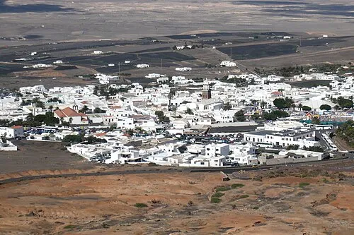
Nearest towns and villages


Nearby attractions & nature
Everything nearby-
Playa del Jablillo Beach, Teguise2.9 km SE
-
Playa de las Cucharas Beach, Las Palmas2.9 km SE
-
Playa Bastián Beach, Teguise2.9 km SE
-
Cabo Ancones Natural site, Teguise3.3 km E
-
Playa de los Charcos Beach, Teguise3 km SE
-
Montaña Tinamala Mountain, Teguise3.9 km N
-
Los Agujeros Beach, Teguise5.7 km NE
-
Fundación César Manrique Museum, Teguise5.1 km SW
More nature in Spain
-
 Montaña Tamia Mountain, Teguise13 km W
-
Tenegüime Natural site, Teguise7.6 km N
-
Cerro Terroso Mountain, Teguise8.5 km NW
-
El Jable Natural site, Teguise13 km NW
-
Caldera Trasera Natural site, Teguise13 km NW
-
La Respingona Natural site, Teguise15 km NW
Sources & licences
Data last updated: