- Elevation
- 382 m
- above sea level
- Local time
- UTC+00:00
- Atlantic/Canary · UTC+00:00
- Airports
- SPC La Palma Airport29 km
- VDE El Hierro Airport113 km
About El Palmar
El Palmar is a village. Location: Garafía, Santa Cruz de Tenerife. Elevation: 382 m. The best months to visit are May–October. The nearest airport is La Palma Airport (29 km). Nearby sights include Roque de los Muchachos and Roque de los Muchachos.
Climate of El Palmar
Best months for sightseeingBest months for sightseeing: May–October.
This month · November
Outside the best season
Day 21° · Night 16° · Rain 49 mm
Better nearby cities in November
- Santa Cruz de Tenerife · 169 km east24°
- Las Palmas de Gran Canaria · 259 km east23°
- Telde · 263 km east23°
- Hottest month
- September (day 24°)
- Coldest month
- February (night 13°)
- Wettest month
- December (69 mm)
- Driest month
- July (0 mm)
Bars: average monthly low and high temperature. Below: precipitation. Monthly averages for 1970–2000 at about 18 km resolution, adjusted for elevation. Highlighted months are mild and relatively dry. Source: WorldClim 2.1 (CC BY 4.0).
Show values as a table
| Month | Jan | Feb | Mar | Apr | May | Jun | Jul | Aug | Sep | Oct | Nov | Dec |
|---|---|---|---|---|---|---|---|---|---|---|---|---|
| Average high (°C) | 17° | 18° | 18° | 18° | 20° | 21° | 23° | 24° | 24° | 23° | 21° | 19° |
| Average low (°C) | 13° | 13° | 13° | 14° | 15° | 17° | 18° | 19° | 19° | 18° | 16° | 15° |
| Precipitation (mm) | 60 | 44 | 35 | 20 | 8 | 1 | 0 | 1 | 12 | 33 | 49 | 69 |
Other places to visit in this season: May June July August September October
How to get to El Palmar
The nearest airport is La Palma Airport (SPC), 29 km to the southeast as the crow flies. For international flights: Tenerife Sur Airport (TFS) (159 km). The nearest large city is San Cristóbal de La Laguna, 162 km to the east.
Airports
- La Palma Airport (SPC) Sta Cruz de la Palma, La Palma Island 29 kmsoutheast
- El Hierro Airport (VDE) El Hierro Island 113 kmsouth
- Tenerife Sur Airport (TFS) Tenerife 159 kmsoutheast
Nearby large cities
- San Cristóbal de La Laguna Population: 150.7K 162 kmeast
- Santa Cruz de Tenerife Population: 211.4K 169 kmeast
- Las Palmas de Gran Canaria Population: 383.5K 259 kmeast
- Telde Population: 123.3K 263 kmeast
Straight-line distances; road distances are longer. Airport data: OurAirports.
Day trips from El Palmar
Within 100 km: 22 historic and cultural sites, 29 natural sites, 13 lakes, rivers and coasts.
0–25 km42 places
- La Palma Island Island 17 kmSE
- Playa del Camariño Beach 12 kmSW
- Playa de Nogales Beach 21 kmSE
- Playa Puerto Espindola Beach 17 kmE
25–60 km16 places
- Playa del Hoyo Beach 30 kmSE
- Playa Delphin Beach 28 kmS
- Piedra Nueva Beach 32 kmSE
- Montaña Vinijogre Mountain 30 kmSE
60–100 km6 places
- Alto Garajonay Mountain 100 kmSE
- Playa de Vallehermoso Beach 97 kmSE
- Bahía de Vallehermosa Natural site 97 kmSE
- Charco del Cieno Natural site 100 kmSE
Straight-line distances.
Nearby attractions & nature
Everything nearby-
Roque de los Muchachos Mountain, Paso, El10 km SE
-
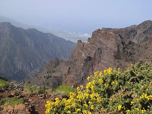 Roque de los Muchachos Mountain, Paso, El10 km SE
-
Roque Palmero Mountain, Paso, El12 km S
-
Casa de La Miel Museum, Tijarafe11 km S
-
Parque Nacional de la Caldera de Taburiente Natural site, Paso, El13 km SE
-
Area Recreativa y Centro de Visitantes Los Tilos Natural site, San Andrés y Sauces14 km SE
Sources & licences
Data last updated: