La Gomera
Located in Santa Cruz de Tenerife, Canary Islands Coordinates: 28°06′00″ N 17°08′00″ W
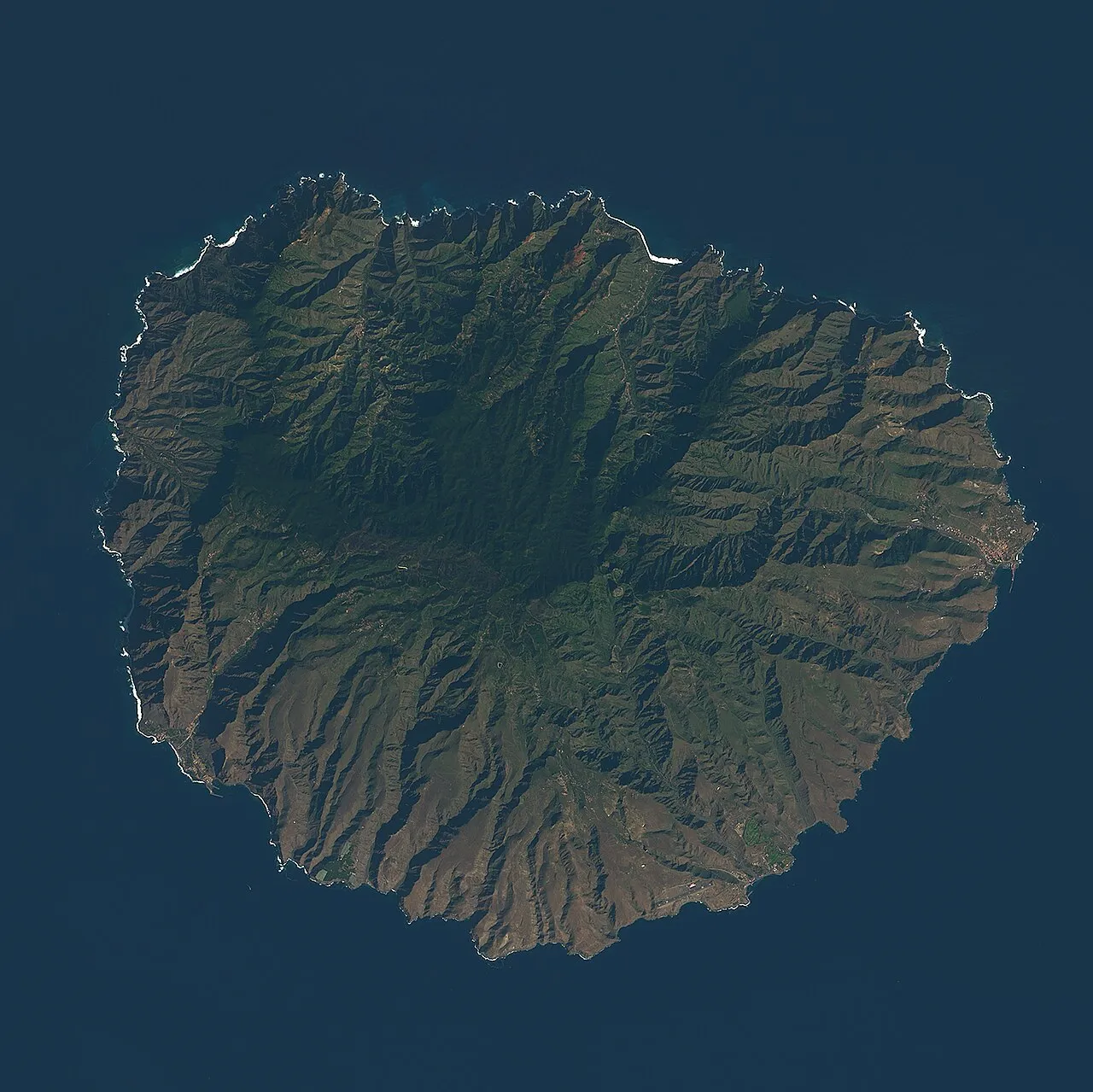
- Elevation
- 226 m
- above sea level
- Local time
- UTC+00:00
- Atlantic/Canary · UTC+00:00
- Population
- 21,952
- 22K
- Airports
- TFS Tenerife Sur Airport55 km
- VDE El Hierro Airport81 km
About La Gomera
La Gomera is an island. Location: Santa Cruz de Tenerife, Canary Islands. Population: 21,952.
La Gomera (Spanish: [la ɣoˈmeɾa] ) is one of Spain's Canary Islands, in the Atlantic Ocean off the coast of Africa. With an area of 370.03 km2 (142.87 sq mi), it is the third-smallest of the archipelago's eight main islands. It belongs to the province of Santa Cruz de Tenerife. La Gomera is the third least populous of the eight main Canary Islands, with 22,361 inhabitants at the start of 2023. Its capital is San Sebastián de La Gomera, where the cabildo insular (island council) is located.
Source: Wikipedia · CC BY-SA 4.0
Photos of La Gomera
-

Bybbisch94, Christian Gebhardt · CC BY-SA 4.0 -

Bybbisch94, Christian Gebhardt · CC BY-SA 4.0 -
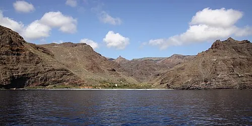
Playa de El Cabrito Waielbi · CC BY-SA 3.0


Travel notes for La Gomera
From Wikivoyage
La Gomera is the second smallest island of the Canary Islands. It is an undeveloped, unspoilt, beautiful island 40 minutes by fast ferry from Tenerife that is ideal for walkers.
Understand+
There is a contrast between lush forests around the summit and in the national park with dry vegetation on the flanks of the island. It is of real interest to botanists for its variety of plant life and number of endemic species. It has a good climate all year round, especially in the south. La Gomera is one of two Canary Islands without direct tourist flights from mainland Europe, the other being El Hierro.
Get in+
By plane:
1 La Gomera Airport (GMZ IATA), Playa Santiago (south of island, 34 km (21 mi) southwest by road from the island's capital city, San Sebastián de la Gomera). It is served only by local planes from Tenerife Nord Airport. Binter Canarias operates 2 flights per day in ATR 72, from Tenerife North airport (TFN IATA, Los Rodeos), at 10:00 and 17:00. 30 min flights, operated by Binter Canarias for €9–18. Some flights also have some code-sharing with Iberia, enabling transit from International flights. (updated Jun 2018)
Most people fly to Tenerife South (TFS IATA, Reina Sofia), then get a ferry from nearby Los Cristianos. Buses 451, 111 and 343 drive from Tenerife South Airport to 2 Los Cristianos bus station. The ride costs €3.70 (April 2018). The buses stop by the roundabout close to the Los Cristianos bus station. From there you need to walk about 1.5 km (0.93 mi) down to the port where the ferries leave from.
By boat:
By ferry from Los Cristianos in Tenerife to 3 San Sebastian de la Gomera port (or if operated, directly to Playa Santiago or Valle Gran Rey).
An advance day return costs around €80 for the 50- to 60-minute crossing.
Two ferry companies are providing service:
Naviera Armas, ☏ +34 902 456 500, +34 928 300 600. Travel time ~60 minutes. Large ferry, taking around an hour to San Sebastian. Very nice ship with a big terrace on the upper deck and a lot of bars and saloons inside. €40 one way (Sept 2021), €80 return (Sept 2021).
Source: Wikivoyage · CC BY-SA 4.0 · abridged
Climate of La Gomera
Best months for sightseeingBest months for sightseeing: March–December.
This month · November
A good month to visit
Day 23° · Night 17° · Rain 39 mm
- Hottest month
- August (day 27°)
- Coldest month
- January (night 14°)
- Wettest month
- December (56 mm)
- Driest month
- July (0 mm)
Bars: average monthly low and high temperature. Below: precipitation. Monthly averages for 1970–2000 at about 18 km resolution, adjusted for elevation. Highlighted months are mild and relatively dry. Source: WorldClim 2.1 (CC BY 4.0).
Show values as a table
| Month | Jan | Feb | Mar | Apr | May | Jun | Jul | Aug | Sep | Oct | Nov | Dec |
|---|---|---|---|---|---|---|---|---|---|---|---|---|
| Average high (°C) | 20° | 20° | 21° | 21° | 22° | 24° | 26° | 27° | 27° | 25° | 23° | 21° |
| Average low (°C) | 14° | 14° | 15° | 15° | 16° | 18° | 19° | 20° | 20° | 19° | 17° | 16° |
| Precipitation (mm) | 48 | 40 | 31 | 18 | 6 | 1 | 0 | 1 | 8 | 24 | 39 | 56 |
Other places to visit in this season: March April May June July August September October November December
How to get to La Gomera
The nearest airport is Tenerife Sur Airport (TFS), 55 km to the east as the crow flies. The nearest large city is San Cristóbal de La Laguna, 90 km to the northeast.
Airports
- Tenerife Sur Airport (TFS) Tenerife 55 kmeast
- El Hierro Airport (VDE) El Hierro Island 81 kmsouthwest
- La Palma Airport (SPC) Sta Cruz de la Palma, La Palma Island 84 kmnorthwest
Nearby large cities
- San Cristóbal de La Laguna Population: 150.7K 90 kmnortheast
- Santa Cruz de Tenerife Population: 211.4K 95 kmnortheast
- Las Palmas de Gran Canaria Population: 383.5K 169 kmeast
- Telde Population: 123.3K 169 kmeast
Straight-line distances; road distances are longer. Airport data: OurAirports.
Day trips from La Gomera
Within 100 km: 136 historic and cultural sites, 154 natural sites, 85 lakes, rivers and coasts.
0–25 km32 places
- Playa San Sebastián Beach 3 kmSE
- Alto Garajonay Mountain 13 kmNW
- Monte San Salvador Mountain 11 kmSW
- Asamblea de Dios de las Islas Canarias Attraction 2 kmSE
25–60 km105 places
- El Arenal Beach 60 kmNE
- Playa de las Vistas Beach 41 kmE
- Playa Las Galgas Beach 35 kmE
- Montaña Rajada Mountain 56 kmE
60–100 km238 places
- Tenerife Island 66 kmNE
- La Palma Island Island 97 kmNW
- El Hierro Island 94 kmSW
- Las Playecillas Beach 87 kmSW
Straight-line distances.
Nearest towns and villages
-
San Sebastián de la Gomera Municipality, Santa Cruz de Tenerife2.3 km SW
-
San Sebastián de La Gomera Town, San Sebastián de la Gomera2.2 km SE
-
Inchereda Village, San Sebastián de la Gomera2.5 km NE
-
Lomito Fragoso y Honduras Village, San Sebastián de la Gomera3.3 km W
-
Hermigua Municipality, Santa Cruz de Tenerife9.5 km NW
-
Seima Village, San Sebastián de la Gomera4 km SW
Nearby attractions & nature
Everything nearby-
Playa San Sebastián Beach, San Sebastián de la Gomera2.5 km SE
-
Playa de El Cabrito Beach, San Sebastián de la Gomera4.2 km S
-
Asamblea de Dios de las Islas Canarias Attraction, San Sebastián de la Gomera2.3 km SE
-
Church of the Assumption Attraction, San Sebastián de la Gomera2.3 km E
-
Torre del Conde Landmark, San Sebastián de la Gomera2.4 km SE
-
Museo Arqueológico de La Gomera Museum, San Sebastián de la Gomera2.4 km E
-
Faro de San Cristóbal Landmark, San Sebastián de la Gomera3.3 km E
-
Cabo Gaviota Natural site, Canary Islands7.7 km SW
More lakes, rivers and coasts in Spain
-
Playa de Santiago Beach, Alajeró9.9 km SW
-
Playa de las Salinas Beach, Vallehermoso17 km NW
-
Playa de Argayal Beach, Vallehermoso18 km W
-
Playa Valle Gran Rey Beach, Santa Cruz de Tenerife20 km W
-
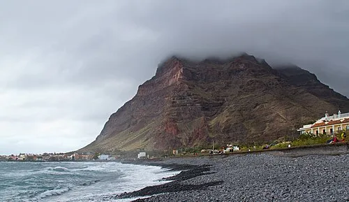 Playa La Puntilla Beach, Santa Cruz de Tenerife20 km W
-
Playa de Vallehermoso Beach, Vallehermoso16 km NW
Sources & licences
Data last updated: · 2 independent sources