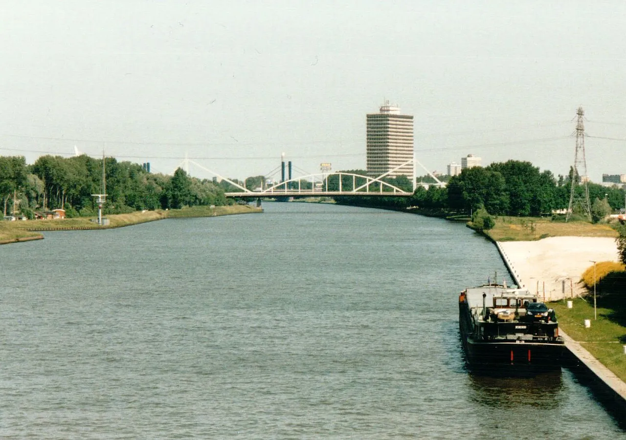
- Population
- 61,489
- 61.5K
- Elevation
- 3 m
- above sea level
- Local time
- UTC+01:00
- Europe/Amsterdam · UTC+01:00
- Airports
- AMS Amsterdam Airport Schiphol38 km
- RTM Rotterdam The Hague Airport45 km
About Nieuwegein
Nieuwegein is a town. Location: Nieuwegein Municipality, Utrecht. Population: 61,489. Elevation: 3 m. The best months to visit are June–August. The nearest airport is Amsterdam Airport Schiphol (38 km). Nearby sights include Kasteel Heemstede and Museum Catharijneconvent.
Photos of Nieuwegein
-

China Crisis · CC BY-SA 3.0 -

Choinowski · CC BY-SA 4.0 -

Jan dijkstra · CC BY-SA 4.0 -

Ben Bender · CC BY-SA 3.0 -

Jan dijkstra · CC BY-SA 4.0


Travel notes for Nieuwegein
From Wikivoyage
Nieuwegein (population 68,000) is a city in Utrecht province in the Netherlands, about 5 km south of Utrecht and just north of the river Lek. Most of Nieuwegein was built as a planned city since the 1970s but it does have its pretty sides, too.
Understand+
Despite its sizable population, Nieuwegein can essentially be considered a suburb of Utrecht. It was founded in 1971 mainly to accommodate Utrecht's rapidly growing population. The city was developed around the older villages of Jutphaas and Vreeswijk, whose character has been at least partly preserved. Therefore, somewhat unusually for a planned city, Nieuwegein still features around 100 listed monuments.
Get in+
Nieuwegein is bounded by three motorways, the A2, A12 and A27, which all have a (different) exit named Nieuwegein. The exits Utrecht-Lunetten and Utrecht-Zuid on the A12 and Nieuwegein Zuid on the A2 also serve the city. All these motorways can get quite congested during rush hour.
Nieuwegein does not have a train station and instead relies on Utrecht for connections to the rest of the country. There are frequent connections to Utrecht's main station, Utrecht Centraal, either by tram (lines 20 and 21) or bus (65, 66, 74, 77). All these buses serve slightly different routes within Nieuwegein, so make sure to double-check where exactly the bus is going when you board it at Utrecht Centraal.
Tram line 21 continues to IJsselstein and bus line 48 connects Nieuwegein with the smaller train stations in Houten and Maarssen. There is also a small ferry (pedestrians/cyclists €1.25/€1.75) across the river Lek to Vianen. Most other destinations are best reached with a change in Utrecht or by car or bike.
Source: Wikivoyage · CC BY-SA 4.0 · abridged
Climate of Nieuwegein
Best months for sightseeingBest months for sightseeing: June–August.
This month · November
A cold month
Day 9° · Night 3° · Rain 82 mm
- Hottest month
- August (day 22°)
- Coldest month
- February (night 0°)
- Wettest month
- November (82 mm)
- Driest month
- April (45 mm)
Bars: average monthly low and high temperature. Below: precipitation. Monthly averages for 1970–2000 at about 18 km resolution, adjusted for elevation. Highlighted months are mild and relatively dry. Source: WorldClim 2.1 (CC BY 4.0).
Show values as a table
| Month | Jan | Feb | Mar | Apr | May | Jun | Jul | Aug | Sep | Oct | Nov | Dec |
|---|---|---|---|---|---|---|---|---|---|---|---|---|
| Average high (°C) | 6° | 6° | 10° | 13° | 18° | 20° | 22° | 22° | 19° | 14° | 9° | 7° |
| Average low (°C) | 0° | 0° | 2° | 4° | 8° | 11° | 13° | 12° | 10° | 7° | 3° | 2° |
| Precipitation (mm) | 67 | 50 | 65 | 45 | 59 | 71 | 72 | 58 | 74 | 77 | 82 | 77 |
How to get to Nieuwegein
The nearest airport is Amsterdam Airport Schiphol (AMS), 38 km to the northwest as the crow flies. The nearest large city is Utrecht, 7 km to the northeast.
Airports
- Amsterdam Airport Schiphol (AMS) Amsterdam 38 kmnorthwest
- Rotterdam The Hague Airport (RTM) Rotterdam 45 kmwest
- Eindhoven Airport (EIN) Eindhoven 68 kmsouth
Nearby large cities
- Utrecht Population: 376.4K 7 kmnortheast
- Amersfoort Population: 139.9K 25 kmnortheast
- Dordrecht Population: 119.3K 37 kmsouthwest
- Almere Stad Population: 176.4K 39 kmnorth
- 's-Hertogenbosch Population: 160.8K 40 kmsoutheast
Straight-line distances; road distances are longer. Airport data: OurAirports.
Day trips from Nieuwegein
Within 100 km: 174 historic and cultural sites, 194 natural sites, 135 lakes, rivers and coasts.
0–25 km22 places
- Zwarte Berg Mountain 19 kmN
- Hoorneboeg Mountain 20 kmN
- Galgenberg Mountain 23 kmNE
- De Soesterberg Mountain 19 kmNE
25–60 km145 places
- IJsselmonde Island 43 kmSW
- Poppelsche Leij River 57 kmS
- Habana Beach Beach 59 kmW
- Eiland van Brienenoord Island 40 kmW
60–100 km336 places
- Putjensberg Mountain 75 kmNE
- Putse Moer Lake 85 kmSW
- Stappensven Lake 82 kmSW
- Groot Gat Lake 99 kmSW
Straight-line distances.
Nieuwegein and similar cities
Side by side with cities of similar size in the same country: population, elevation and climate.
| Measure | Nieuwegein | Assen | Lelystad | Middelburg |
|---|---|---|---|---|
| Population | 61.5K | 68.8K | 79.8K | 46.5K |
| Elevation | 3 m | 12 m | -1 m | 8 m |
| Summer day (hottest month) | 22° | 22° | 22° | 21° |
| Winter night (coldest month) | 0° | -1° | 1° | 1° |
| Annual rainfall | 797 mm | 829 mm | 803 mm | 757 mm |
| Best months | Jun–Aug | Jun–Aug | Jun–Aug | Jun–Aug |
| Distance | — | 147 km | 60 km | 117 km |
Climate values are 1970–2000 monthly averages; straight-line distance.
Nearby attractions & nature
Everything nearby-
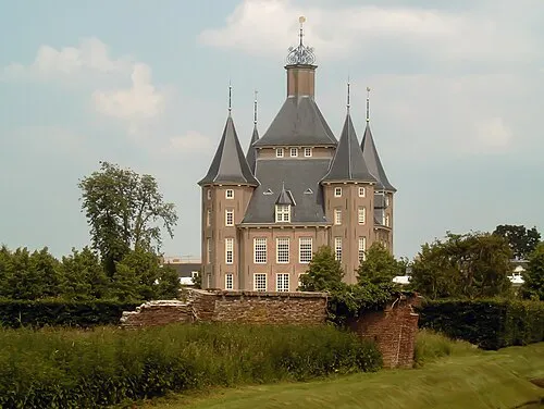 Kasteel Heemstede Historic site, Gemeente Houten3.1 km E
-
 Museum Catharijneconvent Museum, Gemeente Utrecht7.1 km NE
-
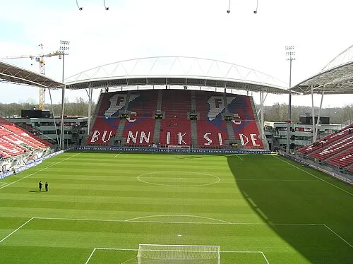 Stadion Galgenwaard Landmark, Gemeente Utrecht7.1 km NE
-
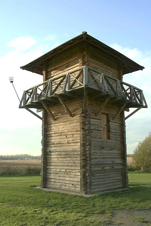 Fectio Historic site, Bunnik Municipality6.6 km NE
-
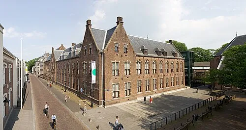 Centraal Museum Museum, Gemeente Utrecht6.8 km NE
-
 Jacobikerk Attraction, Gemeente Utrecht7.7 km N
-
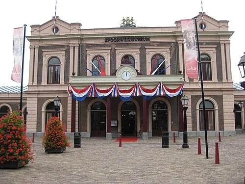 Het Spoorwegmuseum Museum, Gemeente Utrecht7.4 km NE
-
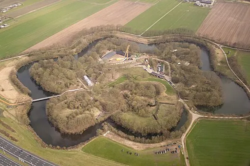 Vechten Fort Historic site, Bunnik Municipality6.8 km NE
Sources & licences
Data last updated: