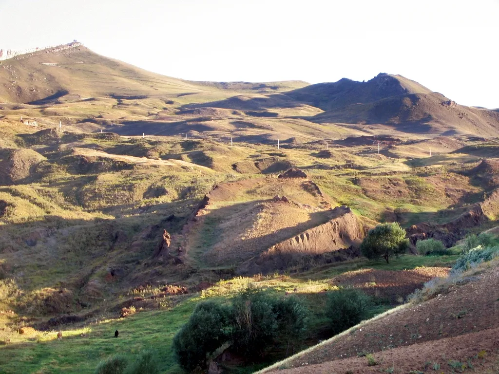
Tabya Tepesi
Located in Doğubayazıt District, Ağrı Province Coordinates: 39°40′29″ N 43°46′36″ E
- Elevation
- 2,099 m
- above sea level
- Local time
- UTC+03:00
- Europe/Istanbul · UTC+03:00
- Airports
- IGD Iğdır Airport35 km
- AJI Ağrı Airport64 km
About Tabya Tepesi
Tabya Tepesi is a mountain. Location: Doğubayazıt District, Ağrı Province. Elevation: 2,099 m. The best months to visit are June–September. The nearest airport is Iğdır Airport (35 km). Nearby sights include Eşik Tepe and Zor Dağ.
Climate of Tabya Tepesi
Best months for sightseeingBest months for sightseeing: June–September.
This month · November
A cold month
Day 6° · Night -3° · Rain 36 mm
Better nearby cities in November
- Silopi · 293 km southwest20°
- Cizre · 295 km southwest20°
- Kızıltepe · 392 km southwest19°
- Hottest month
- August (day 26°)
- Coldest month
- January (night -12°)
- Wettest month
- May (78 mm)
- Driest month
- September (22 mm)
Bars: average monthly low and high temperature. Below: precipitation. Monthly averages for 1970–2000 at about 18 km resolution, adjusted for elevation. Highlighted months are mild and relatively dry. Source: WorldClim 2.1 (CC BY 4.0).
Show values as a table
| Month | Jan | Feb | Mar | Apr | May | Jun | Jul | Aug | Sep | Oct | Nov | Dec |
|---|---|---|---|---|---|---|---|---|---|---|---|---|
| Average high (°C) | -3° | -2° | 2° | 10° | 15° | 20° | 25° | 26° | 22° | 14° | 6° | -1° |
| Average low (°C) | -12° | -11° | -7° | 0° | 4° | 7° | 11° | 11° | 7° | 2° | -3° | -8° |
| Precipitation (mm) | 25 | 32 | 36 | 57 | 78 | 56 | 29 | 24 | 22 | 49 | 36 | 30 |
Other places to visit in this season: June July August September
How to get to Tabya Tepesi
The nearest airport is Iğdır Airport (IGD), 35 km to the north as the crow flies. For international flights: Zvartnots International Airport (EVN) (75 km). The nearest large city is Iğdır, 36 km to the northeast.
Airports
- Iğdır Airport (IGD) Iğdır 35 kmnorth
- Ağrı Airport (AJI) Ağrı 64 kmwest
- Zvartnots International Airport (EVN) Yerevan 75 kmnortheast
Nearby large cities
- Iğdır Population: 101.7K 36 kmnortheast
- Ağrı Population: 124.5K 63 kmwest
- Van Population: 525K 135 kmsouth
- Erzurum Population: 767.8K 216 kmwest
- Siirt Population: 114K 251 kmsouthwest
Straight-line distances; road distances are longer. Airport data: OurAirports.
Day trips from Tabya Tepesi
Within 100 km: 60 historic and cultural sites, 208 natural sites, 169 lakes, rivers and coasts.
0–25 km36 places
- Saz Gölü Lake 25 kmE
- Lake Balık Lake 21 kmNW
- Abbasgöl Lake 22 kmNW
- Yalıntaşdağı Tepesi Mountain 21 kmSE
25–60 km129 places
- Gölyüzü Gölü Lake 32 kmE
- Erhacı Gölü Lake 38 kmNE
- Kazlıgöl Lake 51 kmS
- Aytepe Mountain 51 kmSE
60–100 km272 places
- Ani Historic site 94 kmN
- Lim Island Island 97 kmS
- Süphan Gölü Lake 79 kmS
- Turna Gölü Lake 96 kmNW
Straight-line distances.
Nearest towns and villages
Nearby attractions & nature
Everything nearby-
Eşik Tepe Mountain, Doğubayazıt District8.9 km N
-
Zor Dağ Mountain, Doğubayazıt District13 km NE
-
Arı Dağı Mountain, Doğubayazıt District11 km W
-
Kaldırımlı Tepe Mountain, Doğubayazıt District10 km SE
-
Kervan Pınarı Natural site, Ağrı Province10 km N
-
Sıçanlı Dağ Mountain, Doğubayazıt District12 km NE
-
Durak Dağı Mountain, Ağrı Province17 km NW
-
Akpınar Tepesi Mountain, Doğubayazıt District13 km NE
More nature in Turkey
-
Bozburundağı Tepesi Mountain, Doğubayazıt District18 km SE
-
Hakim Tepesi Mountain, Doğubayazıt District21 km SE
-
Yalıntaşdağı Tepesi Mountain, Doğubayazıt District21 km SE
-
Susuz Tepe Mountain, Doğubayazıt District22 km S
-
Akyayla Tepe Mountain, Doğubayazıt District31 km SE
-
 Tendürek Dağı Mountain, Doğubayazıt District36 km S
Sources & licences
Data last updated: