Yenifakılı Bucağı
Located in Yozgat Province, Turkey Coordinates: 39°12′35″ N 34°59′31″ E
- Elevation
- 1,098 m
- above sea level
- Local time
- UTC+03:00
- Europe/Istanbul · UTC+03:00
- Airports
- NAV Nevşehir Kapadokya Airport63 km
- ASR Kayseri Erkilet International Airport65 km
About Yenifakılı Bucağı
Yenifakılı Bucağı is a municipality. Location: Yozgat Province, Turkey. Elevation: 1,098 m. The best months to visit are May–October. The nearest airport is Nevşehir Kapadokya Airport (63 km). Nearby sights include Büyükacı Deresi and Taşlı Tepe.
Climate of Yenifakılı Bucağı
Best months for sightseeingBest months for sightseeing: May–October.
This month · November
Outside the best season
Day 12° · Night 0° · Rain 39 mm
Better nearby cities in November
- Adana · 249 km south21°
- Tarsus · 255 km south22°
- Osmaniye · 262 km southeast21°
- Hottest month
- August (day 29°)
- Coldest month
- January (night -5°)
- Wettest month
- April (50 mm)
- Driest month
- August (7 mm)
Bars: average monthly low and high temperature. Below: precipitation. Monthly averages for 1970–2000 at about 18 km resolution, adjusted for elevation. Highlighted months are mild and relatively dry. Source: WorldClim 2.1 (CC BY 4.0).
Show values as a table
| Month | Jan | Feb | Mar | Apr | May | Jun | Jul | Aug | Sep | Oct | Nov | Dec |
|---|---|---|---|---|---|---|---|---|---|---|---|---|
| Average high (°C) | 4° | 6° | 11° | 17° | 21° | 25° | 29° | 29° | 26° | 19° | 12° | 6° |
| Average low (°C) | -5° | -4° | -1° | 4° | 8° | 11° | 13° | 13° | 9° | 5° | 0° | -3° |
| Precipitation (mm) | 45 | 37 | 40 | 50 | 47 | 34 | 10 | 7 | 14 | 29 | 39 | 49 |
Other places to visit in this season: May June July August September October
How to get to Yenifakılı Bucağı
The nearest airport is Nevşehir Kapadokya Airport (NAV), 63 km to the southwest as the crow flies. The nearest large city is Kayseri, 68 km to the southeast.
Airports
- Nevşehir Kapadokya Airport (NAV) Nevşehir 63 kmsouthwest
- Kayseri Erkilet International Airport (ASR) Kayseri 65 kmsoutheast
- Tokat Airport (TJK) Tokat 172 kmnortheast
Nearby large cities
- Kayseri Population: 1.5M 68 kmsoutheast
- Kırşehir Population: 150.7K 72 kmwest
- Aksaray Population: 327.6K 125 kmsouthwest
- Kirikkale Population: 187K 146 kmnorthwest
- Çorum Population: 269.6K 149 kmnorth
Straight-line distances; road distances are longer. Airport data: OurAirports.
Nearby attractions & nature
Everything nearby-
Büyükacı Deresi River, Yozgat Province2.3 km E
-
Taşlı Tepe Mountain, Yozgat Province3.5 km W
-
Küçükacı Deresi River, Yozgat Province3.5 km SE
-
Bilkuyu Tepesi Mountain, Yenifakılı İlçesi5.9 km N
-
Sağlep Deresi River, Yozgat Province7.4 km NW
-
Boğazlıyan Çayı River, Turkey5.9 km NW
-
Göz Tepe Mountain, Yenifakılı İlçesi7.6 km E
-
Bağlıca Deresi River, Yozgat Province9.2 km NW
Other cities and towns in Yozgat Province
-
Boğazlıyan Bucağı Municipality, Yozgat Province21 km E
-
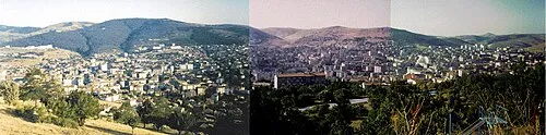 Yozgat City, Yozgat70 km N
-
Şefaatlı City, Şefaatli İlçesi39 km NW
-
Yenipazar Bucağı Municipality, Yozgat Province31 km N
-
Boğazlıyan City, Boğazlıyan İlçesi22 km E
-
Şefaatlı Bucağı Municipality, Yozgat Province38 km NW
Sources & licences
Data last updated: