Gateshead International Stadium
Located in Lamesley, Gateshead Coordinates: 54°57′40″ N 1°34′47″ W

- Local time
- UTC+00:00
- Europe/London · UTC+00:00
- Elevation
- 32 m
- above sea level
- Airports
- NCL Newcastle International Airport11 km
- MME Teesside International Airport51 km
About Gateshead International Stadium
Gateshead International Stadium is a landmark. Location: Lamesley, Gateshead.
Gateshead International Stadium (GIS) is a multi-purpose, all-seater venue in Gateshead, Tyne and Wear, England. Originally known as the Gateshead Youth Stadium, the venue was built in 1955 and has since been extensively redeveloped on three occasions. Its capacity of around 11,800 is the greatest in the Metropolitan Borough of Gateshead, the third-largest in Tyne and Wear (behind St James' Park and the Stadium of Light), and the sixth-largest in North East England.
Source: Wikipedia · CC BY-SA 4.0
At a glance
- Built
- 1955
- Opened
- 1955
Source: Wikidata
Photos of Gateshead International Stadium
-

Bill Henderson · CC BY-SA 2.0 -

Bill Henderson · CC BY-SA 2.0 -

John Lord · CC BY 4.0 -
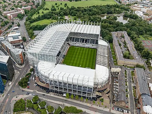
St James' Park Arne Müseler · CC BY-SA 3.0 de -
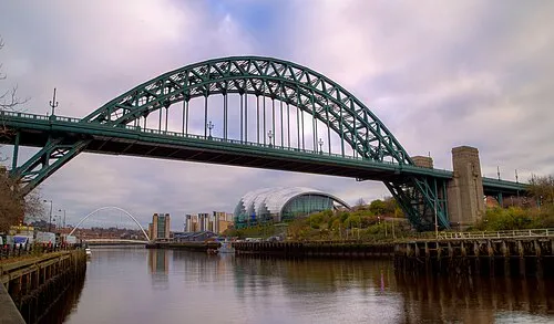
Tyne Bridge PangolinOne · CC BY-SA 4.0


Climate of Gateshead International Stadium
Best months for sightseeingBest months for sightseeing: June–September.
This month · November
A cold month
Day 10° · Night 4° · Rain 58 mm
- Hottest month
- July (day 20°)
- Coldest month
- January (night 2°)
- Wettest month
- August (62 mm)
- Driest month
- February (39 mm)
Bars: average monthly low and high temperature. Below: precipitation. Monthly averages for 1970–2000 at about 18 km resolution, adjusted for elevation. Highlighted months are mild and relatively dry. Source: WorldClim 2.1 (CC BY 4.0).
Show values as a table
| Month | Jan | Feb | Mar | Apr | May | Jun | Jul | Aug | Sep | Oct | Nov | Dec |
|---|---|---|---|---|---|---|---|---|---|---|---|---|
| Average high (°C) | 7° | 7° | 9° | 11° | 14° | 17° | 20° | 20° | 17° | 13° | 10° | 8° |
| Average low (°C) | 2° | 2° | 3° | 3° | 6° | 9° | 11° | 11° | 9° | 7° | 4° | 3° |
| Precipitation (mm) | 56 | 39 | 53 | 46 | 49 | 50 | 48 | 62 | 56 | 54 | 58 | 58 |
Other places to visit in this season: June July August September
How to get to Gateshead International Stadium
The nearest airport is Newcastle International Airport (NCL), 11 km to the northwest as the crow flies. The nearest large city is Newcastle upon Tyne, 3 km to the northwest.
Airports
- Newcastle International Airport (NCL) Newcastle upon Tyne, Tyne and Wear 11 kmnorthwest
- Teesside International Airport (MME) Darlington, Durham 51 kmsouth
- Leeds Bradford Airport (LBA) Leeds, West Yorkshire 122 kmsouth
Nearby large cities
- Newcastle upon Tyne Population: 300.1K 3 kmnorthwest
- Sunderland Population: 170.1K 14 kmsoutheast
- Middlesbrough Population: 142.7K 48 kmsoutheast
- York Population: 156.1K 116 kmsouth
- Leeds Population: 536.3K 130 kmsouth
Straight-line distances; road distances are longer. Airport data: OurAirports.
Day trips from Gateshead International Stadium
Within 100 km: 676 historic and cultural sites, 1,122 natural sites, 242 lakes, rivers and coasts.
0–25 km157 places
- Saint Mary’s Island Island 15 kmNE
- Castle Island Island 23 kmN
- Match Island Island 6 kmS
- Rocky Island Island 15 kmNE
25–60 km466 places
- Longhoughton Beach Beach 53 kmN
- Seaton Carew Beach Beach 42 kmSE
- Redcar Beach Beach 50 kmSE
- Coquet Island Island 42 kmN
60–100 km1,417 places
- Cocklawburn Beach Beach 89 kmN
- Cheswick Sands Beach 87 kmN
- Whitby Beach Beach 79 kmSE
- The Island Island 81 kmS
Straight-line distances.
Nearby attractions & nature
Everything nearby-
Tyne Bridge Landmark, Gateshead1.9 km NW
-
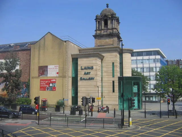 Laing Art Gallery Museum, Newcastle upon Tyne2.4 km NW
-
Baltic Art Centre Museum, Gateshead1.5 km NW
-
Millennium Bridge Landmark, Gateshead1.6 km NW
-
St James' Park Landmark, Newcastle upon Tyne3.1 km NW
-
 Hancock Museum Museum, Newcastle upon Tyne3 km NW
-
 Discovery Museum Museum, Newcastle upon Tyne3 km W
-
Newcastle upon Tyne Town Wall Historic site, Newcastle upon Tyne1.9 km NW
Nearest towns and villages
-
Felling Town, Lamesley1 km SE
-
 Newcastle upon Tyne City, Newcastle upon Tyne2.6 km NW
-
 Sheriff Hill Village, Lamesley1.6 km S
-
Gateshead City, Gateshead1.4 km W
Sources & licences
Data last updated: · 2 independent sources