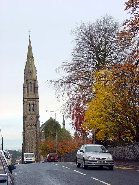
- Population
- 11,935
- 11.9K
- Elevation
- 105 m
- above sea level
- Local time
- UTC+00:00
- Europe/London · UTC+00:00
- Airports
- BFS Belfast International Airport40 km
- BHD George Best Belfast City Airport59 km
About Dungannon
Dungannon is a city. Location: Mid Ulster, Northern Ireland. Population: 11,935. Elevation: 105 m.
Dungannon (from Irish Dún Geanainn, meaning 'Geanann's fort', pronounced [d̪ˠuːn̪ˠ ˈɟan̪ˠən̪ˠ]) is a town in County Tyrone, Northern Ireland. It is the second-largest town in the historic county (after Omagh) and had a population of 16,282 at the 2021 census. Since 2015, the town shares local government with Magherafelt and Cookstown in the Mid-Ulster District Council. For centuries, Dungannon was the chief seat of the O'Neill dynasty of Tír Eoghain, who dominated most of Ulster and built a castle on the hill.
Source: Wikipedia · CC BY-SA 4.0
At a glance
- Area
- 8.4 km²
Source: Wikidata
Photos of Dungannon
-

DColt · CC BY-SA 4.0 -

Peter Moore · CC BY-SA 3.0 -

Rossographer · CC BY-SA 2.0 -
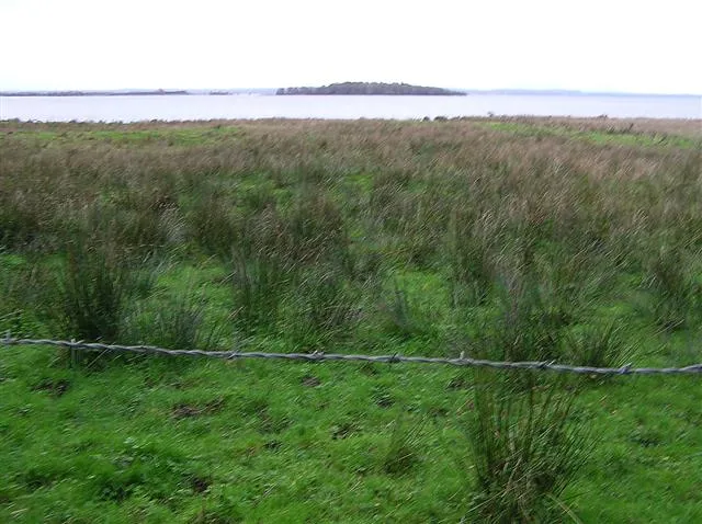
Coney Island Kenneth Allen · CC BY-SA 2.0


Travel notes for Dungannon
From Wikivoyage
Dungannon is a town historically in County Tyrone in Northern Ireland, but since 2015 part of Mid-Ulster "super-council" area. It's industrial, with a population of 16,000 in 2021, and has become a commuter town for Belfast as it stands at the western terminus of M1. Dungannon (which in Irish means "Geanann's fort") is about five miles from the banks of Lough Neagh and ten miles from County Monaghan in the Republic of Ireland.
Understand+
Dungannon is a good example of the rise and fall of the Irish crystal glass trade. Glass was made from ancient times, and Dunmisk Hill 15 miles northwest was a factory as early as the 8th century AD (meaning manufacture from raw materials, not simply molding of existing glass). Medieval Britain and Ireland had many glassworks, almost 90 by 1780 when a tax-break favoured Ireland. Waterford, Cork and Dungannon came to specialise in lead (aka "crystal") glass, a trade that lasted 200 years before collapsing due to becoming uneconomical.
Lead crystal glass has at least 24% by weight of lead oxide. This makes it heavy and resonant — flick the edge of your tumbler and it sings, instead of skittering off the table. Lead glass can be fine-cut and has a high refractive index so it catches the light, with rainbows glinting along its cut edges. It became a popular luxury item, marketed as "crystal" and avoiding any mention of lead. Customers might think that was toxic - and it is! Never use lead crystal as a storage container, as within a few days the lead leaches into the contents. It's alright to use as a wine-glass and even as a decanter providing those are rinsed before and after use, and the contents only sit for hours not days.
Dungannon was near a coalfield and had a range of early modern industries, but local glass-making lapsed until 1971 when the company Tyrone Crystal was founded. In the 1990s it moved to a new factory, wrought many fine pieces and became a tourist attraction; the chandelier in Belfast's magnificent Merchant Hotel Grand Room was made here in 2006. But East European competition brought down all the Irish specialist crystal companies, and Tyrone Glass folded in 2010. Glassworking continues in town in a small way in craft studios, but is no longer an industry here.
Get in+
By road follow M1 west then A29 into town.
The nearest railway station is Portadown 17 miles east, with frequent trains from Lisburn, Belfast and Bangor, and the hourly Enterprise Train between Dublin and Belfast
Ulsterbus 75 takes 50 min between Portadown and Dungannon, with six M-F and three on Saturday. Bus 67 also runs by a slightly longer route.
Goldliner 273 runs from Belfast Grand Central via Lurgan to Dungannon, taking an hour. It runs hourly M-Sa and every two hours Sunday, and continues to Ballygawley, Omagh, Newtonstewart, Sion Mills, Strabane and Derry.
X4 runs six times a day from Dublin city and airport, taking 2 hr 30 min to Dungannon. It's heading to Derry but you can't ride it for that section. Don't take X3, which takes a different route to Derry.
Ulsterbus 72 runs every two hours from Armagh, taking 40 min via Moy, and Bus 80 runs from Cookstown every hourly taking 50 min via Coalisland.
Goldliner 261 runs from Belfast to Lurgan, Dungannon and Enniskillen. It's hourly M-Sa and every two hours on Sunday.
Goldliner 278 runs in university term-time, with one bus Su-F from Monaghan via Armagh, Moy, Dungannon, Cookstown, Magherafelt, Garvagh and Coleraine to Ulster University, Portstewart and Portrush.
1 Dungannon bus station is southwest corner of town on Beechvalley Way.
Source: Wikivoyage · CC BY-SA 4.0 · abridged
Climate of Dungannon
Best months for sightseeingBest months for sightseeing: June–September.
This month · November
A wet month
Day 9° · Night 4° · Rain 105 mm
- Hottest month
- July (day 19°)
- Coldest month
- January (night 2°)
- Wettest month
- October (108 mm)
- Driest month
- May (64 mm)
Bars: average monthly low and high temperature. Below: precipitation. Monthly averages for 1970–2000 at about 18 km resolution, adjusted for elevation. Highlighted months are mild and relatively dry. Source: WorldClim 2.1 (CC BY 4.0).
Show values as a table
| Month | Jan | Feb | Mar | Apr | May | Jun | Jul | Aug | Sep | Oct | Nov | Dec |
|---|---|---|---|---|---|---|---|---|---|---|---|---|
| Average high (°C) | 7° | 7° | 9° | 12° | 15° | 17° | 19° | 18° | 16° | 13° | 9° | 7° |
| Average low (°C) | 2° | 2° | 3° | 4° | 6° | 9° | 11° | 11° | 9° | 7° | 4° | 2° |
| Precipitation (mm) | 105 | 79 | 86 | 67 | 64 | 69 | 70 | 90 | 91 | 108 | 105 | 108 |
Other places to visit in this season: June July August September
How to get to Dungannon
The nearest airport is Belfast International Airport (BFS), 40 km to the northeast as the crow flies. The nearest large city is Belfast, 55 km to the east.
Airports
- Belfast International Airport (BFS) Belfast 40 kmnortheast
- George Best Belfast City Airport (BHD) Belfast 59 kmeast
- City of Derry Airport (LDY) Derry, Derry and Strabane 65 kmnorthwest
Nearby large cities
- Belfast Population: 348K 55 kmeast
- Dublin Population: 1M 135 kmsouth
- Glasgow Population: 626.4K 220 kmnortheast
- Limerick Population: 102.3K 239 kmsouthwest
- Blackpool Population: 145K 255 kmeast
Straight-line distances; road distances are longer. Airport data: OurAirports.
Day trips from Dungannon
Within 100 km: 143 historic and cultural sites, 666 natural sites, 780 lakes, rivers and coasts.
0–25 km29 places
- Reedy Flat Island 18 kmE
- Lough Gullion Lake 21 kmE
- Lough Fea Lake 24 kmN
- Lough More Lake 25 kmSW
25–60 km384 places
- Rams Island Island 31 kmE
- Island More Island 59 kmNW
- White Island Island 43 kmS
- Black Island Island 43 kmS
60–100 km1,176 places
- Pollboy Bridge Landmark 95 kmS
- Portstewart Beach Beach 74 kmN
- Benone Beach Beach 74 kmN
- Portstewart Strand Beach 74 kmN
Straight-line distances.
Nearby attractions & nature
Everything nearby-
Altmore River River, Northern Ireland5.5 km NE
-
Rehagy Mountain Mountain, Mid Ulster13 km SW
-
Coney Island Island, Northern Ireland14 km E
-
Cappagh Mountain Mountain, Mid Ulster13 km W
-
Washing Bay Natural site, Northern Ireland12 km E
-
Oughtmore Mountain, Mid Ulster23 km N
-
Fir Mountain Mountain, Mid Ulster24 km N
-
Cregganconroe Mountain, Fermanagh and Omagh19 km NW
Other cities and towns in Mid Ulster
-
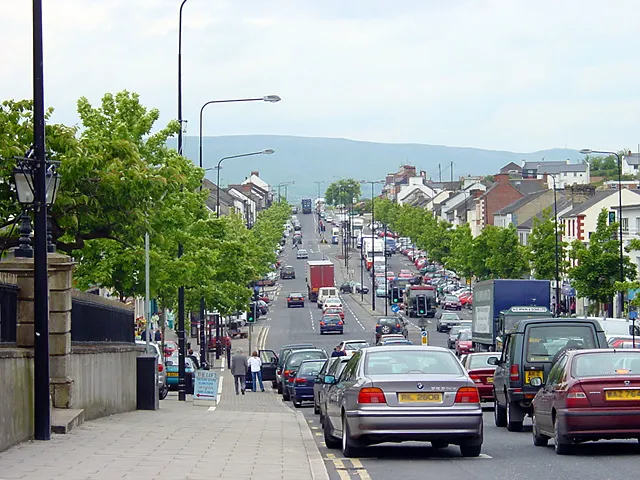 Cookstown City, Mid Ulster16 km N
-
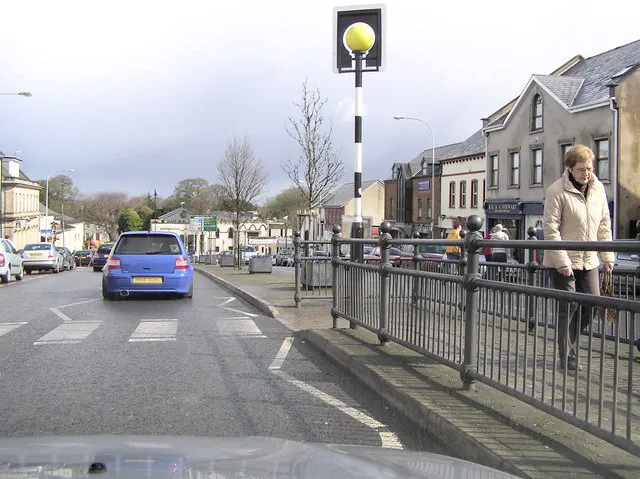 Magherafelt City, Mid Ulster30 km N
Sources & licences
Data last updated: · 2 independent sources