- Population
- 21,911
- 21.9K
- Elevation
- 265 m
- above sea level
- Local time
- UTC+01:00
- Europe/Vienna · UTC+01:00
- Airports
- VIE Vienna International Airport70 km
- LNZ Linz-Hörsching Airport108 km
About Sankt Pölten
Sankt Pölten is a city. Location: St. Pölten, Sankt Pölten Stadt. Population: 21,911. Elevation: 265 m. The best months to visit are May–September. The nearest airport is Vienna International Airport (70 km). Nearby sights include Kamin der Glanzstoffwerke Sankt Pölten and Schildberg.
Photos of Sankt Pölten
-
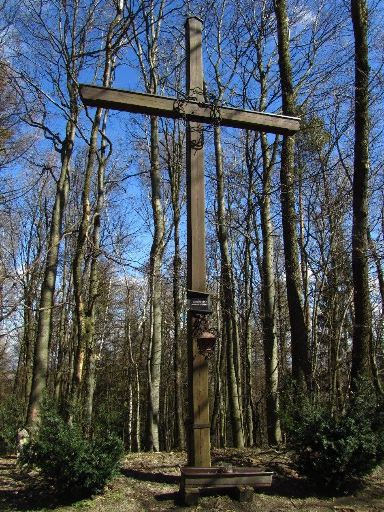
Hegerberg Kat1100 · CC BY-SA 3.0

Travel notes for Sankt Pölten
From Wikivoyage
St. Pölten is a city with about 55,000 inhabitants (2018) in Lower Austria between the Bohemian Massif and the Türnitz Alps.
Many people consider St. Pölten to be a city of low touristic interest. Anyway its high living standard and the convenient location make it a place worthwhile to hang out some time and relax, e. g. at the lakes or to undertake some day trips.
Understand+
1 Tourismusinformation St.Pölten, Rathausplatz 1, ☏ +43 2742 353354, fax: +43 2742 333-2819, tourismus@st-poelten.gv.at. Apr-Oct: Mon-Fri 08:00-17:00, Sat 09:00-17:00, Sun and holidays 10:00-17:00; Nov-Mar: daily 08:00-17:00. Offers free maps, as well as information for sightseeing and accommodation.
Get in+
By train:
St. Pölten is the terminus for the VOR (Verkehrsverbund Ost-Region) suburban train service from Vienna's Westbahnhof to St. Pölten. It leaves Westbahnhof hourly and takes 30 minutes to reach St. Pölten. Tickets cost €12, or Vienna's VOR travelcards can also be used.
1 St. Pölten Hauptbahnhof (Main Train Station), Bahnhofplatz 1, ☏ +43 2742 930000, stpoelten.reisebuero@pv.oebb.at. Ticket counter: Mon 05:15-21:05, Tue-Fri 05:45-21:05, Sat Sun and holidays 06:30-21:05; ticket automats 24 hr. Storage lockers available.
By car:
St. Pölten is connected to the A1 "Autobahn" and the S33 "Schnellstraße". The distance between St. Pölten and Vienna is approximately 60 km, between Linz and St. Pölten ca. 120 km.
Source: Wikivoyage · CC BY-SA 4.0 · abridged
Climate of Sankt Pölten
Best months for sightseeingBest months for sightseeing: May–September.
This month · November
A cold month
Day 7° · Night 0° · Rain 48 mm
- Hottest month
- July (day 25°)
- Coldest month
- January (night -4°)
- Wettest month
- July (87 mm)
- Driest month
- January (28 mm)
Bars: average monthly low and high temperature. Below: precipitation. Monthly averages for 1970–2000 at about 18 km resolution, adjusted for elevation. Highlighted months are mild and relatively dry. Source: WorldClim 2.1 (CC BY 4.0).
Show values as a table
| Month | Jan | Feb | Mar | Apr | May | Jun | Jul | Aug | Sep | Oct | Nov | Dec |
|---|---|---|---|---|---|---|---|---|---|---|---|---|
| Average high (°C) | 3° | 5° | 9° | 14° | 20° | 23° | 25° | 25° | 20° | 14° | 7° | 4° |
| Average low (°C) | -4° | -3° | 0° | 3° | 8° | 12° | 13° | 13° | 9° | 5° | 0° | -3° |
| Precipitation (mm) | 28 | 31 | 39 | 50 | 70 | 85 | 87 | 76 | 54 | 38 | 48 | 37 |
Other places to visit in this season: May June July August September
How to get to Sankt Pölten
The nearest airport is Vienna International Airport (VIE), 70 km to the east as the crow flies. The nearest large city is Linz, 101 km to the west.
Airports
- Vienna International Airport (VIE) Vienna 70 kmeast
- Linz-Hörsching Airport (LNZ) Linz 108 kmwest
- M. R. Štefánik Airport (BTS) Bratislava 117 kmeast
Nearby large cities
- Linz Population: 204.8K 101 kmwest
- Bratislava Population: 423.7K 109 kmeast
- Graz Population: 303.3K 128 kmsouth
- Brno Population: 404.3K 131 kmnortheast
- Győr Population: 129.3K 160 kmeast
Straight-line distances; road distances are longer. Airport data: OurAirports.
Day trips from Sankt Pölten
Within 100 km: 578 historic and cultural sites, 2,187 natural sites, 570 lakes, rivers and coasts.
0–25 km72 places
- Schusterberg Mountain 19 kmNE
- Schaflerberg Mountain 17 kmNE
- Reisberg Mountain 23 kmE
- Reutberg Mountain 21 kmE
25–60 km1,316 places
- Gassner Camel Riding School Natural site 28 kmW
- Waldsee Lake 34 kmNE
- Vienna Forest Lake Lake 36 kmE
- Steinsee Lake 51 kmE
60–100 km1,947 places
- Gusen I Concentration Camp Historic site 87 kmW
- Donauinsel Island 63 kmE
- Zick See Lake 99 kmSE
- Unter-Rosenhofer Teich Lake 81 kmNW
Straight-line distances.
Nearby attractions & nature
Everything nearby-
Kamin der Glanzstoffwerke Sankt Pölten Landmark, St. Pölten0.9 km N
-
Schildberg Mountain, St. Pölten6.3 km E
-
Hegerberg Mountain, Kasten bei Böheimkirchen13 km SE
-
Schloss Fridau Historic site, Ober-Grafendorf8.8 km SW
-
Ammering Mountain, Wölbling14 km NW
-
Kirchmayer Höhe Mountain, Pyhra12 km S
-
Hohenegg Historic site, Hafnerbach12 km NW
-
Dunkelsteiner Wald Natural site, Lower Austria12 km NW
Sources & licences
Data last updated: