- Population
- 8,163,884
- 8.2M
- Elevation
- 532 m
- above sea level
- Local time
- UTC+01:00
- Europe/Paris · UTC+01:00
- Places inside
- 187
- listed under Auvergne-Rhône-Alpes
- Airports
- GNB Grenoble Alpes Isère Airport14 km
- LYS Lyon Saint-Exupéry Airport35 km
About Auvergne-Rhône-Alpes
Auvergne-Rhône-Alpes is a region. Location: France. Population: 8,163,884.
Auvergne-Rhône-Alpes (French pronunciation: [ovɛʁɲ ʁonalp] ; AURA) is a landlocked region in Southern France. It was created by the 2014 territorial reform of French regions; it resulted from the merger of Auvergne and Rhône-Alpes. The new region came into effect on 1 January 2016, after the regional elections in December 2015. The region covers an area of 69,711 km2 (26,916 mi2), making it the third largest in metropolitan France; it had a population of 7,994,459 in 2018, second to Île-de-France.
Source: Wikipedia · CC BY-SA 4.0
At a glance
- Built
- 2016
- Area
- 69,711 km²
Source: Wikidata
Photos of Auvergne-Rhône-Alpes
-

Communauté de communes Ambert Livradois Forez · CC BY-SA 2.0 -

Communauté de communes Ambert Livradois Forez · CC BY-SA 2.0 -
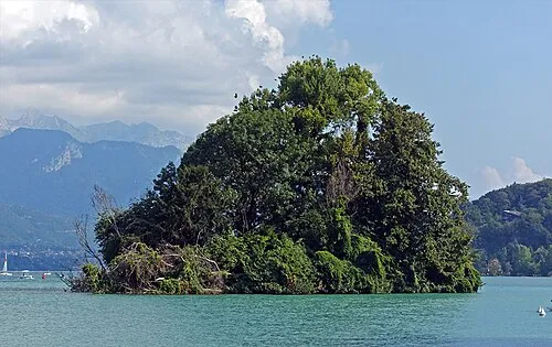
Île des Cygnes Tiia Monto · CC BY-SA 3.0 -
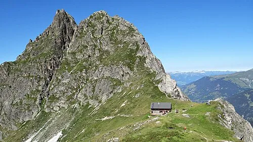
Pointe de la Vuzelle Ibex73 · CC BY-SA 4.0 -
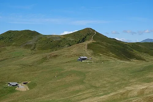
Mont de Vorès Guilhem Vellut from Annecy, France · CC BY 2.0


Travel notes for Auvergne-Rhône-Alpes
From Wikivoyage
Auvergne-Rhône-Alpes is a large region in southeastern France. It is popular with all kinds of visitors, from mountaineers and winter sports enthusiasts, to gastronomes, wine buffs, and those looking for a city break. To the west, Auvergne is a mostly rural area of medium volcanic mountains (the Massif Central) and an abundance of interesting churches. Visitors to the Rhone Valley in the centre of the region can enjoy a temperate climate, rocky canyons, extensive vineyards and the urban area of Lyon, one of France's most important cities. In the east, the stunningly beautiful French Alps are havens for all manner of outdoor activities, not least skiing.
Understand+
Auvergne-Rhône-Alpes has a huge diversity of landscapes due to its climactic and topographic variation. The topography of the region consists of two areas of high elevation, divided by the Rhône Valley, which runs north-south. The western mountains are part of the Massif Central. It is an area of high hills and plateaux, mostly made of old, acidic metamorphic rock. There are several recently extinct (geologically-speaking) volcanoes in this range. East of the Rhône Valley are the Alps. These tall, young mountains are themselves very diverse, and should be divided into at least two groups. A central part of the region is occupied by a north-south line of well-defined mountainous massifs: from north to south, Bornes, Bauges, Chartreuse, Vercors and Baronies. These mountains are mainly made of limestone and are becoming a karst landscape. Another, less prominent valley divides this central area from the eastern part of the region, the Alps proper, which contains some of Europe's highest mountains, most notably Mont Blanc. These mountains are made of acidic rocks such as granite.
The diverse climate of the region is due to a blending of four weather influences: Mediterranean in the south, Alpine in the east, Continental in the north, and Atlantic in the west. The region is well-known overseas for its agriculture, and particularly its wine industry. Lyon is considered the culinary capital of France, if not of all Europe, and there are many dishes of great renown from all around the region; see the Eat and Drink sections for more information on this.
Auvergne-Rhône-Alpes was created in 2016 with the merger of the old regions of Auvergne and Rhône-Alpes, as part of the national territorial reform. Unlike elsewhere in France, local politicians were unable to agree on a brand new name for the larger region (other exciting proposals included "Auvergne-Alpes" and "Rhône-Alpes-Auvergne"), so the provisory alphabetic amalgamation of the old names stuck.
Tourist information:
Get in+
By plane:
Major airports:
Geneva International Airport (GVA IATA), though not in either Auvergne-Rhône-Alpes or even France (it is just over the border in Switzerland), Geneva has by far the widest range of international flights of any airport in the area, due to its important role in world diplomacy. The airport welcomes flights from pretty much everywhere in Europe and the Middle East, as well as transatlantic crossings from New York JFK, Newark and Washington Dulles and a solitary far-eastern link to Beijing Capital. Passengers on 'domestic' flights from France leave the airport on the French side, without ever having to officially enter Switzerland, while all other passengers must leave on the Swiss side. As Switzerland is a member of the Schengen agreement, this should pose no additional visa troubles.
Lyon–Saint-Exupéry Airport (LYS IATA), named for pioneering aviator and Lyon native Antoine de Saint-Exupéry, handles flights from all over Europe and North Africa. The only transatlantic flight is an Air Canada service from Montreal Trudeau.
Minor and seasonal airports:
Chambéry Airport (CMF IATA) operates in winter for the annual skiing season. It receives flights from plenty of European cities, including several competing services from Moscow Domodedovo. Outside of winter, don't expect to be able to fly there.
Clermont-Ferrand Auvergne Airport (CFE IATA) serves a limited number of regular flights from around France (including Paris Charles de Gaulle and Orly) and Europe (Amsterdam Schiphol, London Luton, London Stansted and Porto)
Grenoble Isère Airport (GNB IATA) is also pretty much entirely seasonal. During the winter ski months, there are direct services from many British and European airports, and even from as far afield as Tel Aviv Ben Gurion, while the rest of the year, only Ryanair offers regular flights from London Stansted.
By train:
Source: Wikivoyage · CC BY-SA 4.0 · abridged
Places bordering Auvergne-Rhône-Alpes
- Provence-Alpes-Côte d'Azur Region
- New Aquitaine
- Centre-Val de Loire
- Bourgogne-Franche-Comté
- Canton of Geneva
- Aosta Valley
- Valais
- Piedmont
- Canton of Vaud
Population of Auvergne-Rhône-Alpes over time
| 2013 | 7,757,595 | |
|---|---|---|
| 2014 | 7,820,966 | |
| 2015 | 7,877,698 | |
| 2017 | 7,948,287 | |
| 2018 | 7,994,459 | |
| 2019 | 8,042,936 | |
| 2020 | 8,078,652 | |
| 2021 | 8,114,361 | |
| 2022 | 8,163,884 | |
| 2023 | 8,205,557 |
Censuses and official estimates; source: Wikidata.
Climate of Auvergne-Rhône-Alpes
Best months for sightseeingBest months for sightseeing: June–September.
This month · November
A cold month
Day 9° · Night 2° · Rain 98 mm
- Hottest month
- July (day 26°)
- Coldest month
- January (night -2°)
- Wettest month
- September (110 mm)
- Driest month
- July (68 mm)
Bars: average monthly low and high temperature. Below: precipitation. Monthly averages for 1970–2000 at about 18 km resolution, adjusted for elevation. Highlighted months are mild and relatively dry. Source: WorldClim 2.1 (CC BY 4.0).
Show values as a table
| Month | Jan | Feb | Mar | Apr | May | Jun | Jul | Aug | Sep | Oct | Nov | Dec |
|---|---|---|---|---|---|---|---|---|---|---|---|---|
| Average high (°C) | 5° | 7° | 11° | 14° | 19° | 22° | 26° | 25° | 21° | 15° | 9° | 6° |
| Average low (°C) | -2° | -1° | 1° | 4° | 8° | 11° | 13° | 13° | 10° | 6° | 2° | -1° |
| Precipitation (mm) | 75 | 72 | 83 | 91 | 104 | 93 | 68 | 71 | 110 | 109 | 98 | 79 |
Other places to visit in this season: June July August September
How to get to Auvergne-Rhône-Alpes
The nearest airport is Grenoble Alpes Isère Airport (GNB), 14 km to the south as the crow flies. For international flights: Lyon Saint-Exupéry Airport (LYS) (35 km). The nearest large city is Grenoble, 43 km to the southeast.
Airports
- Grenoble Alpes Isère Airport (GNB) Grenoble 14 kmsouth
- Lyon Saint-Exupéry Airport (LYS) Colombier-Saugnieu, Rhône 35 kmnorthwest
- Chambéry Aix les Bains airport (CMF) Chambéry 43 kmnortheast
Nearby large cities
- Grenoble Population: 158.6K 43 kmsoutheast
- Villeurbanne Population: 131.4K 50 kmnorthwest
- Lyon Population: 520.8K 51 kmnorthwest
- Saint-Etienne Population: 176.3K 77 kmwest
- Geneva Population: 201.7K 100 kmnortheast
Straight-line distances; road distances are longer. Airport data: OurAirports.
Places in Auvergne-Rhône-Alpes
187 placesCities & villages35
- Les Molières · Village
- Les Moulins Cherier · Village
- Les Nals · Village
- Les Prés · Village
- Les Robins · Village
- Les Saillants du Gua · Village
- Les Serres · Village
- Le Suel · Village
- Les Vignons · Village
- Le Temple · Village
- Le They · Village
- Le Tollier · Village
- Le Trésor · Village
- Le Villard · Village
- Le Villard · Village
- Maison Neuve · Village
- Malpas · Village
- Mianes · Village
- Miribel · Village
- Mons · Village
- Montaux · Village
- Montfleury · Village
- Nantizon · Village
- Parissieu · Village
- Petit Nantoin · Village
- Petit Vallon · Village
- Prapérier · Village
- Repidon · Village
- Roche Béranger · Village
- Saint-Germain de Béard · Village
- Saint-Laurent · Village
- Saint-Symphorien · Village
- Talon · Village
- Thieure · Village
- Tignes le Lac · Village
Mountains & nature13
- Les Perrons · Mountain
- Mont Roland · Mountain
- Oeil de Boeuf · Mountain
- Pic Coolidge · Mountain
- Pic Nord des Cavales · Mountain
- Pointe de la Finive · Mountain
- Pointe de l'Ifala · Mountain
- Pointe des Cavales · Mountain
- Pointe des Grands · Mountain
- Pointe Emma · Mountain
- Sex Villemod · Mountain
- Tête à Lugon · Mountain
- Tête des Gouilles · Mountain
Lakes, rivers & coasts11
- Les Rousses · River
- Ligonne · River
- Lodde · River
- Menthon · River
- Pampeluxe · River
- Ruisseau de Burges · River
- Ruisseau de Rioumau · River
- Ruisseau la Vouzance · River
- Ruisseau le Pin · River
- Semène · River
- Sologne · River
Heritage & sights1
- Ruines du château de Luc · Historic site
Largest cities and towns
-
Arrondissement of Lyon Municipality, Rhône1.6M
-
Arrondissement of Grenoble Municipality, Isère750.7K
-
Arrondissement of Saint-Étienne Municipality, Loire427K
-
Lyon Village, Arrondissement of Lyon515.7K
-
Arrondissement of La Tour-du-Pin Municipality, Isère317.9K
-
Arrondissement of Chambéry Municipality, Savoy290.4K
-
Arrondissement of Clermont-Ferrand Municipality, Puy-de-Dôme363.8K
-
Arrondissement de Bourg-en-Bresse Municipality, Ain345.9K
Nature and heritage in Auvergne-Rhône-Alpes
Other regions in France


Sources & licences
Data last updated: · 2 independent sources