Arrondissement of Dole
Located in Jura, Bourgogne-Franche-Comté Coordinates: 47°00′28″ N 5°36′58″ E
- Population
- 106,061
- 106.1K
- Elevation
- 210 m
- above sea level
- Local time
- UTC+01:00
- Europe/Paris · UTC+01:00
- Places inside
- 189
- listed under Arrondissement of Dole
- Airports
- DLE Dole Tavaux Airport15 km
- GVA Geneva International Airport94 km
About Arrondissement of Dole
Arrondissement of Dole is a municipality. Location: Jura, Bourgogne-Franche-Comté. Population: 106,061. Elevation: 210 m. The best months to visit are May–September. The nearest airport is Dole Tavaux Airport (15 km). Nearby sights include Ruisseau de la Tanche and Cuisance.
Photos of Arrondissement of Dole
-
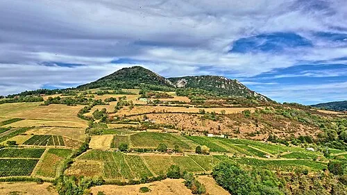
Mont Poupet JGS25 · CC BY 4.0

Climate of Arrondissement of Dole
Best months for sightseeingBest months for sightseeing: May–September.
This month · November
A cold month
Day 9° · Night 3° · Rain 97 mm
- Hottest month
- July (day 25°)
- Coldest month
- January (night 0°)
- Wettest month
- May (102 mm)
- Driest month
- March (67 mm)
Bars: average monthly low and high temperature. Below: precipitation. Monthly averages for 1970–2000 at about 18 km resolution, adjusted for elevation. Highlighted months are mild and relatively dry. Source: WorldClim 2.1 (CC BY 4.0).
Show values as a table
| Month | Jan | Feb | Mar | Apr | May | Jun | Jul | Aug | Sep | Oct | Nov | Dec |
|---|---|---|---|---|---|---|---|---|---|---|---|---|
| Average high (°C) | 5° | 7° | 12° | 15° | 19° | 22° | 25° | 25° | 21° | 16° | 9° | 6° |
| Average low (°C) | 0° | 0° | 3° | 5° | 10° | 13° | 14° | 14° | 11° | 8° | 3° | 1° |
| Precipitation (mm) | 80 | 76 | 67 | 81 | 102 | 90 | 78 | 71 | 93 | 95 | 97 | 88 |
Other places to visit in this season: May June July August September
How to get to Arrondissement of Dole
The nearest airport is Dole Tavaux Airport (DLE), 15 km to the west as the crow flies. For international flights: Geneva International Airport (GVA) (94 km). The nearest large city is Besançon, 41 km to the northeast.
Airports
- Dole Tavaux Airport (DLE) Dole 15 kmwest
- Geneva International Airport (GVA) Geneva 94 kmsoutheast
- Annecy Meythet airport (NCY) Annecy 126 kmsouth
Nearby large cities
- Besançon Population: 128.4K 41 kmnortheast
- Dijon Population: 159.9K 57 kmnorthwest
- Lausanne Population: 139.1K 95 kmsoutheast
- Geneva Population: 201.7K 98 kmsoutheast
- Bern Population: 121.6K 139 kmeast
Straight-line distances; road distances are longer. Airport data: OurAirports.
Day trips from Arrondissement of Dole
Within 100 km: 181 historic and cultural sites, 436 natural sites, 178 lakes, rivers and coasts.
0–25 km34 places
- Étang Seigneur Lake 16 kmSW
- Mont Roland Mountain 16 kmNW
- Bois de Vallun Natural site 14 kmE
- Forêt de Vaivres Natural site 19 kmS
25–60 km202 places
- Lac de Saint-Point Lake 57 kmE
- Lac de Remoray Lake 56 kmSE
- Lac de la Motte Lake 48 kmSE
- Étang Millot Lake 39 kmW
60–100 km559 places
- Lake Neuchâtel Lake 96 kmE
- Lac de Joux Lake 66 kmSE
- Lake Leman Lake 91 kmSE
- Lac Brenet Lake 66 kmSE
Straight-line distances.
Arrondissement of Dole and similar cities
Side by side with cities of similar size in the same country: population, elevation and climate.
| Measure | Arrondissement of Dole | Nancy | Boulogne-Billancourt | Caen |
|---|---|---|---|---|
| Population | 106.1K | 105.1K | 108.8K | 110.6K |
| Elevation | 210 m | 212 m | 35 m | 21 m |
| Summer day (hottest month) | 25° | 24° | 25° | 23° |
| Winter night (coldest month) | 0° | -1° | 2° | 3° |
| Annual rainfall | 1,018 mm | 789 mm | 632 mm | 754 mm |
| Best months | May–Sep | Jun–Sep | May–Sep | Jun–Sep |
| Distance | — | 191 km | 324 km | 506 km |
Climate values are 1970–2000 monthly averages; straight-line distance.
Places in Arrondissement of Dole
189 places- 121 Le Fied 204
- 122 Auxange 201
- 123 Offlanges 198
- 124 Romange 198
- 125 Montmirey-le-Château 194
- 126 La Ferté 193
- 127 Bans 190
- 128 Serre-les-Moulières 189
- 129 Saligney 186
- 130 Chaînée-des-Coupis 180
- 131 Montmirey-la-Ville 179
- 132 Barretaine 177
- 133 Augerans 174
- 134 Mutigney 169
- 135 Brainans 168
- 136 Chamole 166
- 137 Besain 162
- 138 Miéry 153
- 139 Vriange 152
- 140 Mathenay 140
- 141 Cernans 139
- 142 Our 139
- 143 Dournon 137
- 144 Gredisans 137
- 145 Monteplain 136
- 146 Lavangeot 135
- 147 La Châtelaine 134
- 148 Monay 126
- 149 Champagne-sur-Loue 125
- 150 Pointre 125
- 151 Frasne-les-Meulières 124
- 152 Peintre 123
- 153 Chilly-sur-Salins 112
- 154 Molain 108
- 155 Chatelay 105
- 156 Taxenne 104
- 157 Picarreau 103
- 158 Plumont 103
- 159 Rouffange 103
- 160 Les Planches-près-Arbois 100
- 161 Louvatange 98
- 162 Saizenay 98
- 163 Chaussenans 96
- 164 Biefmorin 94
- 165 Ivory 94
- 166 Darbonnay 93
- 167 Molamboz 89
- 168 Le Chateley 88
- 169 Villeneuve-d'Aval 87
- 170 Fay-en-Montagne 86
- 171 Neuvilley 86
- 172 Clucy 81
- 173 Germigney 79
- 174 Séligney 76
- 175 Chaux-Champagny 73
- 176 Thésy 67
- 177 Chêne-Bernard 66
- 178 Abergement-lès-Thésy 63
- 179 Ivrey 63
- 180 Pretin 62
Bar: population relative to the most populous place in this list.
Nearby attractions & nature
Everything nearby-
Ruisseau de la Tanche River, Jura4.3 km N
-
Cuisance River, Jura4.9 km W
-
Ruisseau la Larine River, Jura6.4 km E
-
Forêt de Chaux Natural site, Jura9.2 km NE
-
Forêt de Rahon Natural site, Jura10 km W
-
Veuge River, Jura10 km SW
-
Forêt de Gatey Natural site, Jura13 km SW
-
Grozonne River, Jura12 km S
Sources & licences
Data last updated: