Fukaura Machi
Located in Nishitsugaru-gun, Aomori Coordinates: 40°36′18″ N 140°01′06″ E
- Population
- 9,415
- 9.4K
- Elevation
- 552 m
- above sea level
- Local time
- UTC+09:00
- Asia/Tokyo · UTC+09:00
- Places inside
- 2
- listed under Fukaura Machi
- Airports
- ONJ Odate Noshiro Airport55 km
- AOJ Aomori Airport59 km
About Fukaura Machi
Fukaura Machi is a municipality. Location: Nishitsugaru-gun, Aomori. Population: 9,415. Elevation: 552 m. The best months to visit are June–September. The nearest airport is Odate Noshiro Airport (55 km). Nearby sights include Mount Iwaki and Oirase Gawa.
Climate of Fukaura Machi
Best months for sightseeingBest months for sightseeing: June–September.
This month · November
A wet month
Day 8° · Night 1° · Rain 138 mm
- Hottest month
- August (day 25°)
- Coldest month
- January (night -7°)
- Wettest month
- September (182 mm)
- Driest month
- February (91 mm)
Bars: average monthly low and high temperature. Below: precipitation. Monthly averages for 1970–2000 at about 18 km resolution, adjusted for elevation. Highlighted months are mild and relatively dry. Source: WorldClim 2.1 (CC BY 4.0).
Show values as a table
| Month | Jan | Feb | Mar | Apr | May | Jun | Jul | Aug | Sep | Oct | Nov | Dec |
|---|---|---|---|---|---|---|---|---|---|---|---|---|
| Average high (°C) | -2° | -1° | 2° | 9° | 15° | 19° | 23° | 25° | 20° | 14° | 8° | 1° |
| Average low (°C) | -7° | -7° | -4° | 2° | 7° | 12° | 16° | 18° | 13° | 7° | 1° | -4° |
| Precipitation (mm) | 112 | 91 | 93 | 107 | 102 | 114 | 166 | 177 | 182 | 136 | 138 | 131 |
Other places to visit in this season: June July August September
How to get to Fukaura Machi
The nearest airport is Odate Noshiro Airport (ONJ), 55 km to the southeast as the crow flies. For international flights: Aomori Airport (AOJ) (59 km). The nearest large city is Hirosaki, 38 km to the east.
Airports
- Odate Noshiro Airport (ONJ) Kitaakita 55 kmsoutheast
- Aomori Airport (AOJ) Aomori 59 kmeast
- Akita Airport (AXT) Akita 111 kmsouth
Nearby large cities
- Hirosaki Population: 168.7K 38 kmeast
- Aomori Population: 298.4K 65 kmeast
- Akita Population: 307.7K 99 kmsouth
- Hachinohe Population: 239K 126 kmeast
- Morioka Population: 290.7K 139 kmsoutheast
Straight-line distances; road distances are longer. Airport data: OurAirports.
Day trips from Fukaura Machi
Within 100 km: 5 historic and cultural sites, 12 natural sites, 9 lakes, rivers and coasts.
0–25 km3 places
- Oirase Gawa River 10 kmNW
- Shirakami Sanchi Mountain 23 kmSE
- Mount Iwaki Mountain 25 kmE
25–60 km6 places
- Yoneshiro River River 42 kmS
- Nakamura River River 26 kmNE
- Seibi En Attraction 47 kmE
- Lake Jūsan Lake 54 kmNE
60–100 km17 places
- Oga Quasi National Park Natural site 80 kmS
- Oga Peninsula Natural site 78 kmS
- Akita Port Tower Landmark 95 kmS
- Tai-jima Island 89 kmNE
Straight-line distances.
Places in Fukaura Machi
2 places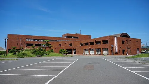
Fukaura
Population: 7.9K
Nearby attractions & nature
Everything nearby-
 Mount Iwaki Mountain, Aomori25 km E
-
Oirase Gawa River, Aomori10 km NW
-
 Shirakami Sanchi Mountain, Japan23 km SE
Sources & licences
Data last updated: