- Population
- 64,901
- 64.9K
- Elevation
- 18 m
- above sea level
- Local time
- UTC+09:00
- Asia/Tokyo · UTC+09:00
- Airports
- HND Tokyo Haneda International Airport26 km
- NRT Narita International Airport52 km
About Sodegaura
Sodegaura is a city. Location: Sodegaura-shi, Chiba. Population: 64,901. Elevation: 18 m. The best months to visit are May–July, September–October. The nearest airport is Tokyo Haneda International Airport (26 km). Nearby sights include Bōsō Peninsula and Tokyo Bay.
Climate of Sodegaura
Best months for sightseeingBest months for sightseeing: May–July, September–October.
This month · November
A wet month
Day 17° · Night 8° · Rain 111 mm
Better nearby cities in November
- Isehara · 64 km west18°
- Odawara · 80 km west19°
- Mishima · 106 km west18°
- Hottest month
- August (day 30°)
- Coldest month
- January (night 1°)
- Wettest month
- September (200 mm)
- Driest month
- December (55 mm)
Bars: average monthly low and high temperature. Below: precipitation. Monthly averages for 1970–2000 at about 18 km resolution, adjusted for elevation. Highlighted months are mild and relatively dry. Source: WorldClim 2.1 (CC BY 4.0).
Show values as a table
| Month | Jan | Feb | Mar | Apr | May | Jun | Jul | Aug | Sep | Oct | Nov | Dec |
|---|---|---|---|---|---|---|---|---|---|---|---|---|
| Average high (°C) | 10° | 10° | 13° | 18° | 22° | 24° | 28° | 30° | 26° | 21° | 17° | 12° |
| Average low (°C) | 1° | 1° | 4° | 10° | 14° | 18° | 22° | 23° | 20° | 14° | 8° | 3° |
| Precipitation (mm) | 59 | 78 | 124 | 132 | 131 | 180 | 123 | 135 | 200 | 195 | 111 | 55 |
Other places to visit in this season: May June July September October
How to get to Sodegaura
The nearest airport is Tokyo Haneda International Airport (HND), 26 km to the northwest as the crow flies. The nearest large city is Kisarazu, 9 km to the southwest.
Airports
- Tokyo Haneda International Airport (HND) Tokyo 26 kmnorthwest
- Narita International Airport (NRT) Narita 52 kmnortheast
- Ibaraki Airport (IBR) Omitama 92 kmnorth
Nearby large cities
- Kisarazu Population: 136.2K 9 kmsouthwest
- Ichihara Population: 283.5K 13 kmnortheast
- Urayasu Population: 171.4K 29 kmnorth
- Narashino Population: 176.2K 30 kmnorth
- Kawasaki Population: 1.5M 30 kmnorthwest
Straight-line distances; road distances are longer. Airport data: OurAirports.
Nearby attractions & nature
Everything nearby-
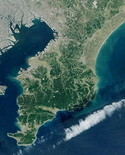 Bōsō Peninsula Natural site, Chiba16 km SE
-
 Tokyo Bay Natural site, Kanagawa21 km W
-
Tama Gawa River, Japan24 km NW
-
Obitsu River River, Chiba11 km W
-
Yōrō River River, Japan15 km N
-
Koito River River, Chiba17 km SW
-
Hanami River River, Japan24 km N
Sources & licences
Data last updated: