Tsumagoi Mura
Local name: 嬬恋村
Located in Agatsuma-gun, Gunma Coordinates: 36°30′54″ N 138°29′37″ E
- Population
- 10,209
- 10.2K
- Elevation
- 1,069 m
- above sea level
- Local time
- UTC+09:00
- Asia/Tokyo · UTC+09:00
- Places inside
- 1
- listed under Tsumagoi Mura
- Airports
- MMJ Shinshu-Matsumoto Airport64 km
- TOY Toyama Kitokito Airport118 km
About Tsumagoi Mura
Tsumagoi Mura is a municipality. Location: Agatsuma-gun, Gunma. Population: 10,209. Elevation: 1,069 m.
Tsumagoi (嬬恋村, Tsumagoi-mura) is a village located in Gunma Prefecture, Japan. As of 1 September 2020, the village had an estimated population of 9,546 in 3,999 households, and a population density of 28 persons per km2. The total area of the village is 337.51 square kilometres (130.31 sq mi).
Source: Wikipedia · CC BY-SA 4.0
Photos of Tsumagoi Mura
-
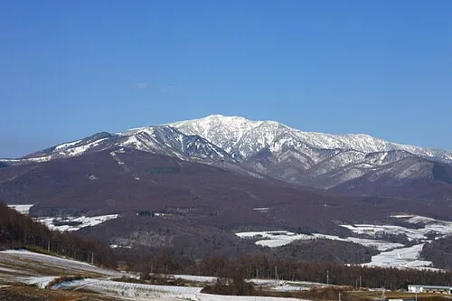
Azumaya San Ski Mania · Public domain

Travel notes for Tsumagoi Mura
From Wikivoyage
Tsumagoi is in Gunma prefecture. It is known for its cabbages and many onsen.
Understand+
Parts of the village are within the borders of the Joshin'etsukogen National Park.
The main industries of Tsumagoi Village are agriculture and service industry. In agriculture, highland vegetables, mainly cabbage, are cultivated in high-cold regions, and it is famous as a cabbage village (the amount of cabbage produced and shipped is the largest in Japan). Its tourism industry draws visitors to a magnificent landscape, and natural environment such as hot springs.
Climate:
In summer, the humidity is low and it is cool, making it a popular summer resort. On the other hand, it is extremely cold in winter, which is comparable to that of Hokkaido, and drops to around -15°C every year.
Get in+
By train:
Tsumagoi is on JR East's Agatsuma Line from Fukurogura to Manza-Kazawaguchi to Ōmae.
By car:
National Routes 144, 146, 292 and 406.
By bus:
Seibu Kanko Bus
JR Bus Kanto (Route Bus Takamine Kogen-Komoro Station / Sakudaira Station), (Highway Bus Takamine Kogen-Shinjuku Station)
Source: Wikivoyage · CC BY-SA 4.0 · abridged
Places bordering Tsumagoi Mura
- Kusatsu Machi
- Naganohara Machi
- Ueda
- Komoro
- Tōmi
- Suzaka
- Karuizawa Machi
- Miyota-machi
- Takayama Mura
Population of Tsumagoi Mura over time
| 2010 | 10,183 | |
|---|---|---|
| 2015 | 9,780 | |
| 2021 | 9,066 |
Censuses and official estimates; source: Wikidata.
Climate of Tsumagoi Mura
Best months for sightseeingBest months for sightseeing: May–September.
This month · November
A cold month
Day 11° · Night 1° · Rain 77 mm
Better nearby cities in November
- Kofu · 95 km south17°
- Isehara · 144 km southeast18°
- Fujinomiya · 145 km south18°
- Hottest month
- August (day 26°)
- Coldest month
- January (night -8°)
- Wettest month
- September (220 mm)
- Driest month
- December (49 mm)
Bars: average monthly low and high temperature. Below: precipitation. Monthly averages for 1970–2000 at about 18 km resolution, adjusted for elevation. Highlighted months are mild and relatively dry. Source: WorldClim 2.1 (CC BY 4.0).
Show values as a table
| Month | Jan | Feb | Mar | Apr | May | Jun | Jul | Aug | Sep | Oct | Nov | Dec |
|---|---|---|---|---|---|---|---|---|---|---|---|---|
| Average high (°C) | 1° | 2° | 5° | 13° | 19° | 21° | 25° | 26° | 22° | 16° | 11° | 5° |
| Average low (°C) | -8° | -8° | -5° | 2° | 7° | 12° | 16° | 17° | 13° | 6° | 1° | -5° |
| Precipitation (mm) | 57 | 64 | 85 | 112 | 129 | 199 | 213 | 214 | 220 | 130 | 77 | 49 |
Other places to visit in this season: May June July August September
How to get to Tsumagoi Mura
The nearest airport is Shinshu-Matsumoto Airport (MMJ), 64 km to the southwest as the crow flies. For international flights: Tokyo Haneda International Airport (HND) (158 km). The nearest large city is Ueda, 23 km to the southwest.
Airports
- Shinshu-Matsumoto Airport (MMJ) Matsumoto 64 kmsouthwest
- Toyama Kitokito Airport (TOY) Toyama 118 kmwest
- Tokyo Haneda International Airport (HND) Tokyo 158 kmsoutheast
Nearby large cities
- Ueda Population: 157.5K 23 kmsouthwest
- Nagano Population: 372.8K 32 kmnorthwest
- Takasaki Population: 373K 51 kmsoutheast
- Maebashi Population: 332.1K 54 kmeast
- Matsumoto Population: 241.1K 57 kmsouthwest
Straight-line distances; road distances are longer. Airport data: OurAirports.
Day trips from Tsumagoi Mura
Within 100 km: 3 historic and cultural sites, 64 natural sites, 13 lakes, rivers and coasts.
0–25 km4 places
- Azumaya San Mountain 8 kmNW
- Mount Asama Mountain 12 kmS
- Mount Kusatsu-Shirane Mountain 15 kmN
- Takama Yama Mountain 18 kmE
25–60 km27 places
- Lake Kizaki Lake 59 kmW
- Lake Nojiri Lake 42 kmNW
- Tanigawa Dake Mountain 53 kmNE
- Mount Myōkō Mountain 54 kmNW
60–100 km49 places
- Honshu Island 72 kmSW
- Umeda Ko Lake 82 kmE
- Mount Bukō Mountain 83 kmSE
- Mount Senjō Mountain 93 kmS
Straight-line distances.
Places in Tsumagoi Mura
1 placeNearby attractions & nature
Everything nearby-
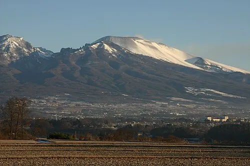 Mount Asama Mountain, Karuizawa Machi12 km S
-
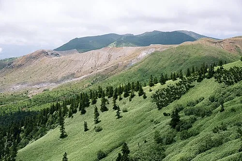 Mount Kusatsu-Shirane Mountain, Gunma15 km N
-
Takama Yama Mountain, Naganohara Machi18 km E
Other cities and towns in Agatsuma-gun
-
Higashiagatsuma Machi Municipality, Agatsuma-gun26 km E
-
Nakanojō Machi Municipality, Agatsuma-gun25 km NE
-
Takayama Mura Municipality, Agatsuma-gun42 km E
-
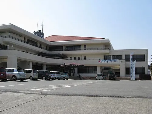 Nakanojō Town, Nakanojō Machi32 km E
Sources & licences
Data last updated: · 2 independent sources