- Population
- 24,948
- 24.9K
- Elevation
- 19 m
- above sea level
- Local time
- UTC+09:00
- Asia/Tokyo · UTC+09:00
- Airports
- IBR Ibaraki Airport41 km
- NRT Narita International Airport54 km
About Ishige
Ishige is a town. Location: Jōsō Shi, Ibaraki. Population: 24,948. Elevation: 19 m.
Ishige (石下町, Ishige-machi) was a town located in Yūki District, Ibaraki Prefecture, Japan. As of 2003, the town had an estimated population of 24,960 and a density of 569.34 persons per km2. The total area was 43.84 km2. On January 1, 2006, Ishige merged with Mitsukaido; which was later renamed "Jōsō".
Source: Wikipedia · CC BY-SA 4.0
At a glance
- Built
- 1897
Source: Wikidata
Climate of Ishige
Best months for sightseeingBest months for sightseeing: May–June, September–October.
This month · November
Outside the best season
Day 16° · Night 6° · Rain 74 mm
Better nearby cities in November
- Isehara · 99 km southwest18°
- Odawara · 120 km southwest19°
- Kofu · 136 km west17°
- Hottest month
- August (day 30°)
- Coldest month
- January (night -2°)
- Wettest month
- September (189 mm)
- Driest month
- January (34 mm)
Bars: average monthly low and high temperature. Below: precipitation. Monthly averages for 1970–2000 at about 18 km resolution, adjusted for elevation. Highlighted months are mild and relatively dry. Source: WorldClim 2.1 (CC BY 4.0).
Show values as a table
| Month | Jan | Feb | Mar | Apr | May | Jun | Jul | Aug | Sep | Oct | Nov | Dec |
|---|---|---|---|---|---|---|---|---|---|---|---|---|
| Average high (°C) | 9° | 9° | 12° | 18° | 22° | 24° | 28° | 30° | 26° | 21° | 16° | 11° |
| Average low (°C) | -2° | -1° | 2° | 8° | 13° | 17° | 21° | 22° | 19° | 12° | 6° | 0° |
| Precipitation (mm) | 34 | 52 | 84 | 109 | 119 | 159 | 146 | 145 | 189 | 162 | 74 | 38 |
Other places to visit in this season: May June September October
How to get to Ishige
The nearest airport is Ibaraki Airport (IBR), 41 km to the east as the crow flies. The nearest large city is Tsukuba, 14 km to the east.
Airports
- Ibaraki Airport (IBR) Omitama 41 kmeast
- Narita International Airport (NRT) Narita 54 kmsoutheast
- Tokyo Haneda International Airport (HND) Tokyo 65 kmsouth
Nearby large cities
- Tsukuba Population: 241.7K 14 kmeast
- Noda Population: 154.1K 21 kmsouthwest
- Tsuchiura Population: 144.4K 22 kmeast
- Chikusei Population: 100.8K 22 kmnorth
- Koga Population: 139.3K 24 kmwest
Straight-line distances; road distances are longer. Airport data: OurAirports.
Nearby attractions & nature
Everything nearby-
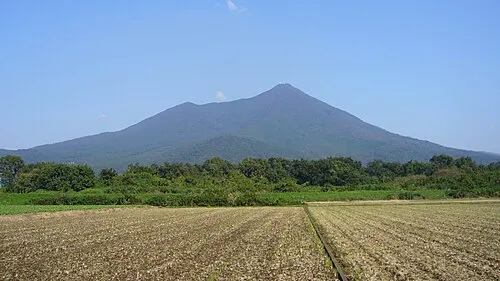 Mount_Tsukuba Mountain, Tsukuba Shi17 km NE
-
Kinu Gawa River, Japan20 km S
-
Watarase River River, Ibaraki25 km W
Sources & licences
Data last updated: · 2 independent sources