- Population
- 16,016
- 16K
- Elevation
- 147 m
- above sea level
- Local time
- UTC+09:00
- Asia/Tokyo · UTC+09:00
- Places inside
- 2
- listed under Shōdoshima Chō
- Airports
- TAK Takamatsu Airport40 km
- TKS Tokushima Awaodori Airport / JMSDF Tokushima Air Base49 km
About Shōdoshima Chō
Shōdoshima Chō is a municipality. Location: Shōzu-gun, Kagawa. Population: 16,016. Elevation: 147 m.
Shōdoshima (小豆島町, Shōdoshima-chō) is a town in Kagawa Prefecture, Japan, with a population of 13,646. The town was established in 2006 and covers various ports and communities on the eastern half of Shōdoshima, the second-largest island in the Seto Inland Sea. Shōdoshima is roughly halfway between the much larger islands of Shikoku to the south and Honshu to the north, and has a mild and relatively dry climate. Soy sauce production, which flourished through the early 20th century, remains a major industry.
Source: Wikipedia · CC BY-SA 4.0
Places bordering Shōdoshima Chō
- Tonoshō
Population of Shōdoshima Chō over time
| 2010 | 16,152 | |
|---|---|---|
| 2015 | 14,862 | |
| 2020 | 13,646 |
Censuses and official estimates; source: Wikidata.
Climate of Shōdoshima Chō
Best months for sightseeingBest months for sightseeing: May–June, September–October.
This month · November
Outside the best season
Day 15° · Night 8° · Rain 75 mm
Better nearby cities in November
- Kochi · 126 km southwest18°
- Ōita · 285 km southwest18°
- Beppu · 291 km southwest17°
- Hottest month
- August (day 30°)
- Coldest month
- January (night 0°)
- Wettest month
- September (237 mm)
- Driest month
- December (31 mm)
Bars: average monthly low and high temperature. Below: precipitation. Monthly averages for 1970–2000 at about 18 km resolution, adjusted for elevation. Highlighted months are mild and relatively dry. Source: WorldClim 2.1 (CC BY 4.0).
Show values as a table
| Month | Jan | Feb | Mar | Apr | May | Jun | Jul | Aug | Sep | Oct | Nov | Dec |
|---|---|---|---|---|---|---|---|---|---|---|---|---|
| Average high (°C) | 8° | 8° | 11° | 17° | 21° | 24° | 28° | 30° | 26° | 20° | 15° | 10° |
| Average low (°C) | 0° | 0° | 3° | 8° | 13° | 17° | 22° | 23° | 19° | 13° | 8° | 3° |
| Precipitation (mm) | 39 | 54 | 89 | 141 | 147 | 224 | 183 | 121 | 237 | 117 | 75 | 31 |
Other places to visit in this season: May June September October
How to get to Shōdoshima Chō
The nearest airport is Takamatsu Airport (TAK), 40 km to the southwest as the crow flies. The nearest large city is Takamatsu, 28 km to the southwest.
Airports
- Takamatsu Airport (TAK) Takamatsu 40 kmsouthwest
- Tokushima Awaodori Airport / JMSDF Tokushima Air Base (TKS) Tokushima 49 kmsoutheast
- Okayama Momotaro Airport (OKJ) Okayama 50 kmnorthwest
Nearby large cities
- Takamatsu Population: 419K 28 kmsouthwest
- Kurashiki Population: 483.6K 49 kmwest
- Himeji Population: 530.5K 52 kmnortheast
- Marugame Population: 109.5K 52 kmsouthwest
- Tokushima Population: 267.3K 53 kmsoutheast
Straight-line distances; road distances are longer. Airport data: OurAirports.
Places in Shōdoshima Chō
2 places
Nearby attractions & nature
Everything nearby-
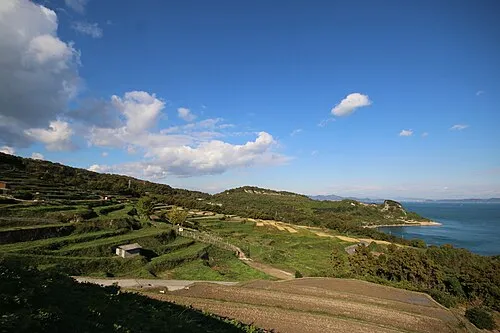 Te Shima Island, Kagawa20 km W
-
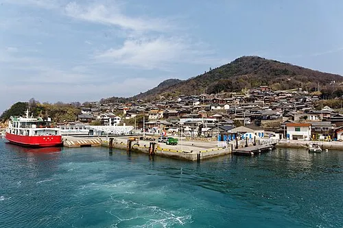 Ogi Shima Island, Kagawa23 km W
-
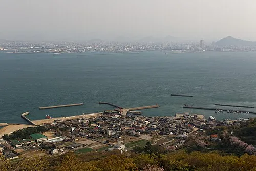 Megi Shima Island, Kagawa25 km SW
-
Inujima Island, Okayama19 km NW
-
Yashima Natural site, Kagawa23 km SW
Sources & licences
Data last updated: · 2 independent sources