- Elevation
- 4 m
- above sea level
- Local time
- UTC+09:00
- Asia/Tokyo · UTC+09:00
- Airports
- TAK Takamatsu Airport36 km
- OKJ Okayama Momotaro Airport46 km
About Ikeda
Ikeda is a village. Location: Shōdoshima Chō, Shōzu-gun. Elevation: 4 m.
Ikeda (池田, Ikeda) is a port and former town, now a part of Shōdoshima Town, Kagawa Prefecture, Japan. It is located midway along the south coast of Shōdoshima, the second-largest island in the Seto Inland Sea. The port is one of three on the island with passenger service to Takamatsu, the prefecture capital. The community was designated a village in 1889, upgraded to a town in 1929, and merged with the villages of Nibu and Mito in 1954.
Source: Wikipedia · CC BY-SA 4.0
At a glance
- Built
- 1929
- Area
- 34.1 km²
Source: Wikidata
Photos of Ikeda
-

Shōdo Island Tdk · CC BY-SA 3.0

Twin towns and sister cities of Ikeda
- Miyoshi Shi· Japan
Source: Wikidata. Only places with a page on this site are shown.
Climate of Ikeda
Best months for sightseeingBest months for sightseeing: May–June, September–October.
This month · November
Outside the best season
Day 16° · Night 9° · Rain 75 mm
Better nearby cities in November
- Kochi · 122 km southwest18°
- Ōita · 280 km southwest18°
- Beppu · 286 km southwest17°
- Hottest month
- August (day 31°)
- Coldest month
- January (night 1°)
- Wettest month
- September (237 mm)
- Driest month
- December (31 mm)
Bars: average monthly low and high temperature. Below: precipitation. Monthly averages for 1970–2000 at about 18 km resolution, adjusted for elevation. Highlighted months are mild and relatively dry. Source: WorldClim 2.1 (CC BY 4.0).
Show values as a table
| Month | Jan | Feb | Mar | Apr | May | Jun | Jul | Aug | Sep | Oct | Nov | Dec |
|---|---|---|---|---|---|---|---|---|---|---|---|---|
| Average high (°C) | 9° | 9° | 12° | 18° | 22° | 25° | 29° | 31° | 27° | 21° | 16° | 11° |
| Average low (°C) | 1° | 1° | 4° | 9° | 14° | 18° | 23° | 24° | 20° | 14° | 9° | 3° |
| Precipitation (mm) | 39 | 54 | 89 | 141 | 147 | 224 | 183 | 121 | 237 | 117 | 75 | 31 |
Other places to visit in this season: May June September October
How to get to Ikeda
The nearest airport is Takamatsu Airport (TAK), 36 km to the southwest as the crow flies. The nearest large city is Takamatsu, 24 km to the southwest.
Airports
- Takamatsu Airport (TAK) Takamatsu 36 kmsouthwest
- Okayama Momotaro Airport (OKJ) Okayama 46 kmnorthwest
- Tokushima Awaodori Airport / JMSDF Tokushima Air Base (TKS) Tokushima 52 kmsoutheast
Nearby large cities
- Takamatsu Population: 419K 24 kmsouthwest
- Kurashiki Population: 483.6K 45 kmwest
- Marugame Population: 109.5K 47 kmsouthwest
- Tokushima Population: 267.3K 55 kmsoutheast
- Himeji Population: 530.5K 57 kmnortheast
Straight-line distances; road distances are longer. Airport data: OurAirports.
Day trips from Ikeda
Within 100 km: 12 historic and cultural sites, 13 natural sites, 26 lakes, rivers and coasts.
0–25 km9 places
- Nao Shima Island 23 kmW
- Te Shima Island 15 kmW
- Ogi Shima Island 17 kmW
- Megi Shima Island 20 kmSW
25–60 km19 places
- Awaji Island Island 55 kmE
- Shiwaku Islands Island 49 kmW
- Ibo Gawa River 45 kmNE
- Ieshima Shotō Island 32 kmNE
60–100 km23 places
- Mount Rokkō Mountain 100 kmE
- Manabe Island Island 62 kmW
- Tomoga Shima Island 75 kmE
- Osaka Bay Natural site 83 kmE
Straight-line distances.
Nearby attractions & nature
Everything nearby-
Shōdo Island Island, Shōdoshima Chō4.2 km NE
-
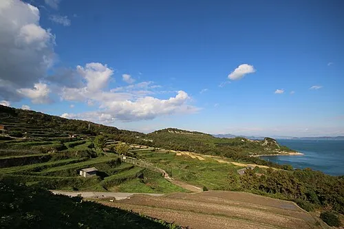 Te Shima Island, Kagawa15 km W
-
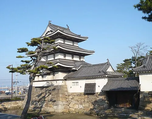 Takamatsu castle Historic site, Takamatsu Shi22 km SW
-
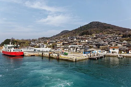 Ogi Shima Island, Kagawa17 km W
-
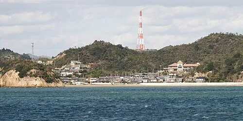 Nao Shima Island, Kagawa23 km W
-
Yashima Natural site, Kagawa18 km SW
Sources & licences
Data last updated: · 2 independent sources