- Elevation
- 47 m
- above sea level
- Local time
- UTC+09:00
- Asia/Tokyo · UTC+09:00
- Airports
- TKN Tokunoshima Airport44 km
- ASJ Amami Airport62 km
About Kiyama Island
Kiyama Island is an island. Location: Kagoshima, Japan.
Kiyama Island (Japanese: 木山島) is an uninhabited island of the Amami Islands within the larger Satsunan Islands, Japan, administratively belonging to Setouchi, Ōshima District, Kagoshima Prefecture. It is just 300 meters from Ukejima and can be reached by a jeep track from Ukeamuro town on Ukejima. There is a diving and fishing spot and a beach on the island.
Source: Wikipedia · CC BY-SA 4.0
At a glance
- Area
- 34 ha
Source: Wikidata
Climate of Kiyama Island
Best months for sightseeingBest months for sightseeing: March–May, October–December.
This month · November
A good month to visit
Day 23° · Night 19° · Rain 177 mm
- Hottest month
- July (day 31°)
- Coldest month
- January (night 13°)
- Wettest month
- June (358 mm)
- Driest month
- December (121 mm)
Bars: average monthly low and high temperature. Below: precipitation. Monthly averages for 1970–2000 at about 18 km resolution, adjusted for elevation. Highlighted months are mild and relatively dry. Source: WorldClim 2.1 (CC BY 4.0).
Show values as a table
| Month | Jan | Feb | Mar | Apr | May | Jun | Jul | Aug | Sep | Oct | Nov | Dec |
|---|---|---|---|---|---|---|---|---|---|---|---|---|
| Average high (°C) | 17° | 17° | 20° | 22° | 25° | 28° | 31° | 31° | 29° | 26° | 23° | 20° |
| Average low (°C) | 13° | 13° | 15° | 18° | 20° | 23° | 26° | 26° | 25° | 22° | 19° | 15° |
| Precipitation (mm) | 135 | 148 | 177 | 236 | 291 | 358 | 203 | 209 | 184 | 167 | 177 | 121 |
Other places to visit in this season: March April May October November December
How to get to Kiyama Island
The nearest airport is Tokunoshima Airport (TKN), 44 km to the southwest as the crow flies. The nearest large city is Uruma, 230 km to the southwest.
Airports
- Tokunoshima Airport (TKN) Amagi 44 kmsouthwest
- Amami Airport (ASJ) Amami 62 kmnortheast
- Kikai Airport (KKX) Kikai 72 kmnortheast
Nearby large cities
- Uruma Population: 125.3K 230 kmsouthwest
- Okinawa Population: 142.8K 237 kmsouthwest
- Ginowan Population: 100.1K 246 kmsouthwest
- Urasoe Population: 115.7K 248 kmsouthwest
- Naha Population: 317.6K 255 kmsouthwest
Straight-line distances; road distances are longer. Airport data: OurAirports.
Nearest towns and villages
-
Setouchi Chō Municipality, Ōshima-gun16 km N
-
Uken Son Municipality, Ōshima-gun28 km N
-
Naze Town, Amami Shi43 km NE
-
Yamato Son Municipality, Ōshima-gun36 km N
-
Amaki Municipality, Ōshima-gun43 km SW
-
Tokunoshima Chō Municipality, Ōshima-gun39 km SW
Nearby attractions & nature
Everything nearby-
 Uke Island Island, Kagoshima3.5 km W
-
 Yoro Jima Island, Kagoshima12 km W
-
 Kakeroma Jima Island, Kagoshima13 km N
-
Sukomo Banare Island, Kagoshima15 km NW
-
Yubanare Island Island, Kagoshima17 km NW
More lakes, rivers and coasts in Japan
-
 Amami Ōshima Island, Kagoshima26 km N
-
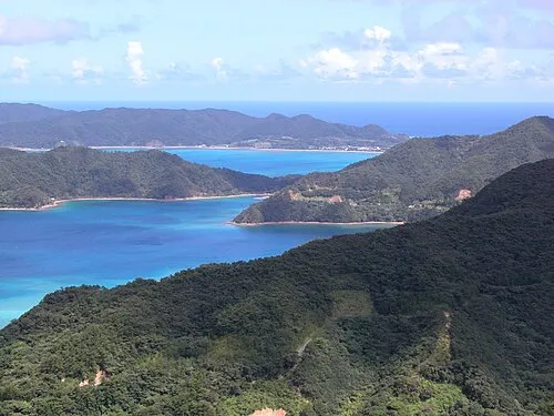 Amami Islands Island, Kagoshima28 km N
-
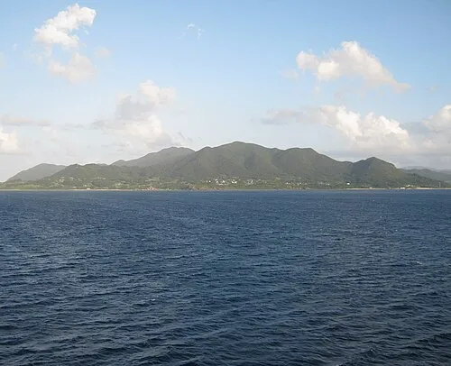 Tokunoshima Island Island, Kagoshima42 km SW
-
Edateku Jima Island, Uken Son31 km N
-
 Okinoerabujima Island Island, Ōshima-gun96 km SW
-
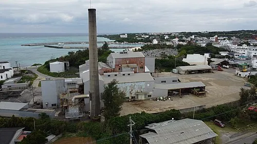 Yoronjima Island, Kagoshima137 km SW
Sources & licences
Data last updated: · 2 independent sources