- Population
- 132,418
- 132.4K
- Elevation
- 645 m
- above sea level
- Local time
- UTC+09:00
- Asia/Tokyo · UTC+09:00
- Places inside
- 1
- listed under Yatsushiro Shi
- Airports
- KMJ Kumamoto Airport40 km
- AXJ Amakusa Airport56 km
About Yatsushiro Shi
Yatsushiro Shi is a district. Location: Kumamoto, Japan. Population: 132,418.
Yatsushiro (八代市, Yatsushiro-shi) is a city located in Kumamoto Prefecture, Japan. As of 1 August 2024, the city had an estimated population of 120,389 in 57,953 households, and a population density of 300 persons per km2. The total area of the city is 681.29 km2 (263.05 sq mi).
Source: Wikipedia · CC BY-SA 4.0
Places bordering Yatsushiro Shi
- Uki Shi
- Ashikita Machi
- Misato Machi
- Yamato Chō
- Mizukami Mura
- Itsuki Mura
- Yamae Mura
- Kuma Mura
- Shiiba Son
Population of Yatsushiro Shi over time
| 2010 | 132,266 | |
|---|---|---|
| 2015 | 127,472 | |
| 2021 | 122,134 |
Censuses and official estimates; source: Wikidata.
Climate of Yatsushiro Shi
Best months for sightseeingBest months for sightseeing: May–October.
This month · November
Outside the best season
Day 14° · Night 6° · Rain 95 mm
Better nearby cities in November
- Kirishima · 83 km south19°
- Nobeoka · 87 km east18°
- Miyakonojō · 89 km south18°
- Hottest month
- August (day 27°)
- Coldest month
- January (night -2°)
- Wettest month
- July (549 mm)
- Driest month
- December (71 mm)
Bars: average monthly low and high temperature. Below: precipitation. Monthly averages for 1970–2000 at about 18 km resolution, adjusted for elevation. Highlighted months are mild and relatively dry. Source: WorldClim 2.1 (CC BY 4.0).
Show values as a table
| Month | Jan | Feb | Mar | Apr | May | Jun | Jul | Aug | Sep | Oct | Nov | Dec |
|---|---|---|---|---|---|---|---|---|---|---|---|---|
| Average high (°C) | 5° | 6° | 10° | 16° | 20° | 22° | 26° | 27° | 24° | 19° | 14° | 8° |
| Average low (°C) | -2° | -1° | 2° | 7° | 12° | 16° | 20° | 20° | 17° | 11° | 6° | 0° |
| Precipitation (mm) | 92 | 120 | 190 | 236 | 286 | 509 | 549 | 300 | 245 | 133 | 95 | 71 |
Other places to visit in this season: May June July August September October
How to get to Yatsushiro Shi
The nearest airport is Kumamoto Airport (KMJ), 40 km to the north as the crow flies. The nearest large city is Honmachi, 14 km to the west.
Airports
- Kumamoto Airport (KMJ) Kumamoto 40 kmnorth
- Amakusa Airport (AXJ) Amakusa 56 kmwest
- Kagoshima Airport (KOJ) Kagoshima 76 kmsouth
Nearby large cities
- Honmachi Population: 123.1K 14 kmwest
- Omuta Population: 132K 66 kmnorthwest
- Isahaya Population: 135.5K 77 kmnorthwest
- Kirishima Population: 123.2K 83 kmsouth
- Nagasaki Population: 409.1K 86 kmwest
Straight-line distances; road distances are longer. Airport data: OurAirports.
Places in Yatsushiro Shi
1 placeBar: population relative to the most populous place in this list.
Nearby attractions & nature
Everything nearby-
Kuma River River, Kumamoto17 km W
-
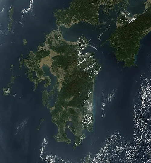 Kyūshū Island, Kumamoto24 km E
-
Hi Kawa River, Kumamoto17 km NW
Sources & licences
Data last updated: · 2 independent sources