Ishinomaki
Local name: 石巻市
Located in Ishinomaki Shi, Miyagi Coordinates: 38°25′00″ N 141°18′00″ E
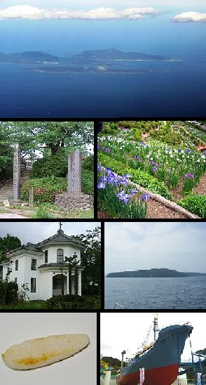
- Population
- 140,151
- 140.2K
- Elevation
- 2 m
- above sea level
- Local time
- UTC+09:00
- Asia/Tokyo · UTC+09:00
- Airports
- SDJ Sendai Airport45 km
- GAJ Yamagata Airport81 km
About Ishinomaki
Ishinomaki is a city. Location: Ishinomaki Shi, Miyagi. Population: 140,151. Elevation: 2 m.
Ishinomaki (石巻市, Ishinomaki-shi; Japanese pronunciation: [ì.ɕí.nó̞.mä̀.k̟ʲì, -mä́.k̟ʲi̥.ɕì]) is a city located in Miyagi Prefecture, Japan. As of 30 May 2025, the city has an estimated population of 131,189, and a population density of 250 persons per km2 in 62,546 households. The total area of the city is 554.55 square kilometres (214.11 sq mi).
Source: Wikipedia · CC BY-SA 4.0
Photos of Ishinomaki
-

United Kingdom Hydrographic Office · Public domain -

Ryo FUKAsawa from Tokyo, Japan · CC BY 2.0 -

石巻敎祖 · CC BY 4.0 -

ToshiJapon · CC BY-SA 4.0 -

Yukius · CC BY-SA 4.0


Travel notes for Ishinomaki
From Wikivoyage
Ishinomaki (石巻市; ishinomaki-shi) is a city in Miyagi. It has a population of around 165,000 people. Its islands, Kinkasan and Tashirojima have separate articles.
Understand+
Ishinomaki was one of the towns hardest hit by the 2011 Tohoku earthquake, with the tsunami reaching up to 5 km inland and some 3,400 people killed.
Tourist information site:
The local tourist association has a partly bilingual guide site.
Source: Wikivoyage · CC BY-SA 4.0 · abridged
Places bordering Ishinomaki
- Higashimatsushima
- Tome Shi
- Wakuya
- Misato Machi
- Onagawa Chō
- Minamisanriku Chō
Twin towns and sister cities of Ishinomaki
- Kahoku Chō· Japan
- Hitachinaka Shi· Japan
- Hagi· Japan
Source: Wikidata. Only places with a page on this site are shown.
Population of Ishinomaki over time
| 2010 | 160,826 | |
|---|---|---|
| 2015 | 147,214 | |
| 2021 | 138,856 |
Censuses and official estimates; source: Wikidata.
Climate of Ishinomaki
Best months for sightseeingBest months for sightseeing: May–October.
This month · November
Outside the best season
Day 13° · Night 4° · Rain 66 mm
Better nearby cities in November
- Isehara · 379 km southwest18°
- Kofu · 390 km southwest17°
- Odawara · 400 km southwest19°
- Hottest month
- August (day 27°)
- Coldest month
- January (night -3°)
- Wettest month
- September (158 mm)
- Driest month
- December (37 mm)
Bars: average monthly low and high temperature. Below: precipitation. Monthly averages for 1970–2000 at about 18 km resolution, adjusted for elevation. Highlighted months are mild and relatively dry. Source: WorldClim 2.1 (CC BY 4.0).
Show values as a table
| Month | Jan | Feb | Mar | Apr | May | Jun | Jul | Aug | Sep | Oct | Nov | Dec |
|---|---|---|---|---|---|---|---|---|---|---|---|---|
| Average high (°C) | 4° | 5° | 8° | 14° | 18° | 21° | 25° | 27° | 24° | 19° | 13° | 7° |
| Average low (°C) | -3° | -3° | 0° | 5° | 11° | 15° | 19° | 21° | 17° | 10° | 4° | -1° |
| Precipitation (mm) | 39 | 49 | 68 | 95 | 100 | 121 | 135 | 127 | 158 | 115 | 66 | 37 |
Other places to visit in this season: May June July August September October
How to get to Ishinomaki
The nearest airport is Sendai Airport (SDJ), 45 km to the southwest as the crow flies. The nearest large city is Ōsaki, 34 km to the northwest.
Airports
- Sendai Airport (SDJ) Natori 45 kmsouthwest
- Yamagata Airport (GAJ) Higashine 81 kmwest
- Iwate Hanamaki Airport (HNA) Hanamaki 113 kmnorth
Nearby large cities
- Ōsaki Population: 128.8K 34 kmnorthwest
- Sendai Population: 1.1M 41 kmsouthwest
- Ichinoseki Population: 114.5K 57 kmnorth
- Ōshū Population: 112.9K 81 kmnorth
- Yamagata Population: 248.8K 84 kmwest
Straight-line distances; road distances are longer. Airport data: OurAirports.
Day trips from Ishinomaki
Within 100 km: 3 historic and cultural sites, 5 natural sites, 14 lakes, rivers and coasts.
0–25 km10 places
- Miyago Jima Island 16 kmSW
- Tashiro Jima Island 17 kmSE
- Tsuki Shima Island 17 kmW
- Naruse River River 12 kmW
25–60 km5 places
- Natori Gawa River 40 kmSW
- Mount Funagata Mountain 59 kmW
- Abukuma River River 53 kmSW
- Kinkasan Island 27 kmSE
60–100 km7 places
- Waga River River 96 kmN
- Isawa-gawa River 86 kmN
- Mount Zaō Mountain 81 kmW
- Mount Zaō Mountain 82 kmW
Straight-line distances.
Ishinomaki and similar cities
Side by side with cities of similar size in the same country: population, elevation and climate.
| Measure | Ishinomaki | Kuwana | Yaizu | Shimotoda |
|---|---|---|---|---|
| Population | 140.2K | 140.1K | 139.6K | 140.9K |
| Elevation | 2 m | 8 m | 8 m | 5 m |
| Summer day (hottest month) | 27° | 31° | 30° | 31° |
| Winter night (coldest month) | -3° | 0° | 2° | 1° |
| Annual rainfall | 1,110 mm | 1,836 mm | 2,174 mm | 1,432 mm |
| Best months | May–Oct | May–Jun, Oct | May–Jun, Oct | May–Jun, Oct |
| Distance | — | 557 km | 475 km | 322 km |
Climate values are 1970–2000 monthly averages; straight-line distance.
Nearby attractions & nature
Everything nearby-
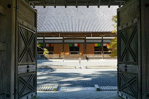 Zuigan Ji Attraction, Matsushima Machi22 km W
-
 Miyago Jima Island, Miyagi16 km SW
-
Naruse River River, Miyagi12 km W
-
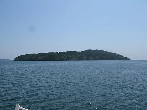 Tashiro Jima Island, Miyagi17 km SE
-
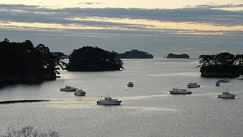 Matsushima Guntō Island, Miyagi21 km W
-
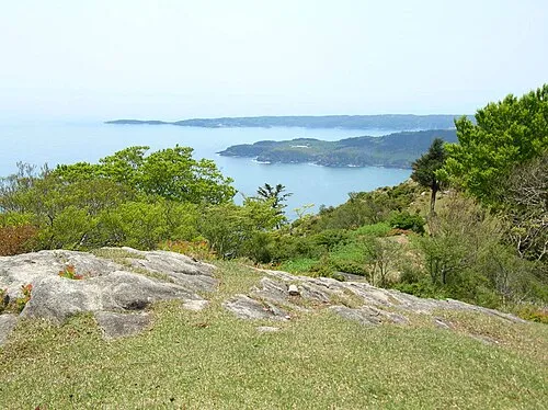 Aji Island Island, Miyagi23 km SE
-
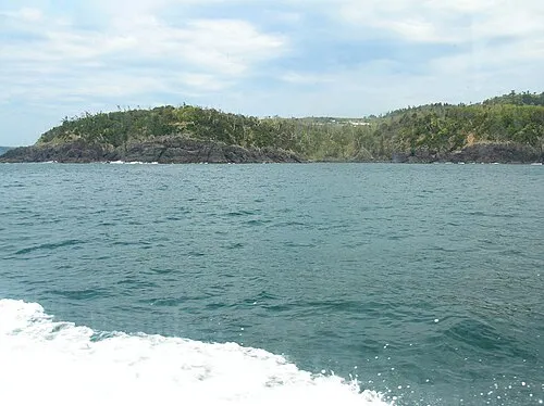 Oshika Peninsula Natural site, Miyagi20 km SE
-
Tsuki Shima Island, Miyagi17 km W
Sources & licences
Data last updated: · 2 independent sources