- Population
- 94,222
- 94.2K
- Elevation
- 568 m
- above sea level
- Local time
- UTC+09:00
- Asia/Tokyo · UTC+09:00
- Airports
- MMJ Shinshu-Matsumoto Airport14 km
- TOY Toyama Kitokito Airport74 km
About Azumino
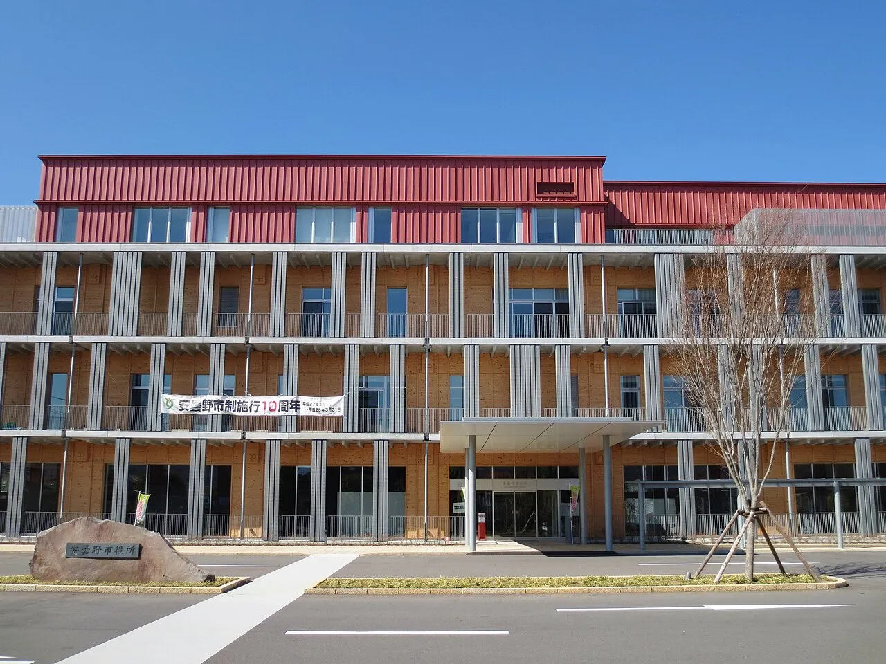
Azumino is a city. Location: Azumino-Shi, Nagano. Population: 94,222. Elevation: 568 m.
Azumino (安曇野市, Azumino-shi; Japanese pronunciation: [ä̀.(d͡)zɨ́.mʲí.nó̞(.ɕì)]) is a city located in Nagano Prefecture, Japan. As of 1 March 2019, the city had an estimated population of 97,761 in 39744 households, and a population density of 290 persons per km2. Its total area is 331.78 square kilometres (128.10 sq mi).
Source: Wikipedia · CC BY-SA 4.0
Photos of Azumino
-

ブルーノ・プラス · CC BY 4.0 -

Naganojmmmm · CC BY-SA 4.0 -

Immanuelle · CC BY 4.0 -

Immanuelle · CC BY 4.0 -

江戸村のとくぞう · CC BY-SA 4.0


Travel notes for Azumino
From Wikivoyage
Azumino (安曇野市 Azumino-shi) is a city in Nagano Prefecture.
Understand+
Situated among the picturesque valleys of central Honshu's famous Alps region, Azumino boasts a unique blend of culture, history and natural beauty.
1 Azumino Tourist Information Center (安曇野市観光情報センター), Hotaka 5948-3 (next to the Hotaka railway station on the north side of the square), ☏ +81 26-382-9363. Apr-Nov 09:00-17:00, Dec-Mar 10:00-16:00. Closed during New Year Holidays. Get a number of useful English brochures for Azumino and the larger region.
Get in+
By train:
From Tokyo: Take the JR Chuo East line from Shinjuku to Matsumoto, then the JR Oito line to Hotaka or the JR Shinonoi line to Akashina (3 hr, ¥6,620 unreserved seat). Alternately, take the Nagano Shinkansen to Nagano, JR Shinonoi line to Akashina (2 hr 30 min, ¥9,390 unreserved seat).
From Nagoya: Take the JR Chuo West line to Matusmoto, then the JR Oito line to Hotaka (2 hr 15 min, ¥5,670 unreserved seat).
From Nagano: Take the Shinonoi line from Nagano station to Akashina.
By car:
From Tokyo: Take the Chuo Expressway west to Oyaka Junction then the Nagano Expressway and exit at Toyoshina.
From Nagoya: Take the Chuo Expressway east to Oyaka Junction then the Nagano Expressway and exit at Toyoshina.
From Nagano: Take the Nagano Expressway and exit at Toyoshina.
Source: Wikivoyage · CC BY-SA 4.0 · abridged
Places bordering Azumino
- Matsumoto
- Ōmachi-shi
- Ikeda
- Matsukawa Mura
- Chikuhoku Mura
- Ikusaka Mura
Twin towns and sister cities of Azumino
- Tōgane· Japan
- Misato Shi· Japan
- Edogawa-ku· Japan
- Musashino· Japan
- Higashi Ku· Japan
- Sangō-chō· Japan
- Manazuru· Japan
Source: Wikidata. Only places with a page on this site are shown.
Population of Azumino over time
| 2010 | 96,479 | |
|---|---|---|
| 2015 | 95,282 | |
| 2021 | 93,927 |
Censuses and official estimates; source: Wikidata.
Climate of Azumino
Best months for sightseeingBest months for sightseeing: May–June, September–October.
This month · November
Outside the best season
Day 13° · Night 2° · Rain 60 mm
Better nearby cities in November
- Kofu · 92 km southeast17°
- Fujinomiya · 136 km southeast18°
- Fuji · 144 km southeast20°
- Hottest month
- August (day 30°)
- Coldest month
- January (night -6°)
- Wettest month
- September (170 mm)
- Driest month
- December (33 mm)
Bars: average monthly low and high temperature. Below: precipitation. Monthly averages for 1970–2000 at about 18 km resolution, adjusted for elevation. Highlighted months are mild and relatively dry. Source: WorldClim 2.1 (CC BY 4.0).
Show values as a table
| Month | Jan | Feb | Mar | Apr | May | Jun | Jul | Aug | Sep | Oct | Nov | Dec |
|---|---|---|---|---|---|---|---|---|---|---|---|---|
| Average high (°C) | 5° | 5° | 10° | 17° | 22° | 25° | 28° | 30° | 25° | 19° | 13° | 8° |
| Average low (°C) | -6° | -5° | -2° | 4° | 10° | 15° | 19° | 20° | 15° | 8° | 2° | -3° |
| Precipitation (mm) | 41 | 50 | 79 | 94 | 101 | 160 | 147 | 107 | 170 | 99 | 60 | 33 |
Other places to visit in this season: May June September October
How to get to Azumino
The nearest airport is Shinshu-Matsumoto Airport (MMJ), 14 km to the south as the crow flies. For international flights: Komatsu Airport / JASDF Komatsu Air Base (KMQ) (133 km). The nearest large city is Matsumoto, 9 km to the southeast.
Airports
- Shinshu-Matsumoto Airport (MMJ) Matsumoto 14 kmsouth
- Toyama Kitokito Airport (TOY) Toyama 74 kmnorthwest
- Komatsu Airport / JASDF Komatsu Air Base (KMQ) Kanazawa 133 kmwest
Nearby large cities
- Matsumoto Population: 241.1K 9 kmsoutheast
- Ueda Population: 157.5K 38 kmeast
- Nagano Population: 372.8K 48 kmnortheast
- Toyama Population: 415.8K 75 kmnorthwest
- Iida Population: 101.5K 85 kmsouth
Straight-line distances; road distances are longer. Airport data: OurAirports.
Day trips from Azumino
Within 100 km: 2 historic and cultural sites, 62 natural sites, 14 lakes, rivers and coasts.
0–25 km9 places
- Tsubakuro Dake Mountain 21 kmNW
- Yariga-take Mountain 22 kmW
- Mount Hotakadake Mountain 21 kmW
- Mount Jōnen Mountain 15 kmW
25–60 km32 places
- Honshu Island 34 kmS
- Chausu-yama Mountain 53 kmS
- Mount Sannosawa Mountain 58 kmS
- Lake Kizaki Lake 31 kmN
60–100 km37 places
- Mount Senjō Mountain 68 kmSE
- Mount Nokogiri Mountain 64 kmSE
- Mount Aino Mountain 78 kmSE
- Mount Shiomi Mountain 84 kmS
Straight-line distances.
Azumino and similar cities
Side by side with cities of similar size in the same country: population, elevation and climate.
| Measure | Azumino | Yonezawa | Ashiya | Sanjō |
|---|---|---|---|---|
| Population | 94.2K | 94.5K | 93.9K | 94.6K |
| Elevation | 568 m | 249 m | 14 m | 9 m |
| Summer day (hottest month) | 30° | 29° | 32° | 30° |
| Winter night (coldest month) | -6° | -4° | 1° | -2° |
| Annual rainfall | 1,141 mm | 1,327 mm | 1,449 mm | 2,234 mm |
| Best months | May–Jun, Sep–Oct | May–Jun, Sep | May, Oct | May–Jun, Sep–Oct |
| Distance | — | 268 km | 291 km | 175 km |
Climate values are 1970–2000 monthly averages; straight-line distance.
Nearby attractions & nature
Everything nearby-
Takase Gawa River, Nagano7.4 km N
-
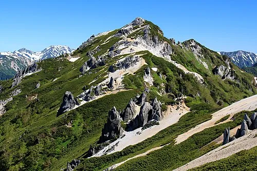 Tsubakuro Dake Mountain, Azumino-Shi21 km NW
-
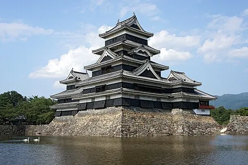 Matsumoto Castle Historic site, Matsumoto Shi9.2 km SE
-
 Mount Jōnen Mountain, Azumino-Shi15 km W
-
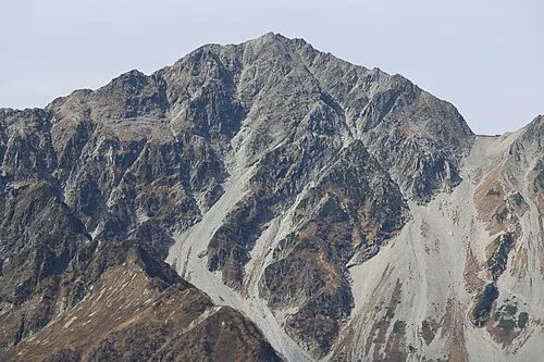 Mount Hotakadake Mountain, Matsumoto Shi21 km W
-
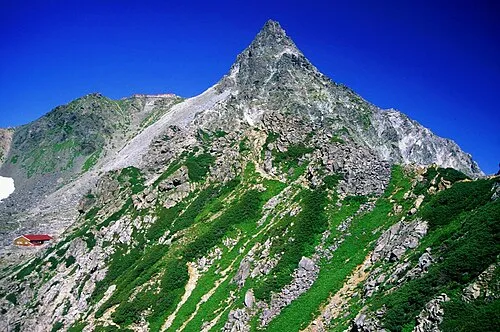 Yariga-take Mountain, Ōmachi-shi22 km W
-
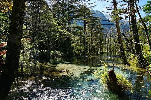 Kamikōchi Natural site, Nagano23 km W
-
Mount Azumaya Mountain, Chikuhoku Mura21 km NE
Sources & licences
Data last updated: · 2 independent sources