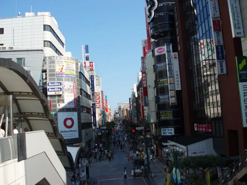
- Population
- 433,436
- 433.4K
- Elevation
- 24 m
- above sea level
- Local time
- UTC+09:00
- Asia/Tokyo · UTC+09:00
- Airports
- NRT Narita International Airport39 km
- HND Tokyo Haneda International Airport39 km
About Kashiwa
Kashiwa is a city. Location: Kashiwa Shi, Chiba. Population: 433,436. Elevation: 24 m.
Kashiwa (柏市, Kashiwa-shi) is a city located in Chiba Prefecture, Japan. As of May 1, 2024, the city had an estimated population of 435,578 in 199,926 households and a population density of 3800 persons per km2. The total area of the city is 114.72 square kilometres (44.29 sq mi). The name of the city is written with a single kanji character: 柏, a reference to Quercus dentata, commonly known in English as the Japanese emperor oak or daimyo oak.
Source: Wikipedia · CC BY-SA 4.0
Photos of Kashiwa
-

Takarkey · CC BY-SA 2.0 -

ゆりのき橋 · CC BY 3.0 -

ゆりのき橋 · CC BY 3.0


Travel notes for Kashiwa
From Wikivoyage
Kashiwa (柏市 Kashiwa-shi) is a city in Chiba prefecture, Japan. It is locally known as "Little Shibuya" due to the shopping.
Understand+
Tourist information:
kamon (Kashiwa Information Center), Family Kashiwa 3F (take the south exit from kashiwa stn. turn left and climb one set of stairs), ☏ +81 7168-8686. 09:00-19:00. If you need to quickly check or send emails, this center offers 30 min free access. Also a good place to pick up Tokyo listings magazine Metropolis and get general Kashiwa info. Occasionally there will be English speakers here to help out but all the staff are very friendly and will make an effort
The local tourist association has a multilingual guide site.
Get in+
From Tokyo
Kashiwa is served by the JR Joban Line (JR常磐線 Jōban-sen) from Tokyo's Ueno station. Rapid services take approximately 30–35 minutes from Ueno (some mid-day services take 25 minutes) at a cost of ¥450. The Joban Line serves 3 station in Kashiwa city - Minami-Kashiwa, Kita-Kashiwa and Kashiwa stations. Kashiwa station is main and is served by all type of trains on the Joban Line.
Local trains continue onto the Chiyoda Line (千代田線 Chiyoda-sen) of Tokyo Metro(東京メトロ Tōkyō-metoro), with some going all the way to the Odakyu Line (小田急線 Odakyū-sen) on the other side of Tokyo. Given the number of stops and routing combinations, taking the local service will be reasonable only if your starting or ending point on the Chiyoda Line. In other cases, taking rapid or special rapid trains on the Joban Line and transferring from/to other lines at major stations in Tokyo (Kita-Senju, Nippori, Tokyo, Shinagawa) will generally make the ride faster and easier.
Another major line connecting north-western part of the Kashiwa city with Tokyo is Tsukuba Express. There are only 2 stations, main one being Kashiwanoha-campus station (served by up to commuter-rapid trains), another one is Kashiwatanaka station (served by only local trains). Since the line is quite new and private, and also starts only from Akihabara station, fares are relatively high. Using Tsukuba Express will make sense only if you are coming from Akihabara/Asakusa area or you need to get exactly to north-western part of the city (with university campuses, Kashiwanoha stadium, baseball field and National Cancer Center).
From Funabashi/Chiba or Omiya/Saitama
Source: Wikivoyage · CC BY-SA 4.0 · abridged
Places bordering Kashiwa
- Matsudo
- Abiko Shi
- Kamagaya
- Noda
- Nagareyama
- Inzai-shi
- Shiroi-shi
- Toride Shi
- Moriya-shi
Twin towns and sister cities of Kashiwa
- Tsugaru· Japan
- Tadami Machi· Japan
Source: Wikidata. Only places with a page on this site are shown.
Population of Kashiwa over time
| 2010 | 404,012 | |
|---|---|---|
| 2015 | 413,954 | |
| 2021 | 427,603 |
Censuses and official estimates; source: Wikidata.
Climate of Kashiwa
Best months for sightseeingBest months for sightseeing: May–June, September–October.
This month · November
Outside the best season
Day 16° · Night 7° · Rain 79 mm
Better nearby cities in November
- Isehara · 79 km southwest18°
- Odawara · 100 km southwest19°
- Mishima · 127 km southwest18°
- Hottest month
- August (day 30°)
- Coldest month
- January (night -1°)
- Wettest month
- September (191 mm)
- Driest month
- January (36 mm)
Bars: average monthly low and high temperature. Below: precipitation. Monthly averages for 1970–2000 at about 18 km resolution, adjusted for elevation. Highlighted months are mild and relatively dry. Source: WorldClim 2.1 (CC BY 4.0).
Show values as a table
| Month | Jan | Feb | Mar | Apr | May | Jun | Jul | Aug | Sep | Oct | Nov | Dec |
|---|---|---|---|---|---|---|---|---|---|---|---|---|
| Average high (°C) | 9° | 9° | 12° | 18° | 22° | 24° | 28° | 30° | 26° | 21° | 16° | 11° |
| Average low (°C) | -1° | 0° | 3° | 9° | 13° | 18° | 21° | 23° | 19° | 13° | 7° | 1° |
| Precipitation (mm) | 36 | 54 | 90 | 112 | 119 | 160 | 143 | 143 | 191 | 163 | 79 | 37 |
Other places to visit in this season: May June September October
How to get to Kashiwa
The nearest airport is Narita International Airport (NRT), 39 km to the east as the crow flies. The nearest large city is Abiko, 4 km to the east.
Airports
- Narita International Airport (NRT) Narita 39 kmeast
- Tokyo Haneda International Airport (HND) Tokyo 39 kmsouthwest
- Ibaraki Airport (IBR) Omitama 53 kmnortheast
Nearby large cities
- Abiko Population: 131.8K 4 kmeast
- Nagareyama Population: 200.1K 7 kmwest
- Misato, Saitama Population: 142.1K 9 kmwest
- Toride Population: 104.5K 10 kmnortheast
- Kamagaya Population: 109.9K 11 kmsouth
Straight-line distances; road distances are longer. Airport data: OurAirports.
Day trips from Kashiwa
Within 100 km: 50 historic and cultural sites, 33 natural sites, 40 lakes, rivers and coasts.
0–25 km13 places
- Lake Tega Lake 10 kmE
- Ebi River River 19 kmS
- Mukōjima Hyakkaen Attraction 21 kmSW
- Tokyo Sky Tree Landmark 23 kmSW
25–60 km56 places
- Saitama Super Arena Landmark 31 kmW
- Iruma River River 39 kmW
- Obitsu River River 51 kmS
- Koito River River 58 kmS
60–100 km54 places
- Jōga Shima Island 87 kmS
- Enoshima Island 77 kmSW
- Umeda Ko Lake 85 kmNW
- Mount Bukō Mountain 80 kmW
Straight-line distances.
Kashiwa and similar cities
Side by side with cities of similar size in the same country: population, elevation and climate.
| Measure | Kashiwa | Machida | Fujisawa | Toyota |
|---|---|---|---|---|
| Population | 433.4K | 431.1K | 439.7K | 426.2K |
| Elevation | 24 m | 103 m | 12 m | 55 m |
| Summer day (hottest month) | 30° | 30° | 31° | 31° |
| Winter night (coldest month) | -1° | -1° | 1° | 0° |
| Annual rainfall | 1,327 mm | 1,553 mm | 1,663 mm | 1,971 mm |
| Best months | May–Jun, Sep–Oct | Apr–Jun, Sep–Oct | Apr–Jun, Oct | May–Jun, Oct |
| Distance | — | 60 km | 73 km | 271 km |
Climate values are 1970–2000 monthly averages; straight-line distance.
Nearby attractions & nature
Everything nearby-
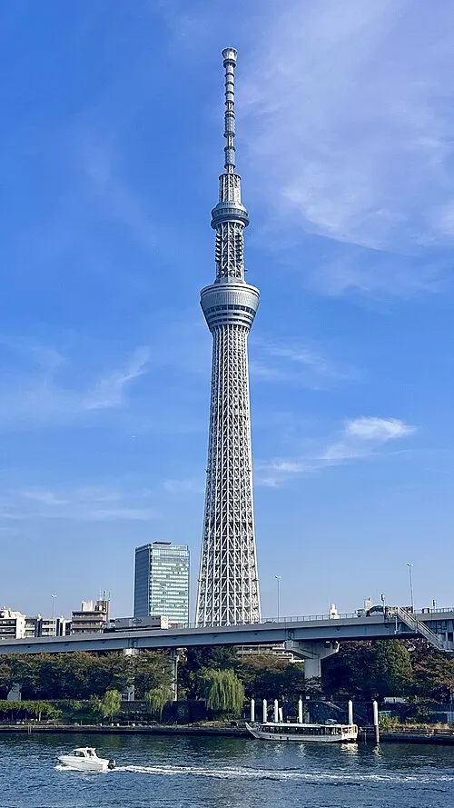 Tokyo Sky Tree Landmark, Sumida23 km SW
-
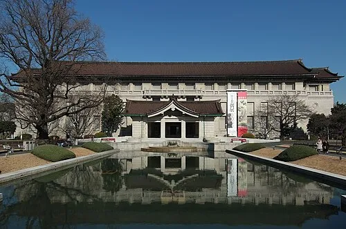 Tokyo National Museum Museum, Taito24 km SW
-
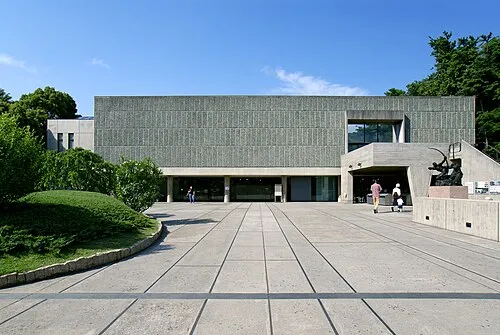 National Museum of Western Art Museum, Taito24 km SW
-
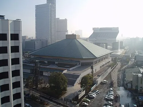 Ryōgoku Kokugikan Landmark, Sumida25 km SW
-
Kinu Gawa River, Japan8.8 km N
-
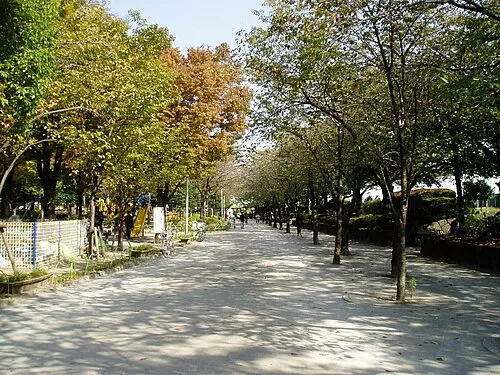 Sumida Kōen Natural site, Sumida23 km SW
-
 Kan’ei Ji Attraction, Taito24 km SW
-
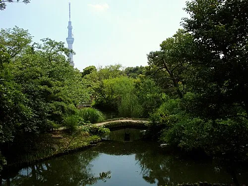 Mukōjima Hyakkaen Attraction, Sumida21 km SW
Sources & licences
Data last updated: · 2 independent sources