Motobu Chō
Local name: 本部町
Located in Kunigami-gun, Okinawa Coordinates: 26°39′31″ N 127°54′32″ E
- Population
- 13,727
- 13.7K
- Elevation
- 9 m
- above sea level
- Local time
- UTC+09:00
- Asia/Tokyo · UTC+09:00
- Places inside
- 2
- listed under Motobu Chō
- Airports
- OKA Naha International Airport58 km
- RNJ Yoron Airport65 km
About Motobu Chō
Motobu Chō is a municipality. Location: Kunigami-gun, Okinawa. Population: 13,727. Elevation: 9 m.
Motobu (本部町, Motobu-chō; Kunigami and Okinawan: Mutubu) is a town located in Kunigami District, Okinawa Prefecture, Japan. As of October 2016, the town has an estimated population of 13,441 and a density of 250 persons per km2. The total area is 54.30 square kilometres (20.97 mi2). Several islands can be accessed from Motobu, namely the small islands of Sesoko (by bridge) and Minna-jima (by ferry). Both islands are incorporated as part of the Town of Motobu. Ferry service also runs from Motobu Port to Ie-jima.
Source: Wikipedia · CC BY-SA 4.0
Travel notes for Motobu Chō
From Wikivoyage
Northern Okinawa (沖縄北部 Okinawa-hokubu), also known as Yanbaru (やんばる) or Kunigami (国頭), is the northernmost part of Okinawa Island.
Understand+
Northern Okinawa is the wildest, least populated and arguably most beautiful region of Okinawa Island. It consists of the city of Nago (名護) and the villages of Onna (恩納), Kunigami (国頭), Ōgimi (大宜味), Higashi (東), Motobu (本部), Nakijin (今帰仁), Ginoza (宜野座) and Kin (金武). Together with Tokunoshima, Iriomote and Amami Oshima, it was listed as a natural world heritage site by UNESCO in 2021.
Tourist information site:
Most towns in Northern Okinawa have their own tourist information sites, which are mostly Japanese only, but may include automated translation. Notable ones include Onna, Nago and Motobu.
Get in+
Route 58 runs the length of Northern Okinawa from Naha through Onna, Nago and all the way to Cape Hedo. If heading from the south to Nago or points beyond, the Okinawa Expressway from Naha is the fastest way to go.
By bus:
The Okinawa Airport Shuttle runs from Naha airport and the Bus Terminal, running across the length of Onna along Route 58 and further on to Motobu. One-way fares run ¥1400-1600, but some hotels offer free rides if you book in advance.
From Naha bus terminal (across the street from Asahibashi monorail station) you can take the Expressway Route bus No. 111 to Nago. The trip will take about 2 hours and will cost ¥2,040. There will be many stops along the expressway on route. The No. 111 runs all the way from the Naha airport as well and costs ¥2,160.
Source: Wikivoyage · CC BY-SA 4.0 · abridged
Places bordering Motobu Chō
- Nago Shi
- Nakijin Son
Population of Motobu Chō over time
| 2010 | 13,870 | |
|---|---|---|
| 2015 | 13,536 | |
| 2021 | 13,073 |
Censuses and official estimates; source: Wikidata.
Climate of Motobu Chō
Best months for sightseeingBest months for sightseeing: November–May.
This month · November
A good month to visit
Day 24° · Night 20° · Rain 137 mm
- Hottest month
- July (day 31°)
- Coldest month
- January (night 14°)
- Wettest month
- May (243 mm)
- Driest month
- December (109 mm)
Bars: average monthly low and high temperature. Below: precipitation. Monthly averages for 1970–2000 at about 18 km resolution, adjusted for elevation. Highlighted months are mild and relatively dry. Source: WorldClim 2.1 (CC BY 4.0).
Show values as a table
| Month | Jan | Feb | Mar | Apr | May | Jun | Jul | Aug | Sep | Oct | Nov | Dec |
|---|---|---|---|---|---|---|---|---|---|---|---|---|
| Average high (°C) | 19° | 19° | 21° | 23° | 26° | 29° | 31° | 31° | 30° | 27° | 24° | 21° |
| Average low (°C) | 14° | 14° | 16° | 19° | 22° | 24° | 26° | 26° | 25° | 23° | 20° | 16° |
| Precipitation (mm) | 122 | 128 | 168 | 196 | 243 | 241 | 175 | 232 | 188 | 169 | 137 | 109 |
Other places to visit in this season: January February March April May November December
How to get to Motobu Chō
The nearest airport is Naha International Airport (OKA), 58 km to the southwest as the crow flies. The nearest large city is Uruma, 32 km to the south.
Airports
- Naha International Airport (OKA) Naha 58 kmsouthwest
- Yoron Airport (RNJ) Yoron 65 kmnortheast
- Okinoerabu Airport (OKE) Wadomari 117 kmnortheast
Nearby large cities
- Uruma Population: 125.3K 32 kmsouth
- Okinawa Population: 142.8K 37 kmsouth
- Ginowan Population: 100.1K 46 kmsouth
- Urasoe Population: 115.7K 48 kmsouth
- Naha Population: 317.6K 54 kmsouthwest
Straight-line distances; road distances are longer. Airport data: OurAirports.
Day trips from Motobu Chō
Within 100 km: 1 historic or cultural site, 9 natural sites, 20 lakes, rivers and coasts.
0–25 km9 places
- Iejima Island Island 14 kmNW
- Okinawa Island 17 kmS
- Okinawa Islands Island 14 kmE
- Minna Shima Island 9 kmW
25–60 km10 places
- Izena Jima Island 31 kmN
- Iheya Island Island 43 kmN
- Kokuba Gawa River 56 kmSW
- Shuri Castle Historic site 52 kmS
60–100 km11 places
- Yoronjima Island 67 kmNE
- Kerama Islands Island 77 kmSW
- Zamami Island Island 76 kmSW
- Aka Island Island 81 kmSW
Straight-line distances.
Places in Motobu Chō
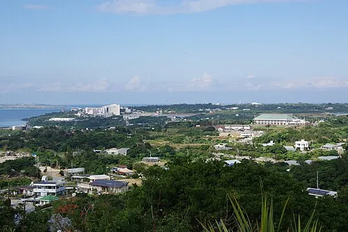
2 placesMotobu
Population: 13.4K
Nearby attractions & nature
Everything nearby-
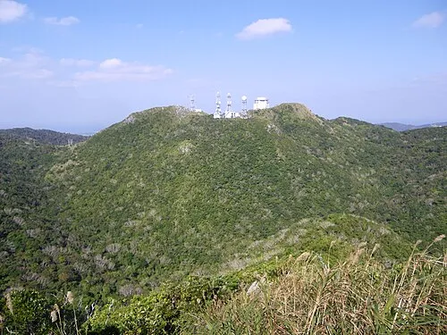
 Motobu Hantō Natural site, Okinawa2.5 km E
-
 Minna Shima Island, Okinawa9.3 km W
-
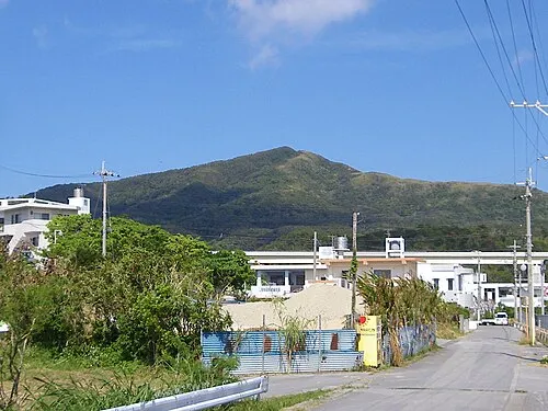 Mount Onna Mountain, Kunigami-gun20 km S
-
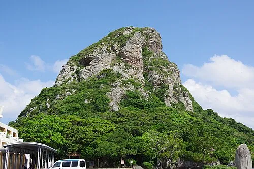 Mount Gusuku Mountain, Ie Village12 km NW
-
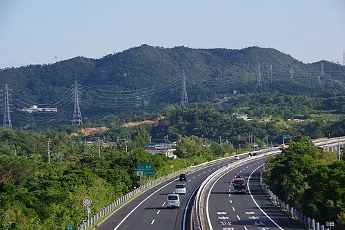 Mount Ishikawa Mountain, Kunigami-gun24 km S
-
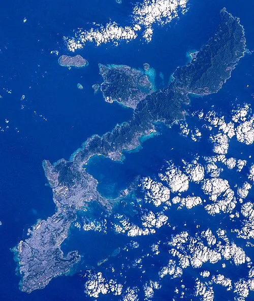 Okinawa Island, Ginoza Son17 km S
-
Iejima Island Island, Japan14 km NW
-
 Okinawa Islands Island, Okinawa14 km E
Other cities and towns in Kunigami-gun
-
Onna Town, Kunigami-gun19 km S
-
Ginoza Son Municipality, Kunigami-gun19 km S
-
Higashi Village Municipality, Kunigami-gun28 km E
-
Ōgimi Son Municipality, Kunigami-gun23 km E
-
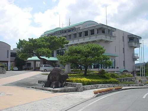 Ginoza Town, Ginoza Son21 km S
-
Tsuha Town, Ōgimi Son18 km E
Sources & licences
Data last updated: · 2 independent sources