England
Located in United Kingdom Coordinates: 52°09′38″ N 0°42′11″ W
- Population
- 57,106,398
- 57.1M
- Elevation
- 62 m
- above sea level
- Local time
- UTC+00:00
- Europe/London · UTC+00:00
- Places inside
- 810
- listed under England
About England
England is a region. Location: United Kingdom. Population: 57,106,398.
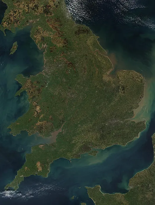
England is a country that is part of the United Kingdom. It is located on the island of Great Britain, of which it covers about 62%, and more than 100 smaller adjacent islands. England shares a land border with Scotland to the north and another land border with Wales to the west, and is surrounded by the North Sea to the east, the English Channel to the south, the Celtic Sea to the south-west, and the Irish Sea to the west. Continental Europe lies to the south-east, and Ireland to the west.
Read more on Wikipedia Text: Wikipedia contributors · CC BY-SA 4.0 · shortened
At a glance
- Built
- 927
- Area
- 130,278 km²
Source: Wikidata
In comparison
- 7 sights and natural places within 10 km Lavendon, Lavendon Castle
- Listed here: River: 341, Natural site: 268, District: 120, Lake: 44
Places in England
810 places-
Milton Keynes District305.9K
-
Stockport District303.9K
-
Salford District294.3K
-
Sunderland District288.6K
-
Sefton District286.3K
-
Brighton and Hove District283.9K
-
Walsall District278.7K
-
Medway District278.5K
-
Rotherham District276.6K
-
Kingston upon Hull District275.4K
-
Derby District274.1K
-
Plymouth District264.2K
-
Stoke-on-Trent District260K
-
Wolverhampton District256.6K
-
Southampton District254.3K
-
Oldham District251.6K
-
Swindon District243.9K
-
Barnsley District241.2K
-
Trafford District241K
-
Tameside District239.6K
-
Rochdale District235.6K
-
North Somerset District224.6K
-
Luton District216.8K
-
Portsmouth District214.8K
-
Solihull District211.8K
-
Calderdale District211.4K
-
Warrington District211K
-
North Tyneside District210.5K
-
York District209.3K
-
Gateshead District202.8K
-
Bath and North East Somerset District200K
-
Borough of Bury District198.9K
-
Peterborough District197.1K
-
Stockton-on-Tees District195.7K
-
Herefordshire District191K
-
St. Helens District188.9K
-
Reading District182.9K
-
Southend-on-Sea District179.8K
-
Telford and Wrekin District173K
-
North Lincolnshire District170.8K
-
Bedford District168.8K
-
Thurrock District167K
-
West Berkshire District165.1K
-
Blackburn with Darwen District162.5K
-
Knowsley District162.6K
-
Wokingham District161.9K
-
North East Lincolnshire District159.9K
-
Windsor and Maidenhead District158.9K
-
Middlesbrough District156.2K
-
South Tyneside District151.4K
-
Slough District147.2K
-
Isle of Wight District141.7K
-
Blackpool District139.2K
-
Redcar and Cleveland District139.2K
-
Torbay District133.9K
-
Halton District131.5K
-
Bracknell Forest District130.8K
-
Darlington District107.8K
-
Hartlepool District98.2K
-
Rutland District41.4K
Largest cities and towns
-
London City, Greater London9M
-
Stoke-on-Trent City, Stoke-on-Trent258.4K
-
Sheffield City, Sheffield556.5K
-
Leeds City, Leeds536.3K
-
Islington City, Islington319.1K
-
Newcastle upon Tyne City, Newcastle upon Tyne300.1K
-
Bradford City, Bradford366.2K
-
Wolverhampton City, Wolverhampton263.7K
Nature and heritage in England
-
White Hart Lane Landmark, Haringey36.3K
-
Brownsea Island Island, Dorset30
-
Burgh Island Island, Devon12
-
Round Island Island, Isles of Scilly
-
Gweal Island, Bryher
-
Gorregan Island, Isles of Scilly
Sources & licences
Data last updated: · 2 independent sources