Nevşehir Province
Local name: Nevşehir ili
Located in Turkey Coordinates: 38°55′00″ N 34°40′00″ E
- Population
- 310,011
- 310K
- Elevation
- 1,167 m
- above sea level
- Local time
- UTC+03:00
- Europe/Istanbul · UTC+03:00
- Places inside
- 64
- listed under Nevşehir Province
- Airports
- NAV Nevşehir Kapadokya Airport20 km
- ASR Kayseri Erkilet International Airport74 km
About Nevşehir Province
Nevşehir Province is a region. Location: Turkey. Population: 310,011.
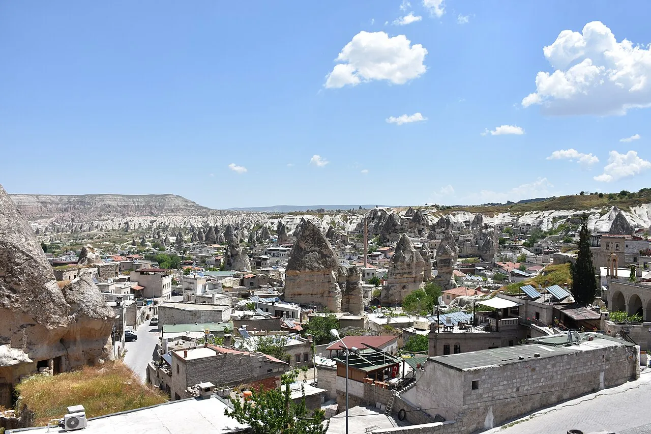
Nevşehir Province (Turkish: Nevşehir ili) is a province in central Turkey with its capital in Nevşehir. Its area is 5,485 km2, and its population is 317,952 (2024). Its adjacent provinces are Kırşehir to the northwest, Aksaray to the southwest, Niğde to the south, Kayseri to the southeast, and Yozgat to the northeast. Nevşehir includes the area called Cappadocia – a tourist attraction in Turkey. The town of Göreme is also located in Nevşehir. Nevşehir was declared a World Peace City by the United Nations.
Source: Wikipedia · CC BY-SA 4.0
Photos of Nevşehir Province
-
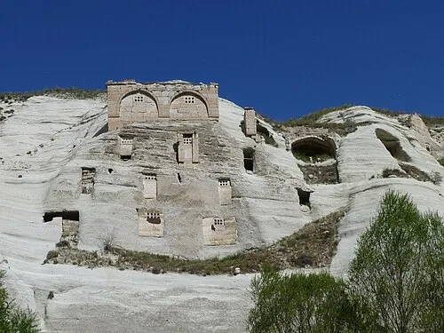
Gomeda Vadisi Ji-Elle · CC BY-SA 3.0

Places bordering Nevşehir Province
- Aksaray Province
- Niğde Province
- Kayseri Province
- Yozgat Province
- Kırşehir Province
Population of Nevşehir Province over time
| 2014 | 286,250 | |
|---|---|---|
| 2018 | 298,339 | |
| 2021 | 284,657 |
Censuses and official estimates; source: Wikidata.
Climate of Nevşehir Province
Best months for sightseeingBest months for sightseeing: May–October.
This month · November
A cold month
Day 12° · Night 1° · Rain 35 mm
Better nearby cities in November
- Adana · 222 km south21°
- Tarsus · 223 km south22°
- Mersin · 234 km south22°
- Hottest month
- July (day 29°)
- Coldest month
- January (night -5°)
- Wettest month
- April (50 mm)
- Driest month
- August (6 mm)
Bars: average monthly low and high temperature. Below: precipitation. Monthly averages for 1970–2000 at about 18 km resolution, adjusted for elevation. Highlighted months are mild and relatively dry. Source: WorldClim 2.1 (CC BY 4.0).
Show values as a table
| Month | Jan | Feb | Mar | Apr | May | Jun | Jul | Aug | Sep | Oct | Nov | Dec |
|---|---|---|---|---|---|---|---|---|---|---|---|---|
| Average high (°C) | 4° | 6° | 11° | 16° | 21° | 25° | 29° | 29° | 25° | 19° | 12° | 6° |
| Average low (°C) | -5° | -3° | -1° | 4° | 8° | 11° | 13° | 13° | 9° | 5° | 1° | -3° |
| Precipitation (mm) | 41 | 35 | 38 | 50 | 50 | 34 | 9 | 6 | 13 | 29 | 35 | 45 |
Other places to visit in this season: May June July August September October
How to get to Nevşehir Province
The nearest airport is Nevşehir Kapadokya Airport (NAV), 20 km to the southwest as the crow flies. The nearest large city is Kırşehir, 50 km to the northwest.
Airports
- Nevşehir Kapadokya Airport (NAV) Nevşehir 20 kmsouthwest
- Kayseri Erkilet International Airport (ASR) Kayseri 74 kmeast
- Esenboğa International Airport (ESB) Ankara 197 kmnorthwest
Nearby large cities
- Kırşehir Population: 150.7K 50 kmnorthwest
- Kayseri Population: 1.5M 74 kmeast
- Aksaray Population: 327.6K 82 kmsouthwest
- Kirikkale Population: 187K 144 kmnorthwest
- Heraclea Population: 156.3K 165 kmsouth
Straight-line distances; road distances are longer. Airport data: OurAirports.
Places in Nevşehir Province
64 places- 1 Nevsehir 126.3K
- 2 Ürgüp 36.7K
- 3 Avanos District 34K
- 4 Gülşehir İlçesi 22.7K
- 5 Derinkuyu District 21.4K
- 6 Acıgöl District 19.7K
- 7 Kozaklı İlçesi 14.7K
- 8 Hacıbektaş District 11.5K
Bar: population relative to the most populous place in this list.
Cities & villages12
- Acıgöl Bucağı · Municipality
- Avanos Bucağı · Municipality
- Bayramuşağı · Village
- Derinkuyu Bucağı · Municipality
- Gülşehir Bucağı · Municipality
- Gümüşkent Bucağı · Municipality
- Hacıbektaş Bucağı · Municipality
- Karahasanlı Bucağı · Municipality
- Kılıçlı · Village
- Kozaklı Bucağı · Municipality
- Kuşaklı · Village
- Özonak Bucağı · Municipality
Mountains & nature22
- Acer Çeşmesi · Natural site
- Ağa Çeşmesi · Natural site
- Akıllı Çeşme · Natural site
- Balyeri Çeşmesi · Natural site
- Çallıyer Pınarı · Natural site
- Çiğdemli Boğazı · Natural site
- Çırçır Çeşmesi · Natural site
- Fatma Çeşmesi · Natural site
- Gomeda Vadisi · Natural site
- Gümüş Pınarı · Natural site
- Haflar Pınarı · Natural site
- Höyük Çeşmesi · Natural site
- Höyük Tepesi · Mountain
- Karavenk Çeşmesi · Natural site
- Kızılçukur · Natural site
- Koçcağız Çeşmesi · Natural site
- Madala Çeşmesi · Natural site
- Pancarlık Vadisi · Natural site
- Paşabağ · Natural site
- Pürçüklü Tepe · Mountain
- Sualgını Çeşmesi · Natural site
- Tarlacı Çeşmesi · Natural site
Lakes, rivers & coasts18
- Acısu Çayı · River
- Alaçorak Deresi · River
- Asarca Deresi · River
- Büyükoluk Deresi · River
- Çayağıl Deresi · River
- Çayır Suyu · River
- Çırdıkınözü · River
- Damsa Çayı · River
- Darinöz · River
- Derinöz Deresi · River
- Eraslan Deresi · River
- Kalaycık Deresi · River
- Karaağaç Deresi · River
- Kavaklı Dere · River
- Kızılöz Deresi · River
- Kurunhöyük Gölü · Lake
- Sicim Deresi · River
- Tokgöz Deresi · River
Largest cities and towns


Nature and heritage in Nevşehir Province
Sources & licences
Data last updated: · 2 independent sources